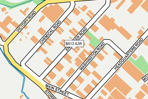
BA13 4JW is located in the Ethandune electoral ward, within the unitary authority of Wiltshire and the English Parliamentary constituency of South West Wiltshire. The Sub Integrated Care Board (ICB) Location is NHS Bath and North East Somerset, Swindon and Wiltshire ICB - 92 and the police force is Wiltshire. This postcode has been in use since August 1993.


GetTheData
Source: OS OpenMap – Local (Ordnance Survey)
Source: OS VectorMap District (Ordnance Survey)
Licence: Open Government Licence (requires attribution)
| Easting | 385334 |
| Northing | 152908 |
| Latitude | 51.275127 |
| Longitude | -2.211632 |
GetTheData
Source: Open Postcode Geo
Licence: Open Government Licence
| Country | England |
| Postcode District | BA13 |
➜ See where BA13 is on a map ➜ Where is Westbury? | |
GetTheData
Source: Land Registry Price Paid Data
Licence: Open Government Licence
Elevation or altitude of BA13 4JW as distance above sea level:
| Metres | Feet | |
|---|---|---|
| Elevation | 50m | 164ft |
Elevation is measured from the approximate centre of the postcode, to the nearest point on an OS contour line from OS Terrain 50, which has contour spacing of ten vertical metres.
➜ How high above sea level am I? Find the elevation of your current position using your device's GPS.
GetTheData
Source: Open Postcode Elevation
Licence: Open Government Licence
| Ward | Ethandune |
| Constituency | South West Wiltshire |
GetTheData
Source: ONS Postcode Database
Licence: Open Government Licence
| Washington Road (Headquarters Road) | Westbury | 211m |
| Celcon (Quartermaster Road) | Westbury | 611m |
| Commerce Close (Link Road) | West Wilts Trading Estate | 925m |
| Commerce Close (Link Road) | West Wilts Trading Estate | 948m |
| The Ham | Westbury | 1,016m |
| Westbury (Wilts) Station | 1.3km |
| Dilton Marsh Station | 2.9km |
| Trowbridge Station | 5km |
GetTheData
Source: NaPTAN
Licence: Open Government Licence
| Median download speed | 20.2Mbps |
| Average download speed | 20.0Mbps |
| Maximum download speed | 45.75Mbps |
| Median upload speed | 5.1Mbps |
| Average upload speed | 4.6Mbps |
| Maximum upload speed | 10.00Mbps |
GetTheData
Source: Ofcom
Licence: Ofcom Terms of Use (requires attribution)
GetTheData
Source: ONS Postcode Database
Licence: Open Government Licence


➜ Get more ratings from the Food Standards Agency
GetTheData
Source: Food Standards Agency
Licence: FSA terms & conditions
| Last Collection | |||
|---|---|---|---|
| Location | Mon-Fri | Sat | Distance |
| West Wilts Trading Estate | 17:30 | 12:00 | 223m |
| Headquarters Road W.w.t.e. | 17:15 | 12:00 | 229m |
| The Ham Post Office | 17:15 | 12:00 | 1,014m |
GetTheData
Source: Dracos
Licence: Creative Commons Attribution-ShareAlike
| Risk of BA13 4JW flooding from rivers and sea | Low |
| ➜ BA13 4JW flood map | |
GetTheData
Source: Open Flood Risk by Postcode
Licence: Open Government Licence
The below table lists the International Territorial Level (ITL) codes (formerly Nomenclature of Territorial Units for Statistics (NUTS) codes) and Local Administrative Units (LAU) codes for BA13 4JW:
| ITL 1 Code | Name |
|---|---|
| TLK | South West (England) |
| ITL 2 Code | Name |
| TLK1 | Gloucestershire, Wiltshire and Bath/Bristol area |
| ITL 3 Code | Name |
| TLK15 | Wiltshire |
| LAU 1 Code | Name |
| E06000054 | Wiltshire |
GetTheData
Source: ONS Postcode Directory
Licence: Open Government Licence
The below table lists the Census Output Area (OA), Lower Layer Super Output Area (LSOA), and Middle Layer Super Output Area (MSOA) for BA13 4JW:
| Code | Name | |
|---|---|---|
| OA | E00163506 | |
| LSOA | E01032056 | Wiltshire 039D |
| MSOA | E02006690 | Wiltshire 039 |
GetTheData
Source: ONS Postcode Directory
Licence: Open Government Licence
| BA13 4JP | Washington Road | 60m |
| BA13 4JU | Main Street | 210m |
| BA13 4WD | Stephenson Road | 449m |
| BA14 9PT | 584m | |
| BA13 4WE | Kingdom Avenue | 623m |
| BA13 4EZ | Kingdom Avenue | 668m |
| BA13 4JB | Link Road | 814m |
| BA13 4HX | Storridge Road | 882m |
| BA13 4HH | Hawkeridge Park | 979m |
| BA13 4HD | The Ham | 998m |
GetTheData
Source: Open Postcode Geo; Land Registry Price Paid Data
Licence: Open Government Licence