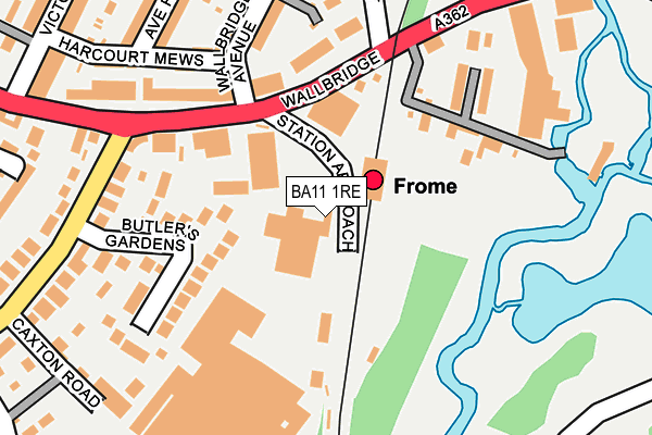
BA11 1RE is located in the Frome East electoral ward, within the unitary authority of Somerset and the English Parliamentary constituency of Somerton and Frome. The Sub Integrated Care Board (ICB) Location is NHS Somerset ICB - 11X and the police force is Avon and Somerset. This postcode has been in use since January 1980.


GetTheData
Source: OS OpenMap – Local (Ordnance Survey)
Source: OS VectorMap District (Ordnance Survey)
Licence: Open Government Licence (requires attribution)
| Easting | 378408 |
| Northing | 147563 |
| Latitude | 51.226839 |
| Longitude | -2.310592 |
GetTheData
Source: Open Postcode Geo
Licence: Open Government Licence
| Country | England |
| Postcode District | BA11 |
| ➜ BA11 open data dashboard ➜ See where BA11 is on a map ➜ Where is Frome? | |
GetTheData
Source: Land Registry Price Paid Data
Licence: Open Government Licence
Elevation or altitude of BA11 1RE as distance above sea level:
| Metres | Feet | |
|---|---|---|
| Elevation | 80m | 262ft |
Elevation is measured from the approximate centre of the postcode, to the nearest point on an OS contour line from OS Terrain 50, which has contour spacing of ten vertical metres.
➜ How high above sea level am I? Find the elevation of your current position using your device's GPS.
GetTheData
Source: Open Postcode Elevation
Licence: Open Government Licence
| Ward | Frome East |
| Constituency | Somerton And Frome |
GetTheData
Source: ONS Postcode Database
Licence: Open Government Licence
| January 2024 | Public order | On or near Garsdale | 486m |
| January 2024 | Violence and sexual offences | On or near Garsdale | 486m |
| January 2024 | Burglary | On or near Garsdale | 486m |
| ➜ Get more crime data in our Crime section | |||
GetTheData
Source: data.police.uk
Licence: Open Government Licence
| Frome Station (Station Approach) | Keyford | 42m |
| Station Approach Bottom (Wallbridge) | Frome | 120m |
| Station Approach (Wallbridge) | Frome | 129m |
| Butler's Gardens (Lock's Hill) | Keyford | 233m |
| Caxton Road (Lock's Hill) | Keyford | 306m |
| Frome Station | 0.1km |
GetTheData
Source: NaPTAN
Licence: Open Government Licence
GetTheData
Source: ONS Postcode Database
Licence: Open Government Licence


➜ Get more ratings from the Food Standards Agency
GetTheData
Source: Food Standards Agency
Licence: FSA terms & conditions
| Last Collection | |||
|---|---|---|---|
| Location | Mon-Fri | Sat | Distance |
| Locks Hill | 17:30 | 12:00 | 435m |
| Portway Post Office | 17:15 | 12:00 | 444m |
| Wallbridge Post Office | 16:45 | 12:00 | 514m |
GetTheData
Source: Dracos
Licence: Creative Commons Attribution-ShareAlike
| Facility | Distance |
|---|---|
| Train Station Gym (Frome) Station Approach, Frome Health and Fitness Gym, Studio | 59m |
| Frome Town Football Club Berkley Road, Frome Grass Pitches, Studio | 875m |
| Curves (Frome) (Closed) Palmer Street, Frome Health and Fitness Gym | 878m |
GetTheData
Source: Active Places
Licence: Open Government Licence
| School | Phase of Education | Distance |
|---|---|---|
| St John's Church of England Voluntary Aided First School, Frome Christchurch Street East, Frome, BA11 1QG | Primary | 650m |
| Hayesdown First School Wyville Road, Frome, BA11 2BN | Primary | 965m |
| Christ Church First School Feltham Lane, Frome, BA11 5AJ | Primary | 1km |
GetTheData
Source: Edubase
Licence: Open Government Licence
The below table lists the International Territorial Level (ITL) codes (formerly Nomenclature of Territorial Units for Statistics (NUTS) codes) and Local Administrative Units (LAU) codes for BA11 1RE:
| ITL 1 Code | Name |
|---|---|
| TLK | South West (England) |
| ITL 2 Code | Name |
| TLK2 | Dorset and Somerset |
| ITL 3 Code | Name |
| TLK23 | Somerset CC |
| LAU 1 Code | Name |
| E07000187 | Mendip |
GetTheData
Source: ONS Postcode Directory
Licence: Open Government Licence
The below table lists the Census Output Area (OA), Lower Layer Super Output Area (LSOA), and Middle Layer Super Output Area (MSOA) for BA11 1RE:
| Code | Name | |
|---|---|---|
| OA | E00147871 | |
| LSOA | E01029035 | Mendip 007B |
| MSOA | E02006053 | Mendip 007 |
GetTheData
Source: ONS Postcode Directory
Licence: Open Government Licence
| BA11 1QZ | Wallbridge | 135m |
| BA11 1QY | Wallbridge | 154m |
| BA11 1FT | Portway Mews | 156m |
| BA11 1LZ | Butlers Gardens | 160m |
| BA11 1QX | Portway | 164m |
| BA11 1QU | Portway | 168m |
| BA11 5JU | The Retreat | 182m |
| BA11 1RL | Wallbridge Avenue | 186m |
| BA11 5JX | Wallbridge | 196m |
| BA11 1RJ | Wallbridge Gardens | 235m |
GetTheData
Source: Open Postcode Geo; Land Registry Price Paid Data
Licence: Open Government Licence