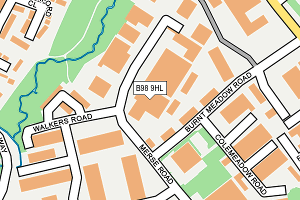
B98 9HL is located in the Church Hill electoral ward, within the local authority district of Redditch and the English Parliamentary constituency of Redditch. The Sub Integrated Care Board (ICB) Location is NHS Herefordshire and Worcestershire ICB - 18C and the police force is West Mercia. This postcode has been in use since September 1981.


GetTheData
Source: OS OpenMap – Local (Ordnance Survey)
Source: OS VectorMap District (Ordnance Survey)
Licence: Open Government Licence (requires attribution)
| Easting | 407251 |
| Northing | 268670 |
| Latitude | 52.316104 |
| Longitude | -1.895044 |
GetTheData
Source: Open Postcode Geo
Licence: Open Government Licence
| Country | England |
| Postcode District | B98 |
| ➜ B98 open data dashboard ➜ See where B98 is on a map ➜ Where is Redditch? | |
GetTheData
Source: Land Registry Price Paid Data
Licence: Open Government Licence
Elevation or altitude of B98 9HL as distance above sea level:
| Metres | Feet | |
|---|---|---|
| Elevation | 90m | 295ft |
Elevation is measured from the approximate centre of the postcode, to the nearest point on an OS contour line from OS Terrain 50, which has contour spacing of ten vertical metres.
➜ How high above sea level am I? Find the elevation of your current position using your device's GPS.
GetTheData
Source: Open Postcode Elevation
Licence: Open Government Licence
| Ward | Church Hill |
| Constituency | Redditch |
GetTheData
Source: ONS Postcode Database
Licence: Open Government Licence
| July 2023 | Violence and sexual offences | On or near Northfield Close | 301m |
| May 2023 | Vehicle crime | On or near Hartlebury Close | 416m |
| May 2023 | Vehicle crime | On or near Hartlebury Close | 416m |
| ➜ Get more crime data in our Crime section | |||
GetTheData
Source: data.police.uk
Licence: Open Government Licence
| Eagle Road (Church Hill Way) | Church Hill | 232m |
| Eagle Road (Church Hill Way) | Church Hill | 248m |
| Thornhill Road (Ravens Bank Drive) | Moon's Moat | 381m |
| Loxley Close | Church Hill | 384m |
| Loxley Close (Church Hill Way) | Church Hill | 385m |
| Redditch Station | 3.6km |
| Wood End Station | 4.6km |
| The Lakes Station | 5.9km |
GetTheData
Source: NaPTAN
Licence: Open Government Licence
GetTheData
Source: ONS Postcode Database
Licence: Open Government Licence


➜ Get more ratings from the Food Standards Agency
GetTheData
Source: Food Standards Agency
Licence: FSA terms & conditions
| Last Collection | |||
|---|---|---|---|
| Location | Mon-Fri | Sat | Distance |
| Impney Drive / Home Meadow Lan | 17:30 | 10:30 | 363m |
| Churchill Post Office | 17:30 | 12:00 | 738m |
| Ridings Lane / Church Hill Nor | 18:15 | 11:30 | 1,092m |
GetTheData
Source: Dracos
Licence: Creative Commons Attribution-ShareAlike
| Facility | Distance |
|---|---|
| Ymca (Redditch) (Closed) Loxley Close, Redditch Sports Hall | 554m |
| Church Hill Middle School Wood Piece Lane, Redditch Grass Pitches, Sports Hall, Outdoor Tennis Courts | 593m |
| Willow Trees Community Centre Loxley Close, Redditch Sports Hall | 645m |
GetTheData
Source: Active Places
Licence: Open Government Licence
| School | Phase of Education | Distance |
|---|---|---|
| Church Hill Middle School Wood Piece Lane, Church Hill, Redditch, B98 9LR | Middle deemed secondary | 593m |
| Abbeywood First School Wood Piece Lane, Church Hill, Redditch, B98 9LR | Primary | 634m |
| Moons Moat First School Cleeve Close, Church Hill, Redditch, B98 9HR | Primary | 857m |
GetTheData
Source: Edubase
Licence: Open Government Licence
The below table lists the International Territorial Level (ITL) codes (formerly Nomenclature of Territorial Units for Statistics (NUTS) codes) and Local Administrative Units (LAU) codes for B98 9HL:
| ITL 1 Code | Name |
|---|---|
| TLG | West Midlands (England) |
| ITL 2 Code | Name |
| TLG1 | Herefordshire, Worcestershire and Warwickshire |
| ITL 3 Code | Name |
| TLG12 | Worcestershire CC |
| LAU 1 Code | Name |
| E07000236 | Redditch |
GetTheData
Source: ONS Postcode Directory
Licence: Open Government Licence
The below table lists the Census Output Area (OA), Lower Layer Super Output Area (LSOA), and Middle Layer Super Output Area (MSOA) for B98 9HL:
| Code | Name | |
|---|---|---|
| OA | E00164471 | |
| LSOA | E01032243 | Redditch 001C |
| MSOA | E02006721 | Redditch 001 |
GetTheData
Source: ONS Postcode Directory
Licence: Open Government Licence
| B98 9HE | Walkers Road | 78m |
| B98 9NQ | Latchford Close | 200m |
| B98 9NH | Moorgate Close | 204m |
| B98 9PA | Burnt Meadow Road | 212m |
| B98 9NE | Home Meadow Lane | 251m |
| B98 9LX | Hillmorton Close | 282m |
| B98 9NF | Keele Close | 294m |
| B98 9NJ | Northfield Close | 315m |
| B98 9JH | Loxley Close | 319m |
| B98 9LZ | Impney Close | 333m |
GetTheData
Source: Open Postcode Geo; Land Registry Price Paid Data
Licence: Open Government Licence