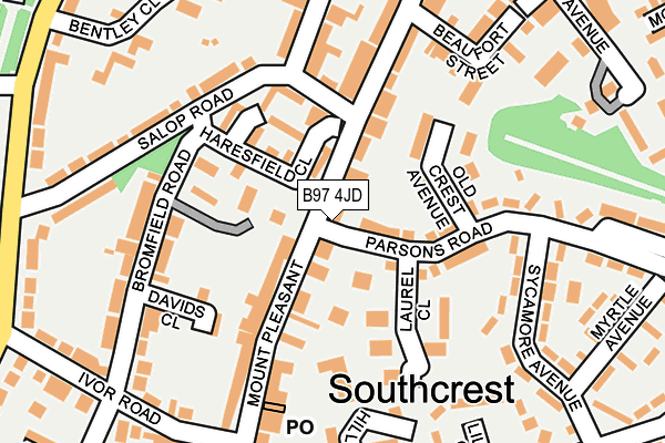
B97 4JD is located in the Central electoral ward, within the local authority district of Redditch and the English Parliamentary constituency of Redditch. The Sub Integrated Care Board (ICB) Location is NHS Herefordshire and Worcestershire ICB - 18C and the police force is West Mercia. This postcode has been in use since January 1980.


GetTheData
Source: OS OpenMap – Local (Ordnance Survey)
Source: OS VectorMap District (Ordnance Survey)
Licence: Open Government Licence (requires attribution)
| Easting | 403964 |
| Northing | 266949 |
| Latitude | 52.300665 |
| Longitude | -1.943284 |
GetTheData
Source: Open Postcode Geo
Licence: Open Government Licence
| Country | England |
| Postcode District | B97 |
| ➜ B97 open data dashboard ➜ See where B97 is on a map ➜ Where is Redditch? | |
GetTheData
Source: Land Registry Price Paid Data
Licence: Open Government Licence
Elevation or altitude of B97 4JD as distance above sea level:
| Metres | Feet | |
|---|---|---|
| Elevation | 150m | 492ft |
Elevation is measured from the approximate centre of the postcode, to the nearest point on an OS contour line from OS Terrain 50, which has contour spacing of ten vertical metres.
➜ How high above sea level am I? Find the elevation of your current position using your device's GPS.
GetTheData
Source: Open Postcode Elevation
Licence: Open Government Licence
| Ward | Central |
| Constituency | Redditch |
GetTheData
Source: ONS Postcode Database
Licence: Open Government Licence
| January 2024 | Violence and sexual offences | On or near Myrtle Avenue | 276m |
| January 2024 | Criminal damage and arson | On or near Petrol Station | 373m |
| January 2024 | Violence and sexual offences | On or near Petrol Station | 373m |
| ➜ Get more crime data in our Crime section | |||
GetTheData
Source: data.police.uk
Licence: Open Government Licence
| Parsons Road (Mount Pleasant) | Southcrest | 31m |
| Parsons Road (Mount Pleasant) | Southcrest | 42m |
| Mount Pleasant | Southcrest | 241m |
| Bentley Close | Southcrest | 247m |
| Mayfields Hillside (The Mayfields) | Southcrest | 250m |
| Redditch Station | 0.6km |
GetTheData
Source: NaPTAN
Licence: Open Government Licence
GetTheData
Source: ONS Postcode Database
Licence: Open Government Licence
➜ Get more ratings from the Food Standards Agency
GetTheData
Source: Food Standards Agency
Licence: FSA terms & conditions
| Last Collection | |||
|---|---|---|---|
| Location | Mon-Fri | Sat | Distance |
| Mount Pleasant Post Office | 18:30 | 11:30 | 178m |
| Bentley Close | 17:30 | 11:30 | 283m |
| The Mayfields / Sycamore Road | 17:30 | 10:30 | 313m |
GetTheData
Source: Dracos
Licence: Creative Commons Attribution-ShareAlike
| Facility | Distance |
|---|---|
| Tds Leisure (Closed) Ipsley Street, Redditch Sports Hall, Health and Fitness Gym | 287m |
| Pitcheroak Golf Course Plymouth Road, Redditch Golf | 347m |
| Puregym (Redditch) Silver Street, Redditch Health and Fitness Gym, Studio | 547m |
GetTheData
Source: Active Places
Licence: Open Government Licence
| School | Phase of Education | Distance |
|---|---|---|
| St Luke's CofE First School Plymouth Road North, Southcrest, Redditch, B97 4NU | Primary | 539m |
| Heart of Worcestershire College Peakman Campus, Peakman Street, Redditch, B98 8DW | 16 plus | 836m |
| Holyoakes Field First School Cookridge Close, Redditch, B97 6HF | Primary | 927m |
GetTheData
Source: Edubase
Licence: Open Government Licence
The below table lists the International Territorial Level (ITL) codes (formerly Nomenclature of Territorial Units for Statistics (NUTS) codes) and Local Administrative Units (LAU) codes for B97 4JD:
| ITL 1 Code | Name |
|---|---|
| TLG | West Midlands (England) |
| ITL 2 Code | Name |
| TLG1 | Herefordshire, Worcestershire and Warwickshire |
| ITL 3 Code | Name |
| TLG12 | Worcestershire CC |
| LAU 1 Code | Name |
| E07000236 | Redditch |
GetTheData
Source: ONS Postcode Directory
Licence: Open Government Licence
The below table lists the Census Output Area (OA), Lower Layer Super Output Area (LSOA), and Middle Layer Super Output Area (MSOA) for B97 4JD:
| Code | Name | |
|---|---|---|
| OA | E00164439 | |
| LSOA | E01032236 | Redditch 006A |
| MSOA | E02006726 | Redditch 006 |
GetTheData
Source: ONS Postcode Directory
Licence: Open Government Licence
| B97 4HZ | Mount Pleasant | 46m |
| B97 4JE | Mount Pleasant | 49m |
| B98 7EQ | Parsons Road | 66m |
| B97 4PP | Haresfield Close | 83m |
| B98 7EG | Old Crest Avenue | 98m |
| B97 4PW | Bromfield Road | 99m |
| B97 4JT | Mount Pleasant | 113m |
| B97 4PR | Salop Road | 115m |
| B98 7EP | Laurel Close | 119m |
| B97 4JH | Mount Pleasant | 127m |
GetTheData
Source: Open Postcode Geo; Land Registry Price Paid Data
Licence: Open Government Licence