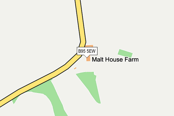
B95 5EW is located in the Claverdon & Snitterfield electoral ward, within the local authority district of Stratford-on-Avon and the English Parliamentary constituency of Stratford-on-Avon. The Sub Integrated Care Board (ICB) Location is NHS Coventry and Warwickshire ICB - B2M3M and the police force is Warwickshire. This postcode has been in use since January 1992.


GetTheData
Source: OS OpenMap – Local (Ordnance Survey)
Source: OS VectorMap District (Ordnance Survey)
Licence: Open Government Licence (requires attribution)
| Easting | 417389 |
| Northing | 266944 |
| Latitude | 52.300347 |
| Longitude | -1.746422 |
GetTheData
Source: Open Postcode Geo
Licence: Open Government Licence
| Country | England |
| Postcode District | B95 |
| ➜ B95 open data dashboard ➜ See where B95 is on a map | |
GetTheData
Source: Land Registry Price Paid Data
Licence: Open Government Licence
Elevation or altitude of B95 5EW as distance above sea level:
| Metres | Feet | |
|---|---|---|
| Elevation | 90m | 295ft |
Elevation is measured from the approximate centre of the postcode, to the nearest point on an OS contour line from OS Terrain 50, which has contour spacing of ten vertical metres.
➜ How high above sea level am I? Find the elevation of your current position using your device's GPS.
GetTheData
Source: Open Postcode Elevation
Licence: Open Government Licence
| Ward | Claverdon & Snitterfield |
| Constituency | Stratford-on-avon |
GetTheData
Source: ONS Postcode Database
Licence: Open Government Licence
| May 2022 | Other theft | On or near Henley Road | 292m |
| June 2021 | Burglary | On or near Henley Road | 292m |
| June 2021 | Vehicle crime | On or near Henley Road | 292m |
| ➜ Get more crime data in our Crime section | |||
GetTheData
Source: data.police.uk
Licence: Open Government Licence
| Mill Lane (Lapworth Street) | Lowsonford | 1,688m |
| Mill Lane (Lapworth Street) | Lowsonford | 1,703m |
| Henley-in-Arden Station | 2.7km |
| Claverdon Station | 4.3km |
| Wootton Wawen Station | 4.5km |
GetTheData
Source: NaPTAN
Licence: Open Government Licence
GetTheData
Source: ONS Postcode Database
Licence: Open Government Licence


➜ Get more ratings from the Food Standards Agency
GetTheData
Source: Food Standards Agency
Licence: FSA terms & conditions
| Last Collection | |||
|---|---|---|---|
| Location | Mon-Fri | Sat | Distance |
| Lowsonford Village | 16:45 | 09:00 | 1,674m |
| Top Of Whitley Hill Warwick Road | 10:00 | 07:30 | 1,769m |
| Yarningale Common | 16:15 | 09:00 | 1,880m |
GetTheData
Source: Dracos
Licence: Creative Commons Attribution-ShareAlike
| Facility | Distance |
|---|---|
| Claverdon Rfc Rod Noon Memorial Theatre, Ossetts Hole Lane, Yarningale Common, Warwick Grass Pitches | 1.5km |
| Henley-in-arden C Of E Primary School Arden Road, Henley-in-arden Grass Pitches | 2.1km |
| Henley In Arden High School Stratford Road, Henley-in-arden Grass Pitches, Sports Hall, Studio | 2.7km |
GetTheData
Source: Active Places
Licence: Open Government Licence
| School | Phase of Education | Distance |
|---|---|---|
| Henley-In-Arden CofE Primary School Arden Road, Henley-in-Arden, B95 5FT | Primary | 2.2km |
| St Mary's Catholic Primary School Arden Road, St Mary's Catholic School, Henley-in-Arden, B95 5LT | Primary | 2.2km |
| Henley-in-Arden Montessori Primary School The Memorial Hall, Station Road, Henley-in-Arden, B95 5JP | Not applicable | 2.4km |
GetTheData
Source: Edubase
Licence: Open Government Licence
The below table lists the International Territorial Level (ITL) codes (formerly Nomenclature of Territorial Units for Statistics (NUTS) codes) and Local Administrative Units (LAU) codes for B95 5EW:
| ITL 1 Code | Name |
|---|---|
| TLG | West Midlands (England) |
| ITL 2 Code | Name |
| TLG1 | Herefordshire, Worcestershire and Warwickshire |
| ITL 3 Code | Name |
| TLG13 | Warwickshire CC |
| LAU 1 Code | Name |
| E07000221 | Stratford-on-Avon |
GetTheData
Source: ONS Postcode Directory
Licence: Open Government Licence
The below table lists the Census Output Area (OA), Lower Layer Super Output Area (LSOA), and Middle Layer Super Output Area (MSOA) for B95 5EW:
| Code | Name | |
|---|---|---|
| OA | E00159031 | |
| LSOA | E01031195 | Stratford-on-Avon 002A |
| MSOA | E02006505 | Stratford-on-Avon 002 |
GetTheData
Source: ONS Postcode Directory
Licence: Open Government Licence
| B95 5EN | 262m | |
| B95 5EQ | Preston Fields Lane | 538m |
| B95 5EZ | Preston Road | 819m |
| B95 5EA | 898m | |
| B95 5EB | 979m | |
| B95 5EL | Rookery Lane | 1016m |
| B95 5DU | Kyte Green | 1198m |
| B95 5ED | 1333m | |
| B95 5EY | Preston Road | 1341m |
| B95 5QJ | Camp Lane | 1403m |
GetTheData
Source: Open Postcode Geo; Land Registry Price Paid Data
Licence: Open Government Licence