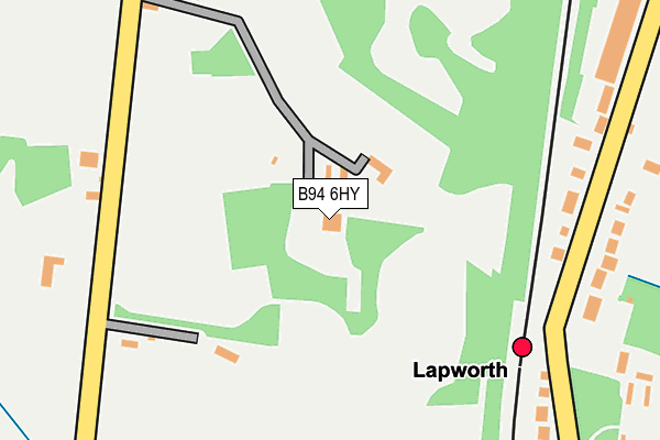
B94 6HY is located in the Kenilworth Abbey & Arden electoral ward, within the local authority district of Warwick and the English Parliamentary constituency of Kenilworth and Southam. The Sub Integrated Care Board (ICB) Location is NHS Coventry and Warwickshire ICB - B2M3M and the police force is Warwickshire. This postcode has been in use since January 1980.


GetTheData
Source: OS OpenMap – Local (Ordnance Survey)
Source: OS VectorMap District (Ordnance Survey)
Licence: Open Government Licence (requires attribution)
| Easting | 418607 |
| Northing | 271700 |
| Latitude | 52.343080 |
| Longitude | -1.728290 |
GetTheData
Source: Open Postcode Geo
Licence: Open Government Licence
| Country | England |
| Postcode District | B94 |
| ➜ B94 open data dashboard ➜ See where B94 is on a map ➜ Where is Kingswood? | |
GetTheData
Source: Land Registry Price Paid Data
Licence: Open Government Licence
Elevation or altitude of B94 6HY as distance above sea level:
| Metres | Feet | |
|---|---|---|
| Elevation | 120m | 394ft |
Elevation is measured from the approximate centre of the postcode, to the nearest point on an OS contour line from OS Terrain 50, which has contour spacing of ten vertical metres.
➜ How high above sea level am I? Find the elevation of your current position using your device's GPS.
GetTheData
Source: Open Postcode Elevation
Licence: Open Government Licence
| Ward | Kenilworth Abbey & Arden |
| Constituency | Kenilworth And Southam |
GetTheData
Source: ONS Postcode Database
Licence: Open Government Licence
| February 2022 | Violence and sexual offences | On or near Meadow Lane | 446m |
| January 2022 | Vehicle crime | On or near Meadow Lane | 446m |
| December 2021 | Burglary | On or near Meadow Lane | 446m |
| ➜ Get more crime data in our Crime section | |||
GetTheData
Source: data.police.uk
Licence: Open Government Licence
| Railway Station (Station Road) | Lapworth | 214m |
| Railway Station (Station Road) | Lapworth | 229m |
| Brome Hall Lane (Old Warwick Road) | Lapworth | 624m |
| Station Lane (Old Warwick Road) | Lapworth | 664m |
| Station Lane (Old Warwick Road) | Lapworth | 666m |
| Lapworth Station | 0.2km |
| Dorridge Station | 3.6km |
GetTheData
Source: NaPTAN
Licence: Open Government Licence
| Percentage of properties with Next Generation Access | 100.0% |
| Percentage of properties with Superfast Broadband | 100.0% |
| Percentage of properties with Ultrafast Broadband | 0.0% |
| Percentage of properties with Full Fibre Broadband | 0.0% |
Superfast Broadband is between 30Mbps and 300Mbps
Ultrafast Broadband is > 300Mbps
| Percentage of properties unable to receive 2Mbps | 0.0% |
| Percentage of properties unable to receive 5Mbps | 0.0% |
| Percentage of properties unable to receive 10Mbps | 0.0% |
| Percentage of properties unable to receive 30Mbps | 0.0% |
GetTheData
Source: Ofcom
Licence: Ofcom Terms of Use (requires attribution)
GetTheData
Source: ONS Postcode Database
Licence: Open Government Licence


➜ Get more ratings from the Food Standards Agency
GetTheData
Source: Food Standards Agency
Licence: FSA terms & conditions
| Last Collection | |||
|---|---|---|---|
| Location | Mon-Fri | Sat | Distance |
| Punch Bowl | 17:30 | 08:15 | 466m |
| Kingswood Close / Station Lane | 17:15 | 09:30 | 575m |
| Kingswood | 17:15 | 08:15 | 691m |
GetTheData
Source: Dracos
Licence: Creative Commons Attribution-ShareAlike
| Facility | Distance |
|---|---|
| Melson Memorial Ground Old Warwick Road, Lapworth Grass Pitches | 1.6km |
| Chadwick End Football Pitch Warwick Road, Chadwick End, Solihull Grass Pitches | 2.5km |
| Hockley Heath Recreation Ground Old Warwick Road, Hockley Heath, Solihull Grass Pitches | 3.3km |
GetTheData
Source: Active Places
Licence: Open Government Licence
| School | Phase of Education | Distance |
|---|---|---|
| Lapworth CofE Primary School Station Lane, Lapworth, Solihull, B94 6LT | Primary | 522m |
| Tudor Grange Primary Academy Hockley Heath School Road, Hockley Heath, Solihull, B94 6RA | Primary | 3.7km |
| Dorridge Primary School Station Road, Dorridge, Solihull, B93 8EU | Primary | 4.1km |
GetTheData
Source: Edubase
Licence: Open Government Licence
The below table lists the International Territorial Level (ITL) codes (formerly Nomenclature of Territorial Units for Statistics (NUTS) codes) and Local Administrative Units (LAU) codes for B94 6HY:
| ITL 1 Code | Name |
|---|---|
| TLG | West Midlands (England) |
| ITL 2 Code | Name |
| TLG1 | Herefordshire, Worcestershire and Warwickshire |
| ITL 3 Code | Name |
| TLG13 | Warwickshire CC |
| LAU 1 Code | Name |
| E07000222 | Warwick |
GetTheData
Source: ONS Postcode Directory
Licence: Open Government Licence
The below table lists the Census Output Area (OA), Lower Layer Super Output Area (LSOA), and Middle Layer Super Output Area (MSOA) for B94 6HY:
| Code | Name | |
|---|---|---|
| OA | E00159502 | |
| LSOA | E01031282 | Warwick 004B |
| MSOA | E02006522 | Warwick 004 |
GetTheData
Source: ONS Postcode Directory
Licence: Open Government Licence
| B94 6JJ | Station Lane | 252m |
| B94 6JH | Station Lane | 260m |
| B94 6LP | Station Lane | 317m |
| B94 6HR | Mill Lane | 375m |
| B94 6LR | Station Lane | 399m |
| B94 6JA | Rising Lane | 441m |
| B94 6LS | Meadow Lane | 483m |
| B94 6JG | Station Lane | 493m |
| B94 6LW | Station Lane | 502m |
| B94 6ES | Chessetts Wood Road | 516m |
GetTheData
Source: Open Postcode Geo; Land Registry Price Paid Data
Licence: Open Government Licence