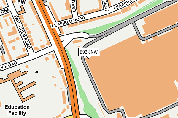
B92 8NW is located in the Elmdon electoral ward, within the metropolitan district of Solihull and the English Parliamentary constituency of Solihull. The Sub Integrated Care Board (ICB) Location is NHS Birmingham and Solihull ICB - 15E and the police force is West Midlands. This postcode has been in use since January 1980.


GetTheData
Source: OS OpenMap – Local (Ordnance Survey)
Source: OS VectorMap District (Ordnance Survey)
Licence: Open Government Licence (requires attribution)
| Easting | 415212 |
| Northing | 281977 |
| Latitude | 52.435574 |
| Longitude | -1.777662 |
GetTheData
Source: Open Postcode Geo
Licence: Open Government Licence
| Country | England |
| Postcode District | B92 |
| ➜ B92 open data dashboard ➜ See where B92 is on a map ➜ Where is Solihull? | |
GetTheData
Source: Land Registry Price Paid Data
Licence: Open Government Licence
Elevation or altitude of B92 8NW as distance above sea level:
| Metres | Feet | |
|---|---|---|
| Elevation | 110m | 361ft |
Elevation is measured from the approximate centre of the postcode, to the nearest point on an OS contour line from OS Terrain 50, which has contour spacing of ten vertical metres.
➜ How high above sea level am I? Find the elevation of your current position using your device's GPS.
GetTheData
Source: Open Postcode Elevation
Licence: Open Government Licence
| Ward | Elmdon |
| Constituency | Solihull |
GetTheData
Source: ONS Postcode Database
Licence: Open Government Licence
| June 2022 | Drugs | On or near Lode Lane | 293m |
| June 2022 | Vehicle crime | On or near Lode Lane | 293m |
| June 2022 | Drugs | On or near Lode Lane | 293m |
| ➜ Get more crime data in our Crime section | |||
GetTheData
Source: data.police.uk
Licence: Open Government Licence
| Land Rover Works Site (Valiant Way) | Elmdon | 206m |
| Land Rover Works (Lode Lane) | Hobs Moat | 288m |
| Land Rover Works (Lode Lane) | Hobs Moat | 320m |
| Dovecote Close (Dove House Lane) | Hobs Moat | 358m |
| Dovecote Close (Dove House Lane) | Hobs Moat | 369m |
| Olton Station | 1.8km |
| Solihull Station | 2.5km |
| Acocks Green Station | 3.2km |
GetTheData
Source: NaPTAN
Licence: Open Government Licence
GetTheData
Source: ONS Postcode Database
Licence: Open Government Licence


➜ Get more ratings from the Food Standards Agency
GetTheData
Source: Food Standards Agency
Licence: FSA terms & conditions
| Last Collection | |||
|---|---|---|---|
| Location | Mon-Fri | Sat | Distance |
| Highwood Avenue / Dovehouse La | 17:15 | 12:00 | 498m |
| Henley Crescent / Lode Lane | 17:15 | 12:00 | 528m |
| Trinity Close Off Faulkner Road | 17:15 | 12:00 | 648m |
GetTheData
Source: Dracos
Licence: Creative Commons Attribution-ShareAlike
| Facility | Distance |
|---|---|
| The Land Rover Sports & Social Club Billsmore Green, Solihull Grass Pitches | 653m |
| Elmdon Park Tanhouse Farm Road, Solihull Grass Pitches, Outdoor Tennis Courts | 929m |
| St Mary's Church Hall Hobs Meadow, Solihull Sports Hall | 937m |
GetTheData
Source: Active Places
Licence: Open Government Licence
| School | Phase of Education | Distance |
|---|---|---|
| Ulverley School Rodney Road, Solihull, B92 8RZ | Primary | 510m |
| Damson Wood Nursery and Infant School Stockwell Rise, Solihull, B92 9LX | Primary | 950m |
| Triple Crown Centre Lode Lane, Solihull, B91 2HW | Not applicable | 1km |
GetTheData
Source: Edubase
Licence: Open Government Licence
The below table lists the International Territorial Level (ITL) codes (formerly Nomenclature of Territorial Units for Statistics (NUTS) codes) and Local Administrative Units (LAU) codes for B92 8NW:
| ITL 1 Code | Name |
|---|---|
| TLG | West Midlands (England) |
| ITL 2 Code | Name |
| TLG3 | West Midlands |
| ITL 3 Code | Name |
| TLG32 | Solihull |
| LAU 1 Code | Name |
| E08000029 | Solihull |
GetTheData
Source: ONS Postcode Directory
Licence: Open Government Licence
The below table lists the Census Output Area (OA), Lower Layer Super Output Area (LSOA), and Middle Layer Super Output Area (MSOA) for B92 8NW:
| Code | Name | |
|---|---|---|
| OA | E00051227 | |
| LSOA | E01010135 | Solihull 011D |
| MSOA | E02002091 | Solihull 011 |
GetTheData
Source: ONS Postcode Directory
Licence: Open Government Licence
| B92 8NR | Lode Lane | 306m |
| B92 8NS | Lode Lane | 332m |
| B92 8NY | Leafield Road | 348m |
| B92 8NN | Lode Lane | 359m |
| B91 2EW | Dove House Lane | 366m |
| B91 2ER | Dove House Lane | 376m |
| B92 8NZ | Leafield Road | 385m |
| B92 8NX | Lode Lane | 397m |
| B92 8SB | Rodney Road | 426m |
| B91 2EP | Dovecote Close | 437m |
GetTheData
Source: Open Postcode Geo; Land Registry Price Paid Data
Licence: Open Government Licence