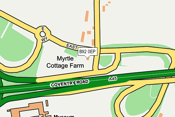
B92 0EP is located in the Bickenhill electoral ward, within the metropolitan district of Solihull and the English Parliamentary constituency of Meriden. The Sub Integrated Care Board (ICB) Location is NHS Birmingham and Solihull ICB - 15E and the police force is West Midlands. This postcode has been in use since December 2014.


GetTheData
Source: OS OpenMap – Local (Ordnance Survey)
Source: OS VectorMap District (Ordnance Survey)
Licence: Open Government Licence (requires attribution)
| Easting | 420245 |
| Northing | 283177 |
| Latitude | 52.446185 |
| Longitude | -1.703566 |
GetTheData
Source: Open Postcode Geo
Licence: Open Government Licence
| Country | England |
| Postcode District | B92 |
| ➜ B92 open data dashboard ➜ See where B92 is on a map | |
GetTheData
Source: Land Registry Price Paid Data
Licence: Open Government Licence
Elevation or altitude of B92 0EP as distance above sea level:
| Metres | Feet | |
|---|---|---|
| Elevation | 100m | 328ft |
Elevation is measured from the approximate centre of the postcode, to the nearest point on an OS contour line from OS Terrain 50, which has contour spacing of ten vertical metres.
➜ How high above sea level am I? Find the elevation of your current position using your device's GPS.
GetTheData
Source: Open Postcode Elevation
Licence: Open Government Licence
| Ward | Bickenhill |
| Constituency | Meriden |
GetTheData
Source: ONS Postcode Database
Licence: Open Government Licence
| June 2022 | Theft from the person | On or near Parking Area | 129m |
| June 2022 | Anti-social behaviour | On or near Parking Area | 129m |
| March 2022 | Other theft | On or near Parking Area | 129m |
| ➜ Get more crime data in our Crime section | |||
GetTheData
Source: data.police.uk
Licence: Open Government Licence
| Bickenhill Lane (Coventry Rd) | Stonebridge | 29m |
| Bickenhill Lane (Coventry Rd) | Stonebridge | 270m |
| Middle Bickenhill Lane (East Way) | Stonebridge | 434m |
| East Way (Coventry Rd) | Stonebridge | 470m |
| Stonebridge Island (Coventry Rd) | Stonebridge | 912m |
| Birmingham International Station | 1.6km |
| Hampton-in-Arden Station | 1.9km |
| Marston Green Station | 4.2km |
GetTheData
Source: NaPTAN
Licence: Open Government Licence
GetTheData
Source: ONS Postcode Database
Licence: Open Government Licence


➜ Get more ratings from the Food Standards Agency
GetTheData
Source: Food Standards Agency
Licence: FSA terms & conditions
| Last Collection | |||
|---|---|---|---|
| Location | Mon-Fri | Sat | Distance |
| Bham Intl Station | 17:00 | 12:00 | 1,559m |
| 4 Police House Diddington Lane | 17:00 | 08:30 | 1,810m |
| Hampton In Arden Post Office | 17:30 | 12:00 | 2,387m |
GetTheData
Source: Dracos
Licence: Creative Commons Attribution-ShareAlike
| Facility | Distance |
|---|---|
| Livingwell Health Club (Birmingham Metropole) National Exhibition Centre, Birmingham Swimming Pool, Health and Fitness Gym | 952m |
| Arden Hotel And Leisure Club Coventry Road, Bickenhill, Solihull Health and Fitness Gym, Swimming Pool | 1.2km |
| The Hampton Health And Fitness Club Old Station Road, Hampton-in-arden, Solihull Health and Fitness Gym, Studio | 1.5km |
GetTheData
Source: Active Places
Licence: Open Government Licence
| School | Phase of Education | Distance |
|---|---|---|
| The Island Project School Diddington Hall, Diddington Lane, Meriden, CV7 7HQ | Not applicable | 1.4km |
| George Fentham Endowed School Fentham Road, Hampton-in-Arden, Solihull, B92 0AY | Primary | 2.3km |
| Mill House School Old Hall Farm, Whitestitch Lane, Meridan, CV7 7JE | Not applicable | 3.7km |
GetTheData
Source: Edubase
Licence: Open Government Licence
The below table lists the International Territorial Level (ITL) codes (formerly Nomenclature of Territorial Units for Statistics (NUTS) codes) and Local Administrative Units (LAU) codes for B92 0EP:
| ITL 1 Code | Name |
|---|---|
| TLG | West Midlands (England) |
| ITL 2 Code | Name |
| TLG3 | West Midlands |
| ITL 3 Code | Name |
| TLG32 | Solihull |
| LAU 1 Code | Name |
| E08000029 | Solihull |
GetTheData
Source: ONS Postcode Directory
Licence: Open Government Licence
The below table lists the Census Output Area (OA), Lower Layer Super Output Area (LSOA), and Middle Layer Super Output Area (MSOA) for B92 0EP:
| Code | Name | |
|---|---|---|
| OA | E00051124 | |
| LSOA | E01010109 | Solihull 009A |
| MSOA | E02002089 | Solihull 009 |
GetTheData
Source: ONS Postcode Directory
Licence: Open Government Licence
| B92 0HJ | Middle Bickenhill Lane | 182m |
| B92 0HQ | Old Station Road | 609m |
| B92 0HF | Old Station Road | 961m |
| B92 0HE | Old Station Road | 1015m |
| B92 0DT | Church Lane | 1074m |
| B92 0HD | The Grove | 1200m |
| B37 7ES | 1207m | |
| B92 0HA | Old Station Road | 1416m |
| B92 0DS | Pitt Lane | 1419m |
| B92 0EY | Old Station Road | 1512m |
GetTheData
Source: Open Postcode Geo; Land Registry Price Paid Data
Licence: Open Government Licence