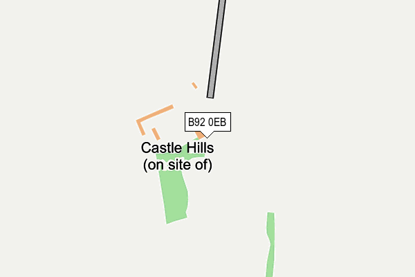
B92 0EB is located in the Bickenhill electoral ward, within the metropolitan district of Solihull and the English Parliamentary constituency of Meriden. The Sub Integrated Care Board (ICB) Location is NHS Birmingham and Solihull ICB - 15E and the police force is West Midlands. This postcode has been in use since December 1996.


GetTheData
Source: OS OpenMap – Local (Ordnance Survey)
Source: OS VectorMap District (Ordnance Survey)
Licence: Open Government Licence (requires attribution)
| Easting | 417717 |
| Northing | 282121 |
| Latitude | 52.436793 |
| Longitude | -1.740808 |
GetTheData
Source: Open Postcode Geo
Licence: Open Government Licence
| Country | England |
| Postcode District | B92 |
| ➜ B92 open data dashboard ➜ See where B92 is on a map | |
GetTheData
Source: Land Registry Price Paid Data
Licence: Open Government Licence
Elevation or altitude of B92 0EB as distance above sea level:
| Metres | Feet | |
|---|---|---|
| Elevation | 110m | 361ft |
Elevation is measured from the approximate centre of the postcode, to the nearest point on an OS contour line from OS Terrain 50, which has contour spacing of ten vertical metres.
➜ How high above sea level am I? Find the elevation of your current position using your device's GPS.
GetTheData
Source: Open Postcode Elevation
Licence: Open Government Licence
| Ward | Bickenhill |
| Constituency | Meriden |
GetTheData
Source: ONS Postcode Database
Licence: Open Government Licence
| Old Damson Lane (Damson Parkway) | Elmdon Park | 920m |
| Old Damson Lane (Damson Parkway) | Elmdon Park | 943m |
| The Clock (Coventry Rd) | Bickenhill | 1,042m |
| Huxbey Drive (Damson Parkway) | Elmdon Park | 1,071m |
| Old Damson Lane (Coventry Rd) | Elmdon | 1,085m |
| Birmingham International Station | 1.9km |
| Hampton-in-Arden Station | 2.9km |
| Marston Green Station | 3.5km |
GetTheData
Source: NaPTAN
Licence: Open Government Licence
GetTheData
Source: ONS Postcode Database
Licence: Open Government Licence

➜ Get more ratings from the Food Standards Agency
GetTheData
Source: Food Standards Agency
Licence: FSA terms & conditions
| Last Collection | |||
|---|---|---|---|
| Location | Mon-Fri | Sat | Distance |
| Wharrhall Road | 17:00 | 12:00 | 712m |
| Cloudbridge Drive / De Moram G | 17:30 | 12:00 | 1,427m |
| Catherine De Barnes Post Offic | 17:00 | 12:00 | 1,767m |
GetTheData
Source: Dracos
Licence: Creative Commons Attribution-ShareAlike
| Facility | Distance |
|---|---|
| Pairc Na Heireann Catherine-de-barnes Lane, Bickenhill, Solihull Grass Pitches | 692m |
| Birmingham Exiles Rfc Old Damson Lane, Solihull Grass Pitches, Health and Fitness Gym | 822m |
| Civil Service Sports Ground (Closed) Old Damson Lane, Solihull Grass Pitches | 870m |
GetTheData
Source: Active Places
Licence: Open Government Licence
| School | Phase of Education | Distance |
|---|---|---|
| Coppice Academy Coppice Road, Solihull, B92 9JY | Primary | 1.6km |
| Damson Wood Nursery and Infant School Stockwell Rise, Solihull, B92 9LX | Primary | 1.9km |
| Tudor Grange Primary Academy Yew Tree Wherretts Well Lane, Solihull, B91 2SD | Primary | 2.2km |
GetTheData
Source: Edubase
Licence: Open Government Licence
The below table lists the International Territorial Level (ITL) codes (formerly Nomenclature of Territorial Units for Statistics (NUTS) codes) and Local Administrative Units (LAU) codes for B92 0EB:
| ITL 1 Code | Name |
|---|---|
| TLG | West Midlands (England) |
| ITL 2 Code | Name |
| TLG3 | West Midlands |
| ITL 3 Code | Name |
| TLG32 | Solihull |
| LAU 1 Code | Name |
| E08000029 | Solihull |
GetTheData
Source: ONS Postcode Directory
Licence: Open Government Licence
The below table lists the Census Output Area (OA), Lower Layer Super Output Area (LSOA), and Middle Layer Super Output Area (MSOA) for B92 0EB:
| Code | Name | |
|---|---|---|
| OA | E00051124 | |
| LSOA | E01010109 | Solihull 009A |
| MSOA | E02002089 | Solihull 009 |
GetTheData
Source: ONS Postcode Directory
Licence: Open Government Licence
| B92 0DB | Catherine De Barnes Lane | 899m |
| B92 9ED | Old Damson Lane | 946m |
| B92 0DP | St Peters Lane | 974m |
| B92 0DR | St Peters Lane | 1033m |
| B92 0PR | Maywell Drive | 1037m |
| B92 0PJ | Windridge Crescent | 1044m |
| B92 0DX | Clock Lane | 1044m |
| B92 0PP | Lansdale Avenue | 1045m |
| B92 0PS | Kendal Grove | 1052m |
| B92 0PW | Limbury Grove | 1098m |
GetTheData
Source: Open Postcode Geo; Land Registry Price Paid Data
Licence: Open Government Licence