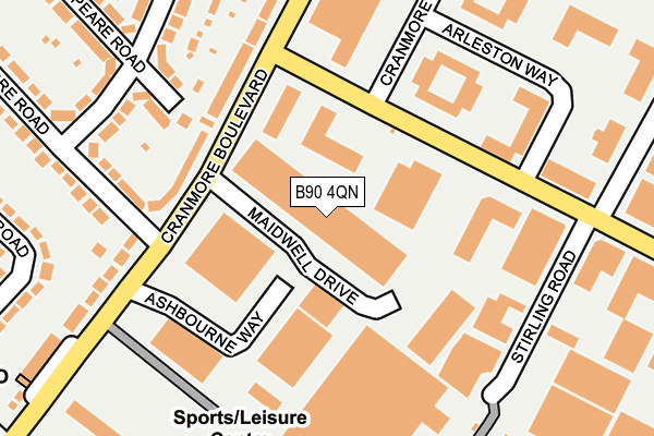
B90 4QN is located in the Shirley South electoral ward, within the metropolitan district of Solihull and the English Parliamentary constituency of Solihull. The Sub Integrated Care Board (ICB) Location is NHS Birmingham and Solihull ICB - 15E and the police force is West Midlands. This postcode has been in use since August 1993.


GetTheData
Source: OS OpenMap – Local (Ordnance Survey)
Source: OS VectorMap District (Ordnance Survey)
Licence: Open Government Licence (requires attribution)
| Easting | 413161 |
| Northing | 277766 |
| Latitude | 52.397770 |
| Longitude | -1.807995 |
GetTheData
Source: Open Postcode Geo
Licence: Open Government Licence
| Country | England |
| Postcode District | B90 |
| ➜ B90 open data dashboard ➜ See where B90 is on a map ➜ Where is Solihull? | |
GetTheData
Source: Land Registry Price Paid Data
Licence: Open Government Licence
Elevation or altitude of B90 4QN as distance above sea level:
| Metres | Feet | |
|---|---|---|
| Elevation | 140m | 459ft |
Elevation is measured from the approximate centre of the postcode, to the nearest point on an OS contour line from OS Terrain 50, which has contour spacing of ten vertical metres.
➜ How high above sea level am I? Find the elevation of your current position using your device's GPS.
GetTheData
Source: Open Postcode Elevation
Licence: Open Government Licence
| Ward | Shirley South |
| Constituency | Solihull |
GetTheData
Source: ONS Postcode Database
Licence: Open Government Licence
| June 2022 | Other theft | On or near Ashbourne Way | 159m |
| June 2022 | Other theft | On or near Ashbourne Way | 159m |
| June 2022 | Public order | On or near Cranmore Drive | 298m |
| ➜ Get more crime data in our Crime section | |||
GetTheData
Source: data.police.uk
Licence: Open Government Licence
| Cranmore Boulevard (Highlands Rd) | Blossomfield | 121m |
| Highlands Rd (Cranmore Boulevard) | Blossomfield | 125m |
| Highlands Rd (Cranmore Boulevard) | Blossomfield | 129m |
| Cranmore Boulevard (Highlands Rd) | Blossomfield | 144m |
| Stirling Rd (Highlands Rd) | Blossomfield | 162m |
| Solihull Station | 2.3km |
| Widney Manor Station | 2.3km |
| Shirley Station | 2.6km |
GetTheData
Source: NaPTAN
Licence: Open Government Licence
GetTheData
Source: ONS Postcode Database
Licence: Open Government Licence


➜ Get more ratings from the Food Standards Agency
GetTheData
Source: Food Standards Agency
Licence: FSA terms & conditions
| Last Collection | |||
|---|---|---|---|
| Location | Mon-Fri | Sat | Distance |
| Cranmore Boulevard Post Office | 18:30 | 11:30 | 306m |
| Cranmore Road / Marshall Lake Road | 17:45 | 11:30 | 532m |
| Widney Lane / Marshall Lake Ro | 17:30 | 12:00 | 551m |
GetTheData
Source: Dracos
Licence: Creative Commons Attribution-ShareAlike
| Facility | Distance |
|---|---|
| David Lloyd (Solihull Cranmore) Cranmore Boulevard, Shirley, Solihull Sports Hall, Swimming Pool, Health and Fitness Gym, Indoor Tennis Centre, Studio, Squash Courts, Outdoor Tennis Courts | 264m |
| Solihull Indoor Bowls Club Brick Kiln Lane, Solihull Indoor Bowls | 535m |
| Solihull Football Centre Brick Kiln Lane, Solihull Artificial Grass Pitch | 565m |
GetTheData
Source: Active Places
Licence: Open Government Licence
| School | Phase of Education | Distance |
|---|---|---|
| Solihull Alternative Provision Academy Cranmore Avenue, Shirley, Solihull, B90 4LE | Not applicable | 198m |
| Cranmore Infant School Northland Road, Shirley, Solihull, B90 4SA | Primary | 447m |
| Widney Junior School Clifton Crescent, Solihull, B91 3LQ | Primary | 573m |
GetTheData
Source: Edubase
Licence: Open Government Licence
The below table lists the International Territorial Level (ITL) codes (formerly Nomenclature of Territorial Units for Statistics (NUTS) codes) and Local Administrative Units (LAU) codes for B90 4QN:
| ITL 1 Code | Name |
|---|---|
| TLG | West Midlands (England) |
| ITL 2 Code | Name |
| TLG3 | West Midlands |
| ITL 3 Code | Name |
| TLG32 | Solihull |
| LAU 1 Code | Name |
| E08000029 | Solihull |
GetTheData
Source: ONS Postcode Directory
Licence: Open Government Licence
The below table lists the Census Output Area (OA), Lower Layer Super Output Area (LSOA), and Middle Layer Super Output Area (MSOA) for B90 4QN:
| Code | Name | |
|---|---|---|
| OA | E00051625 | |
| LSOA | E01010209 | Solihull 022D |
| MSOA | E02002102 | Solihull 022 |
GetTheData
Source: ONS Postcode Directory
Licence: Open Government Licence
| B90 4PD | Highlands Road | 67m |
| B90 4RT | Cranmore Boulevard | 148m |
| B90 4LE | Cranmore Avenue | 180m |
| B90 4RP | Shakespeare Road | 204m |
| B90 4PU | Cranmore Road | 235m |
| B90 4RW | Clinton Road | 252m |
| B90 4ZL | Cranmore Boulevard | 264m |
| B90 4PX | Cranmore Boulevard | 280m |
| B90 4RN | Clinton Road | 285m |
| B90 4RU | Cranmore Boulevard | 316m |
GetTheData
Source: Open Postcode Geo; Land Registry Price Paid Data
Licence: Open Government Licence