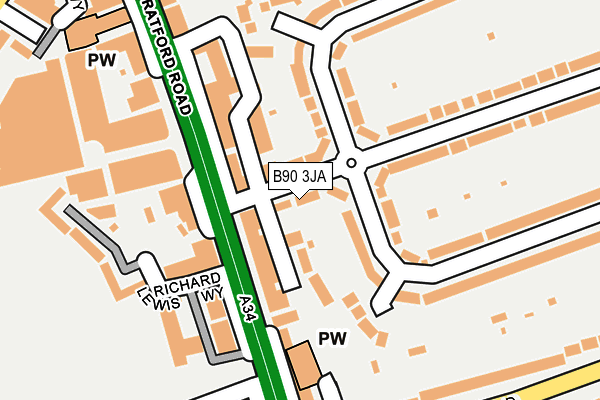
B90 3JA lies on Stanway Road in Shirley, Solihull. B90 3JA is located in the Shirley East electoral ward, within the metropolitan district of Solihull and the English Parliamentary constituency of Solihull. The Sub Integrated Care Board (ICB) Location is NHS Birmingham and Solihull ICB - 15E and the police force is West Midlands. This postcode has been in use since January 1980.


GetTheData
Source: OS OpenMap – Local (Ordnance Survey)
Source: OS VectorMap District (Ordnance Survey)
Licence: Open Government Licence (requires attribution)
| Easting | 411937 |
| Northing | 279396 |
| Latitude | 52.412436 |
| Longitude | -1.825933 |
GetTheData
Source: Open Postcode Geo
Licence: Open Government Licence
| Street | Stanway Road |
| Locality | Shirley |
| Town/City | Solihull |
| Country | England |
| Postcode District | B90 |
| ➜ B90 open data dashboard ➜ See where B90 is on a map ➜ Where is Solihull? | |
GetTheData
Source: Land Registry Price Paid Data
Licence: Open Government Licence
Elevation or altitude of B90 3JA as distance above sea level:
| Metres | Feet | |
|---|---|---|
| Elevation | 140m | 459ft |
Elevation is measured from the approximate centre of the postcode, to the nearest point on an OS contour line from OS Terrain 50, which has contour spacing of ten vertical metres.
➜ How high above sea level am I? Find the elevation of your current position using your device's GPS.
GetTheData
Source: Open Postcode Elevation
Licence: Open Government Licence
| Ward | Shirley East |
| Constituency | Solihull |
GetTheData
Source: ONS Postcode Database
Licence: Open Government Licence
| January 2024 | Shoplifting | On or near Parking Area | 187m |
| January 2024 | Shoplifting | On or near Parking Area | 187m |
| January 2024 | Violence and sexual offences | On or near Parking Area | 187m |
| ➜ Stanway Road crime map and outcomes | |||
GetTheData
Source: data.police.uk
Licence: Open Government Licence
| The Saracens Head (Stratford Rd) | Shirley | 78m |
| The Saracens Head (Stratford Rd) | Shirley | 137m |
| Sutherland Ave (Solihull Rd) | Shirley | 248m |
| Sutherland Ave (Solihull Rd) | Shirley | 260m |
| Jacey Rd (Stratford Rd) | Shirley | 291m |
| Shirley Station | 1.6km |
| Yardley Wood Station | 2.2km |
| Solihull Station | 2.6km |
GetTheData
Source: NaPTAN
Licence: Open Government Licence
| Percentage of properties with Next Generation Access | 100.0% |
| Percentage of properties with Superfast Broadband | 100.0% |
| Percentage of properties with Ultrafast Broadband | 100.0% |
| Percentage of properties with Full Fibre Broadband | 0.0% |
Superfast Broadband is between 30Mbps and 300Mbps
Ultrafast Broadband is > 300Mbps
| Percentage of properties unable to receive 2Mbps | 0.0% |
| Percentage of properties unable to receive 5Mbps | 0.0% |
| Percentage of properties unable to receive 10Mbps | 0.0% |
| Percentage of properties unable to receive 30Mbps | 0.0% |
GetTheData
Source: Ofcom
Licence: Ofcom Terms of Use (requires attribution)
GetTheData
Source: ONS Postcode Database
Licence: Open Government Licence


➜ Get more ratings from the Food Standards Agency
GetTheData
Source: Food Standards Agency
Licence: FSA terms & conditions
| Last Collection | |||
|---|---|---|---|
| Location | Mon-Fri | Sat | Distance |
| Parade Post Office | 18:30 | 11:30 | 98m |
| Sandy Hill | 17:15 | 11:30 | 311m |
| 58 Stanway Road | 18:00 | 11:30 | 350m |
GetTheData
Source: Dracos
Licence: Creative Commons Attribution-ShareAlike
| Facility | Distance |
|---|---|
| The Gym Group (Shirley Solihull) Parkgate Shopping Centre, Stratford Road, Shirley, Solihull Health and Fitness Gym | 327m |
| Shirley Park Grenville Road, Shirley, Solihull Grass Pitches, Outdoor Tennis Courts | 484m |
| Tudor Grange Primary Academy, St James Halifax Road, Shirley, Solihull Grass Pitches | 545m |
GetTheData
Source: Active Places
Licence: Open Government Licence
| School | Phase of Education | Distance |
|---|---|---|
| Tudor Grange Primary Academy, St James Halifax Road, Shirley, Solihull, B90 2BT | Primary | 490m |
| Haslucks Green School Haslucks Green Road, Shirley, Solihull, B90 2EJ | Primary | 561m |
| Kingswood School St James Place, Shirley, Solihull, B90 2BA | Not applicable | 591m |
GetTheData
Source: Edubase
Licence: Open Government Licence
The below table lists the International Territorial Level (ITL) codes (formerly Nomenclature of Territorial Units for Statistics (NUTS) codes) and Local Administrative Units (LAU) codes for B90 3JA:
| ITL 1 Code | Name |
|---|---|
| TLG | West Midlands (England) |
| ITL 2 Code | Name |
| TLG3 | West Midlands |
| ITL 3 Code | Name |
| TLG32 | Solihull |
| LAU 1 Code | Name |
| E08000029 | Solihull |
GetTheData
Source: ONS Postcode Directory
Licence: Open Government Licence
The below table lists the Census Output Area (OA), Lower Layer Super Output Area (LSOA), and Middle Layer Super Output Area (MSOA) for B90 3JA:
| Code | Name | |
|---|---|---|
| OA | E00051590 | |
| LSOA | E01010201 | Solihull 018C |
| MSOA | E02002098 | Solihull 018 |
GetTheData
Source: ONS Postcode Directory
Licence: Open Government Licence
| B90 3JB | Stanway Road | 44m |
| B90 3AH | Stratford Road | 69m |
| B90 3AU | Stratford Road | 97m |
| B90 3FD | Cropthorne Gardens | 137m |
| B90 3AG | Stratford Road | 141m |
| B90 3HX | Welford Road | 171m |
| B90 3AX | Stratford Road | 178m |
| B90 3HZ | Clarence Grove | 182m |
| B90 3JE | Stanway Road | 201m |
| B90 3JN | Cropthorne Road | 204m |
GetTheData
Source: Open Postcode Geo; Land Registry Price Paid Data
Licence: Open Government Licence