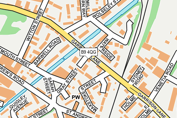
B9 4QG is located in the Bordesley & Highgate electoral ward, within the metropolitan district of Birmingham and the English Parliamentary constituency of Birmingham, Ladywood. The Sub Integrated Care Board (ICB) Location is NHS Birmingham and Solihull ICB - 15E and the police force is West Midlands. This postcode has been in use since January 1980.


GetTheData
Source: OS OpenMap – Local (Ordnance Survey)
Source: OS VectorMap District (Ordnance Survey)
Licence: Open Government Licence (requires attribution)
| Easting | 408917 |
| Northing | 286770 |
| Latitude | 52.478786 |
| Longitude | -1.870137 |
GetTheData
Source: Open Postcode Geo
Licence: Open Government Licence
| Country | England |
| Postcode District | B9 |
| ➜ B9 open data dashboard ➜ See where B9 is on a map ➜ Where is Birmingham? | |
GetTheData
Source: Land Registry Price Paid Data
Licence: Open Government Licence
Elevation or altitude of B9 4QG as distance above sea level:
| Metres | Feet | |
|---|---|---|
| Elevation | 110m | 361ft |
Elevation is measured from the approximate centre of the postcode, to the nearest point on an OS contour line from OS Terrain 50, which has contour spacing of ten vertical metres.
➜ How high above sea level am I? Find the elevation of your current position using your device's GPS.
GetTheData
Source: Open Postcode Elevation
Licence: Open Government Licence
| Ward | Bordesley & Highgate |
| Constituency | Birmingham, Ladywood |
GetTheData
Source: ONS Postcode Database
Licence: Open Government Licence
| January 2024 | Violence and sexual offences | On or near Waterside Close | 69m |
| January 2024 | Violence and sexual offences | On or near Lower Dartmouth Street | 237m |
| December 2023 | Robbery | On or near Waterside Close | 69m |
| ➜ Get more crime data in our Crime section | |||
GetTheData
Source: data.police.uk
Licence: Open Government Licence
| Maxstoke St (Garrison Lane) | Bordesley | 11m |
| Maxstoke St (Garrison Lane) | Bordesley | 63m |
| Venetia Rd (Garrison Lane) | Bordesley | 168m |
| Witton St (Garrison Lane) | Bordesley | 200m |
| Witton St (Garrison Lane) | Bordesley | 233m |
| Bordesley Station | 0.9km |
| Duddeston Station | 1.1km |
| Adderley Park Station | 1.1km |
GetTheData
Source: NaPTAN
Licence: Open Government Licence
GetTheData
Source: ONS Postcode Database
Licence: Open Government Licence


➜ Get more ratings from the Food Standards Agency
GetTheData
Source: Food Standards Agency
Licence: FSA terms & conditions
| Last Collection | |||
|---|---|---|---|
| Location | Mon-Fri | Sat | Distance |
| Grey Street | 18:30 | 11:30 | 42m |
| St Andrews Way / Kingston Road | 18:30 | 11:30 | 328m |
| Midway Along Glover St | 18:30 | 11:30 | 531m |
GetTheData
Source: Dracos
Licence: Creative Commons Attribution-ShareAlike
| Facility | Distance |
|---|---|
| Birmingham City Fc (St Andrews Stadium) Cattell Road, Birmingham Grass Pitches | 381m |
| The Gym Group (Birmingham Digbeth) Westley Street, Birmingham Health and Fitness Gym, Studio | 472m |
| Pat Benson Boxing Academy Adderley Street, Birmingham Health and Fitness Gym | 669m |
GetTheData
Source: Active Places
Licence: Open Government Licence
| School | Phase of Education | Distance |
|---|---|---|
| Bordesley Village Primary School Emmeline Street, Bordesley Village, Birmingham, B9 4NG | Primary | 259m |
| Regents Park Community Primary School Arthur Street, Small Heath, Birmingham, B10 0NJ | Primary | 728m |
| St Vincent's Catholic Primary School Vauxhall Grove, Vauxhall, St Vincent's Catholic Primary School, BIRMINGHAM, B7 4HP | Primary | 767m |
GetTheData
Source: Edubase
Licence: Open Government Licence
The below table lists the International Territorial Level (ITL) codes (formerly Nomenclature of Territorial Units for Statistics (NUTS) codes) and Local Administrative Units (LAU) codes for B9 4QG:
| ITL 1 Code | Name |
|---|---|
| TLG | West Midlands (England) |
| ITL 2 Code | Name |
| TLG3 | West Midlands |
| ITL 3 Code | Name |
| TLG31 | Birmingham |
| LAU 1 Code | Name |
| E08000025 | Birmingham |
GetTheData
Source: ONS Postcode Directory
Licence: Open Government Licence
The below table lists the Census Output Area (OA), Lower Layer Super Output Area (LSOA), and Middle Layer Super Output Area (MSOA) for B9 4QG:
| Code | Name | |
|---|---|---|
| OA | E00046653 | |
| LSOA | E01009199 | Birmingham 052D |
| MSOA | E02001878 | Birmingham 052 |
GetTheData
Source: ONS Postcode Directory
Licence: Open Government Licence
| B9 4QJ | Waterside Close | 70m |
| B9 4PG | Hoff Beck Court | 86m |
| B9 4LA | Lower Dartmouth Street | 113m |
| B9 4LS | Gray Street | 128m |
| B9 4JQ | Maxstoke Street | 133m |
| B9 4PJ | Alport Croft | 158m |
| B9 4QH | Artillery Street | 160m |
| B9 4LB | Barwell Road | 161m |
| B9 4LJ | Park Villas | 192m |
| B9 4PW | Mease Croft | 193m |
GetTheData
Source: Open Postcode Geo; Land Registry Price Paid Data
Licence: Open Government Licence