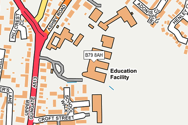
B79 8AH is located in the Spital electoral ward, within the local authority district of Tamworth and the English Parliamentary constituency of Tamworth. The Sub Integrated Care Board (ICB) Location is NHS Staffordshire and Stoke-on-Trent ICB - 05Q and the police force is Staffordshire. This postcode has been in use since January 1980.


GetTheData
Source: OS OpenMap – Local (Ordnance Survey)
Source: OS VectorMap District (Ordnance Survey)
Licence: Open Government Licence (requires attribution)
| Easting | 420986 |
| Northing | 304805 |
| Latitude | 52.640587 |
| Longitude | -1.691304 |
GetTheData
Source: Open Postcode Geo
Licence: Open Government Licence
| Country | England |
| Postcode District | B79 |
| ➜ B79 open data dashboard ➜ See where B79 is on a map ➜ Where is Tamworth? | |
GetTheData
Source: Land Registry Price Paid Data
Licence: Open Government Licence
Elevation or altitude of B79 8AH as distance above sea level:
| Metres | Feet | |
|---|---|---|
| Elevation | 80m | 262ft |
Elevation is measured from the approximate centre of the postcode, to the nearest point on an OS contour line from OS Terrain 50, which has contour spacing of ten vertical metres.
➜ How high above sea level am I? Find the elevation of your current position using your device's GPS.
GetTheData
Source: Open Postcode Elevation
Licence: Open Government Licence
| Ward | Spital |
| Constituency | Tamworth |
GetTheData
Source: ONS Postcode Database
Licence: Open Government Licence
| January 2024 | Public order | On or near Salter'S Lane | 381m |
| December 2023 | Vehicle crime | On or near Kensington Drive | 400m |
| November 2023 | Anti-social behaviour | On or near Salter'S Lane | 381m |
| ➜ Get more crime data in our Crime section | |||
GetTheData
Source: data.police.uk
Licence: Open Government Licence
| Queen Elizabeth School (Ashby Rd) | Perry Crofts | 188m |
| Queen Elizabeth School (Ashby Rd) | Perry Crofts | 192m |
| Tennis Courts (Wigginton Road) | Perry Crofts | 242m |
| Tennis Courts (Wigginton Road) | Perry Crofts | 242m |
| Hillcrest Close (Comberford Road) | Leyfields | 285m |
| Tamworth Station | 0.5km |
| Tamworth High Level Station | 0.5km |
| Wilnecote (Staffs) Station | 3.4km |
GetTheData
Source: NaPTAN
Licence: Open Government Licence
GetTheData
Source: ONS Postcode Database
Licence: Open Government Licence


➜ Get more ratings from the Food Standards Agency
GetTheData
Source: Food Standards Agency
Licence: FSA terms & conditions
| Last Collection | |||
|---|---|---|---|
| Location | Mon-Fri | Sat | Distance |
| Perrycrofts Crescent / Farm Cl | 17:15 | 11:30 | 405m |
| Lichfield Road Hopwas Hill | 17:15 | 09:00 | 487m |
| 2 Albert Road | 18:30 | 11:30 | 495m |
GetTheData
Source: Dracos
Licence: Creative Commons Attribution-ShareAlike
| Facility | Distance |
|---|---|
| Landau-forte Academy Tamworth Sixth Form Ashby Road, Tamworth Health and Fitness Gym, Studio, Grass Pitches | 0m |
| Landau-forte Academy Qems Ashby Road, Tamworth Grass Pitches, Sports Hall, Swimming Pool, Artificial Grass Pitch, Studio | 127m |
| South Staffordshire College Croft Street, Tamworth Health and Fitness Gym, Grass Pitches | 136m |
GetTheData
Source: Active Places
Licence: Open Government Licence
| School | Phase of Education | Distance |
|---|---|---|
| Landau Forte Academy Tamworth Sixth Form Ashby Road, Tamworth, B79 8AA | 16 plus | 1m |
| Landau Forte Academy, QEMS Ashby Road, Tamworth, B79 8AH | Secondary | 124m |
| Mortimer House School Mortimer House, 17 Victoria Road, Tamworth, Staffordshire, B79 7HS | Not applicable | 595m |
GetTheData
Source: Edubase
Licence: Open Government Licence
The below table lists the International Territorial Level (ITL) codes (formerly Nomenclature of Territorial Units for Statistics (NUTS) codes) and Local Administrative Units (LAU) codes for B79 8AH:
| ITL 1 Code | Name |
|---|---|
| TLG | West Midlands (England) |
| ITL 2 Code | Name |
| TLG2 | Shropshire and Staffordshire |
| ITL 3 Code | Name |
| TLG24 | Staffordshire CC |
| LAU 1 Code | Name |
| E07000199 | Tamworth |
GetTheData
Source: ONS Postcode Directory
Licence: Open Government Licence
The below table lists the Census Output Area (OA), Lower Layer Super Output Area (LSOA), and Middle Layer Super Output Area (MSOA) for B79 8AH:
| Code | Name | |
|---|---|---|
| OA | E00152119 | |
| LSOA | E01029853 | Tamworth 001E |
| MSOA | E02006217 | Tamworth 001 |
GetTheData
Source: ONS Postcode Directory
Licence: Open Government Licence
| B79 8AY | Croft Avenue | 120m |
| B79 8AF | School Walk | 136m |
| B79 8AJ | Perry Close | 158m |
| B79 8AZ | Standon Gardens | 183m |
| B79 8AG | Ashby Road | 189m |
| B79 8AA | Upper Gungate | 191m |
| B79 8AB | Croft Street | 212m |
| B79 8TZ | Iris Close | 233m |
| B79 8AX | Upper Gungate | 255m |
| B79 8TY | Adonis Close | 277m |
GetTheData
Source: Open Postcode Geo; Land Registry Price Paid Data
Licence: Open Government Licence