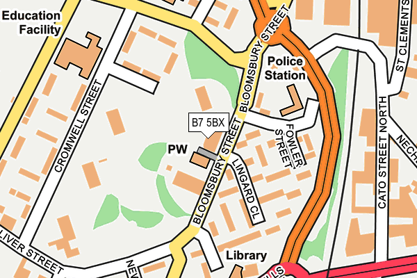
B7 5BX is located in the Nechells electoral ward, within the metropolitan district of Birmingham and the English Parliamentary constituency of Birmingham, Ladywood. The Sub Integrated Care Board (ICB) Location is NHS Birmingham and Solihull ICB - 15E and the police force is West Midlands. This postcode has been in use since January 1980.


GetTheData
Source: OS OpenMap – Local (Ordnance Survey)
Source: OS VectorMap District (Ordnance Survey)
Licence: Open Government Licence (requires attribution)
| Easting | 408775 |
| Northing | 288477 |
| Latitude | 52.494148 |
| Longitude | -1.872179 |
GetTheData
Source: Open Postcode Geo
Licence: Open Government Licence
| Country | England |
| Postcode District | B7 |
| ➜ B7 open data dashboard ➜ See where B7 is on a map ➜ Where is Birmingham? | |
GetTheData
Source: Land Registry Price Paid Data
Licence: Open Government Licence
Elevation or altitude of B7 5BX as distance above sea level:
| Metres | Feet | |
|---|---|---|
| Elevation | 110m | 361ft |
Elevation is measured from the approximate centre of the postcode, to the nearest point on an OS contour line from OS Terrain 50, which has contour spacing of ten vertical metres.
➜ How high above sea level am I? Find the elevation of your current position using your device's GPS.
GetTheData
Source: Open Postcode Elevation
Licence: Open Government Licence
| Ward | Nechells |
| Constituency | Birmingham, Ladywood |
GetTheData
Source: ONS Postcode Database
Licence: Open Government Licence
| January 2024 | Violence and sexual offences | On or near Oliver Street | 286m |
| January 2024 | Other theft | On or near Oliver Street | 286m |
| December 2023 | Robbery | On or near Oliver Street | 286m |
| ➜ Get more crime data in our Crime section | |||
GetTheData
Source: data.police.uk
Licence: Open Government Licence
| Rocky Lane (Bloomsbury St) | Nechells Green | 45m |
| Rocky Lane (Bloomsbury St) | Nechells Green | 106m |
| Oliver St (Bloomsbury St) | Nechells Green | 128m |
| Oliver St (Bloomsbury St) | Nechells Green | 156m |
| Nechells Police Station (Goodrick Way) | Saltley | 165m |
| Duddeston Station | 0.6km |
| Aston Station | 1.1km |
| Adderley Park Station | 1.7km |
GetTheData
Source: NaPTAN
Licence: Open Government Licence
GetTheData
Source: ONS Postcode Database
Licence: Open Government Licence


➜ Get more ratings from the Food Standards Agency
GetTheData
Source: Food Standards Agency
Licence: FSA terms & conditions
| Last Collection | |||
|---|---|---|---|
| Location | Mon-Fri | Sat | Distance |
| Bloomsbury Walk / Bloomsbury S | 17:30 | 12:30 | 145m |
| Brough Close | 17:30 | 12:30 | 327m |
| Bloomsbury Post Office | 18:30 | 12:30 | 467m |
GetTheData
Source: Dracos
Licence: Creative Commons Attribution-ShareAlike
| Facility | Distance |
|---|---|
| Heartlands Academy (Closed) Great Francis Street, Birmingham Sports Hall, Artificial Grass Pitch | 645m |
| Nechells Wellbeing Centre Rupert Street, Birmingham Sports Hall, Health and Fitness Gym, Grass Pitches, Studio, Artificial Grass Pitch | 652m |
| Heartlands Academy Great Francis Street, Nechells, Birmingham Health and Fitness Gym, Sports Hall, Studio, Artificial Grass Pitch | 674m |
GetTheData
Source: Active Places
Licence: Open Government Licence
| School | Phase of Education | Distance |
|---|---|---|
| Bloomsbury Nursery School Bloomsbury Street, Nechells, Birmingham, B7 5BX | Nursery | 65m |
| St Joseph's Catholic Primary School Rocky Lane, Nechells, Birmingham, B7 5HA | Primary | 222m |
| Cromwell Junior and Infant School Cromwell Street, Nechells, Birmingham, B7 5BA | Primary | 222m |
GetTheData
Source: Edubase
Licence: Open Government Licence
The below table lists the International Territorial Level (ITL) codes (formerly Nomenclature of Territorial Units for Statistics (NUTS) codes) and Local Administrative Units (LAU) codes for B7 5BX:
| ITL 1 Code | Name |
|---|---|
| TLG | West Midlands (England) |
| ITL 2 Code | Name |
| TLG3 | West Midlands |
| ITL 3 Code | Name |
| TLG31 | Birmingham |
| LAU 1 Code | Name |
| E08000025 | Birmingham |
GetTheData
Source: ONS Postcode Directory
Licence: Open Government Licence
The below table lists the Census Output Area (OA), Lower Layer Super Output Area (LSOA), and Middle Layer Super Output Area (MSOA) for B7 5BX:
| Code | Name | |
|---|---|---|
| OA | E00046670 | |
| LSOA | E01009203 | Birmingham 043C |
| MSOA | E02001869 | Birmingham 043 |
GetTheData
Source: ONS Postcode Directory
Licence: Open Government Licence
| B7 5BN | Bloomsbury Street | 71m |
| B7 5BS | Bloomsbury Street | 79m |
| B7 5DJ | Lingard Close | 90m |
| B7 5DA | Fowler Street | 108m |
| B7 5AZ | Chadsmoor Terrace | 143m |
| B7 5DG | Bloomsbury Walk | 148m |
| B7 5EY | Rocky Lane | 157m |
| B7 5BP | Bloomsbury Street | 161m |
| B7 5HA | Rocky Lane | 169m |
| B7 5AY | Cromwell Street | 180m |
GetTheData
Source: Open Postcode Geo; Land Registry Price Paid Data
Licence: Open Government Licence