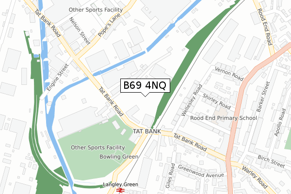
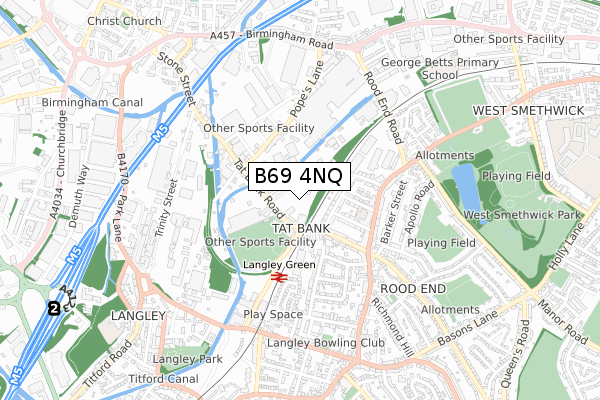
B69 4NQ is located in the Oldbury electoral ward, within the metropolitan district of Sandwell and the English Parliamentary constituency of West Bromwich West. The Sub Integrated Care Board (ICB) Location is NHS Black Country ICB - D2P2L and the police force is West Midlands. This postcode has been in use since January 1980.


GetTheData
Source: OS Open Zoomstack (Ordnance Survey)
Licence: Open Government Licence (requires attribution)
Attribution: Contains OS data © Crown copyright and database right 2024
Source: Open Postcode Geo
Licence: Open Government Licence (requires attribution)
Attribution: Contains OS data © Crown copyright and database right 2024; Contains Royal Mail data © Royal Mail copyright and database right 2024; Source: Office for National Statistics licensed under the Open Government Licence v.3.0
| Easting | 399773 |
| Northing | 288673 |
| Latitude | 52.495979 |
| Longitude | -2.004767 |
GetTheData
Source: Open Postcode Geo
Licence: Open Government Licence
| Country | England |
| Postcode District | B69 |
| ➜ B69 open data dashboard ➜ See where B69 is on a map ➜ Where is Oldbury? | |
GetTheData
Source: Land Registry Price Paid Data
Licence: Open Government Licence
Elevation or altitude of B69 4NQ as distance above sea level:
| Metres | Feet | |
|---|---|---|
| Elevation | 160m | 525ft |
Elevation is measured from the approximate centre of the postcode, to the nearest point on an OS contour line from OS Terrain 50, which has contour spacing of ten vertical metres.
➜ How high above sea level am I? Find the elevation of your current position using your device's GPS.
GetTheData
Source: Open Postcode Elevation
Licence: Open Government Licence
| Ward | Oldbury |
| Constituency | West Bromwich West |
GetTheData
Source: ONS Postcode Database
Licence: Open Government Licence
| January 2024 | Violence and sexual offences | On or near Parking Area | 336m |
| October 2023 | Drugs | On or near Parking Area | 336m |
| September 2023 | Burglary | On or near Park/Open Space | 331m |
| ➜ Get more crime data in our Crime section | |||
GetTheData
Source: data.police.uk
Licence: Open Government Licence
| Western Rd (Tat Bank Rd) | Tat Bank | 45m |
| Western Rd (Tat Bank Rd) | Tat Bank | 55m |
| Langley Green Station (Western Rd) | Langley Green | 167m |
| Langley Green Station (Western Rd) | Langley Green | 172m |
| Pope's Lane (Tat Bank Rd) | Tat Bank | 315m |
| Kenrick Park (Midland Metro Stop) (Roebuck Lane) | West Bromwich | 2,063m |
| Langley Green Station | 0.2km |
| Sandwell & Dudley Station | 1.5km |
| Smethwick Galton Bridge Station | 1.8km |
GetTheData
Source: NaPTAN
Licence: Open Government Licence
GetTheData
Source: ONS Postcode Database
Licence: Open Government Licence


➜ Get more ratings from the Food Standards Agency
GetTheData
Source: Food Standards Agency
Licence: FSA terms & conditions
| Last Collection | |||
|---|---|---|---|
| Location | Mon-Fri | Sat | Distance |
| Priory Drive / Vicarage Road | 17:15 | 12:00 | 423m |
| Rood End Post Office | 17:15 | 12:00 | 498m |
| Crosswells Road / Vicarage Road | 17:45 | 12:00 | 654m |
GetTheData
Source: Dracos
Licence: Creative Commons Attribution-ShareAlike
| Facility | Distance |
|---|---|
| Warley Rfc Tat Bank Road, Oldbury Grass Pitches, Artificial Grass Pitch | 186m |
| Legacy (Closed) Popes Lane, Oldbury Health and Fitness Gym | 275m |
| Legacy (Closed) Popes Lane, Oldbury Health and Fitness Gym | 275m |
GetTheData
Source: Active Places
Licence: Open Government Licence
| School | Phase of Education | Distance |
|---|---|---|
| Rood End Primary School Rood End Road, Oldbury, B68 8SQ | Primary | 326m |
| Langley Primary School Titford Road, Oldbury, B69 4QB | Primary | 859m |
| George Betts Primary Academy West End Avenue, Smethwick, B66 1RE | Primary | 900m |
GetTheData
Source: Edubase
Licence: Open Government Licence
The below table lists the International Territorial Level (ITL) codes (formerly Nomenclature of Territorial Units for Statistics (NUTS) codes) and Local Administrative Units (LAU) codes for B69 4NQ:
| ITL 1 Code | Name |
|---|---|
| TLG | West Midlands (England) |
| ITL 2 Code | Name |
| TLG3 | West Midlands |
| ITL 3 Code | Name |
| TLG37 | Sandwell |
| LAU 1 Code | Name |
| E08000028 | Sandwell |
GetTheData
Source: ONS Postcode Directory
Licence: Open Government Licence
The below table lists the Census Output Area (OA), Lower Layer Super Output Area (LSOA), and Middle Layer Super Output Area (MSOA) for B69 4NQ:
| Code | Name | |
|---|---|---|
| OA | E00050674 | |
| LSOA | E01010019 | Sandwell 024B |
| MSOA | E02002066 | Sandwell 024 |
GetTheData
Source: ONS Postcode Directory
Licence: Open Government Licence
| B69 4NH | Tat Bank Road | 74m |
| B69 4ND | Tat Bank Road | 130m |
| B69 4NB | Tat Bank Road | 138m |
| B68 8RY | Wellesley Road | 150m |
| B68 8RZ | Wellesley Road | 185m |
| B68 8JG | Giles Road | 222m |
| B68 8NR | Tat Bank Road | 241m |
| B68 8JQ | Giles Road | 252m |
| B68 8SB | Gresham Road | 254m |
| B68 8NP | Tat Bank Road | 261m |
GetTheData
Source: Open Postcode Geo; Land Registry Price Paid Data
Licence: Open Government Licence