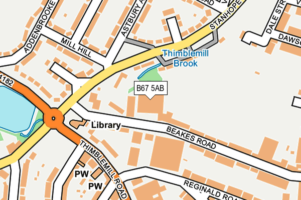
B67 5AB is located in the Abbey electoral ward, within the metropolitan district of Sandwell and the English Parliamentary constituency of Warley. The Sub Integrated Care Board (ICB) Location is NHS Black Country ICB - D2P2L and the police force is West Midlands. This postcode has been in use since January 1980.


GetTheData
Source: OS OpenMap – Local (Ordnance Survey)
Source: OS VectorMap District (Ordnance Survey)
Licence: Open Government Licence (requires attribution)
| Easting | 401841 |
| Northing | 287119 |
| Latitude | 52.481991 |
| Longitude | -1.974320 |
GetTheData
Source: Open Postcode Geo
Licence: Open Government Licence
| Country | England |
| Postcode District | B67 |
| ➜ B67 open data dashboard ➜ See where B67 is on a map ➜ Where is Smethwick? | |
GetTheData
Source: Land Registry Price Paid Data
Licence: Open Government Licence
Elevation or altitude of B67 5AB as distance above sea level:
| Metres | Feet | |
|---|---|---|
| Elevation | 170m | 558ft |
Elevation is measured from the approximate centre of the postcode, to the nearest point on an OS contour line from OS Terrain 50, which has contour spacing of ten vertical metres.
➜ How high above sea level am I? Find the elevation of your current position using your device's GPS.
GetTheData
Source: Open Postcode Elevation
Licence: Open Government Licence
| Ward | Abbey |
| Constituency | Warley |
GetTheData
Source: ONS Postcode Database
Licence: Open Government Licence
| January 2024 | Violence and sexual offences | On or near Stanhope Road | 170m |
| January 2024 | Theft from the person | On or near Stanhope Road | 170m |
| January 2024 | Other theft | On or near Stanhope Road | 170m |
| ➜ Get more crime data in our Crime section | |||
GetTheData
Source: data.police.uk
Licence: Open Government Licence
| Davidsons Rd (Stanhope Rd) | Bearwood | 134m |
| Mill Hill (Stanhope Rd) | Bearwood | 136m |
| Davidsons Rd (Stanhope Rd) | Bearwood | 143m |
| Swimming Baths (Thimblemill Rd) | Bearwood | 203m |
| Addenbrooke Road (Thimblemill Rd) | Bearwood | 241m |
| Smethwick Rolfe Street Station | 1.6km |
| Smethwick Galton Bridge Station | 2.2km |
| Langley Green Station | 2.5km |
GetTheData
Source: NaPTAN
Licence: Open Government Licence
GetTheData
Source: ONS Postcode Database
Licence: Open Government Licence

➜ Get more ratings from the Food Standards Agency
GetTheData
Source: Food Standards Agency
Licence: FSA terms & conditions
| Last Collection | |||
|---|---|---|---|
| Location | Mon-Fri | Sat | Distance |
| Thimblemill Post Office | 18:30 | 12:00 | 158m |
| Davison Road / Astbury Road | 17:30 | 12:00 | 257m |
| Bearwood Road Bet Talbot Road &lin | 17:30 | 12:00 | 352m |
GetTheData
Source: Dracos
Licence: Creative Commons Attribution-ShareAlike
| Facility | Distance |
|---|---|
| Smethwick Swimming Centre (Closed) Thimblemill Road, Smethwick Swimming Pool, Health and Fitness Gym, Studio | 192m |
| Thimblemill Recreation Centre Thimblemill Road, Smethwick Sports Hall, Grass Pitches | 579m |
| Hadley Stadium Waterloo Road, Smethwick Sports Hall, Athletics, Health and Fitness Gym, Artificial Grass Pitch, Grass Pitches | 624m |
GetTheData
Source: Active Places
Licence: Open Government Licence
| School | Phase of Education | Distance |
|---|---|---|
| Uplands Manor Primary School and Nursery Addenbrooke Road, Smethwick, B67 6HT | Primary | 364m |
| Bearwood Primary School Bearwood Road, Smethwick, B66 4HB | Primary | 515m |
| St Gregory's Catholic Primary School Park Road, Bearwood, Smethwick, B67 5HX | Primary | 616m |
GetTheData
Source: Edubase
Licence: Open Government Licence
The below table lists the International Territorial Level (ITL) codes (formerly Nomenclature of Territorial Units for Statistics (NUTS) codes) and Local Administrative Units (LAU) codes for B67 5AB:
| ITL 1 Code | Name |
|---|---|
| TLG | West Midlands (England) |
| ITL 2 Code | Name |
| TLG3 | West Midlands |
| ITL 3 Code | Name |
| TLG37 | Sandwell |
| LAU 1 Code | Name |
| E08000028 | Sandwell |
GetTheData
Source: ONS Postcode Directory
Licence: Open Government Licence
The below table lists the Census Output Area (OA), Lower Layer Super Output Area (LSOA), and Middle Layer Super Output Area (MSOA) for B67 5AB:
| Code | Name | |
|---|---|---|
| OA | E00050185 | |
| LSOA | E01009928 | Sandwell 034G |
| MSOA | E02002076 | Sandwell 034 |
GetTheData
Source: ONS Postcode Directory
Licence: Open Government Licence
| B67 5RN | Beakes Road | 0m |
| B67 6JJ | Stanhope Road | 162m |
| B67 5RG | Thimblemill Road | 172m |
| B67 6HP | Stanhope Road | 183m |
| B67 5AF | Reginald Road | 183m |
| B67 6JH | Astbury Avenue | 188m |
| B67 6HR | Mill Hill | 193m |
| B67 5RU | Beakes Road | 204m |
| B67 6HU | Old Chapel Road | 205m |
| B67 5RS | Beakes Road | 207m |
GetTheData
Source: Open Postcode Geo; Land Registry Price Paid Data
Licence: Open Government Licence