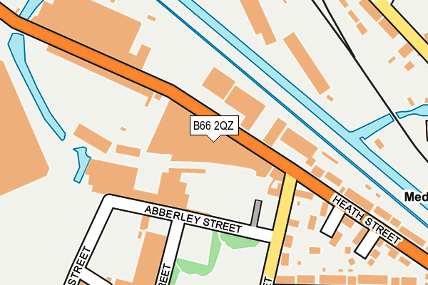
B66 2QZ lies on Heath Street Industrial Estate in Smethwick. B66 2QZ is located in the Soho and Victoria electoral ward, within the metropolitan district of Sandwell and the English Parliamentary constituency of Warley. The Sub Integrated Care Board (ICB) Location is NHS Black Country ICB - D2P2L and the police force is West Midlands. This postcode has been in use since June 1997.


GetTheData
Source: OS OpenMap – Local (Ordnance Survey)
Source: OS VectorMap District (Ordnance Survey)
Licence: Open Government Licence (requires attribution)
| Easting | 403816 |
| Northing | 288135 |
| Latitude | 52.491115 |
| Longitude | -1.945228 |
GetTheData
Source: Open Postcode Geo
Licence: Open Government Licence
| Street | Heath Street Industrial Estate |
| Town/City | Smethwick |
| Country | England |
| Postcode District | B66 |
| ➜ B66 open data dashboard ➜ See where B66 is on a map ➜ Where is Birmingham? | |
GetTheData
Source: Land Registry Price Paid Data
Licence: Open Government Licence
Elevation or altitude of B66 2QZ as distance above sea level:
| Metres | Feet | |
|---|---|---|
| Elevation | 140m | 459ft |
Elevation is measured from the approximate centre of the postcode, to the nearest point on an OS contour line from OS Terrain 50, which has contour spacing of ten vertical metres.
➜ How high above sea level am I? Find the elevation of your current position using your device's GPS.
GetTheData
Source: Open Postcode Elevation
Licence: Open Government Licence
| Ward | Soho And Victoria |
| Constituency | Warley |
GetTheData
Source: ONS Postcode Database
Licence: Open Government Licence
| January 2024 | Burglary | On or near Parking Area | 415m |
| January 2024 | Burglary | On or near Parking Area | 415m |
| January 2024 | Anti-social behaviour | On or near Barleycorn Drive | 493m |
| ➜ Get more crime data in our Crime section | |||
GetTheData
Source: data.police.uk
Licence: Open Government Licence
| Unett St (Grove Lane) | Cape Hill | 368m |
| Cape Hill (Grove Lane) | Cape Hill | 378m |
| Dugdale St (Dudley Rd) | Rotton Park | 431m |
| Dugdale St (Dudley Rd) | Rotton Park | 433m |
| London St (Grove Lane) | Cape Hill | 441m |
| Winson Green Outer Circle (Midland Metro Stop) (Boulton Road) | Winson Green | 939m |
| Soho Benson Road (Midland Metro Stop) (Benson Road) | Winson Green | 1,151m |
| Handsworth Booth Street (Midland Metro Stop) (Booth Street) | Handsworth | 1,295m |
| Smethwick Rolfe Street Station | 1.8km |
| The Hawthorns Station | 2km |
| Jewellery Quarter Station | 2.2km |
GetTheData
Source: NaPTAN
Licence: Open Government Licence
GetTheData
Source: ONS Postcode Database
Licence: Open Government Licence

➜ Get more ratings from the Food Standards Agency
GetTheData
Source: Food Standards Agency
Licence: FSA terms & conditions
| Last Collection | |||
|---|---|---|---|
| Location | Mon-Fri | Sat | Distance |
| Winson St / Abberly St | 17:30 | 12:30 | 163m |
| Dudley Road Post Office | 18:30 | 12:30 | 448m |
| Winson Green Post Office | 18:30 | 12:30 | 484m |
GetTheData
Source: Dracos
Licence: Creative Commons Attribution-ShareAlike
| Facility | Distance |
|---|---|
| Oasis Academy Foundry Foundry Road, Birmingham Grass Pitches | 433m |
| Summerfield Junior And Infant School Cuthbert Road, Winson Green, Birmingham Grass Pitches | 462m |
| Summerfield Community Sports Centre Dudley Road, Birmingham Sports Hall, Health and Fitness Gym, Studio | 660m |
GetTheData
Source: Active Places
Licence: Open Government Licence
| School | Phase of Education | Distance |
|---|---|---|
| Oasis Academy Foundry Foundry Road, Birmingham, B18 4LP | Primary | 433m |
| Summerfield Junior and Infant School Cuthbert Road, Winson Green, Birmingham, B18 4AH | Primary | 462m |
| Summerfield Junior and Infant School Cuthbert Road, Winson Green, Birmingham, B18 4AH | Primary | 462m |
GetTheData
Source: Edubase
Licence: Open Government Licence
The below table lists the International Territorial Level (ITL) codes (formerly Nomenclature of Territorial Units for Statistics (NUTS) codes) and Local Administrative Units (LAU) codes for B66 2QZ:
| ITL 1 Code | Name |
|---|---|
| TLG | West Midlands (England) |
| ITL 2 Code | Name |
| TLG3 | West Midlands |
| ITL 3 Code | Name |
| TLG37 | Sandwell |
| LAU 1 Code | Name |
| E08000028 | Sandwell |
GetTheData
Source: ONS Postcode Directory
Licence: Open Government Licence
The below table lists the Census Output Area (OA), Lower Layer Super Output Area (LSOA), and Middle Layer Super Output Area (MSOA) for B66 2QZ:
| Code | Name | |
|---|---|---|
| OA | E00050892 | |
| LSOA | E01010063 | Sandwell 026D |
| MSOA | E02002068 | Sandwell 026 |
GetTheData
Source: ONS Postcode Directory
Licence: Open Government Licence
| B66 2QY | Heath Street | 64m |
| B18 4JW | Winson Street | 171m |
| B18 4DF | Heath Street | 214m |
| B18 4DE | Hamberley Court | 216m |
| B18 4NS | Wellington Street | 230m |
| B18 4DG | Tudor Street | 235m |
| B18 4DD | Smeaton Gardens | 242m |
| B18 4JT | Winson Street | 288m |
| B18 4DA | Heath Street | 296m |
| B18 4DJ | Wood Green Road | 313m |
GetTheData
Source: Open Postcode Geo; Land Registry Price Paid Data
Licence: Open Government Licence