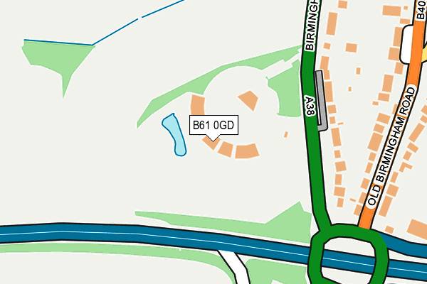
B61 0GD is located in the Catshill South electoral ward, within the local authority district of Bromsgrove and the English Parliamentary constituency of Bromsgrove. The Sub Integrated Care Board (ICB) Location is NHS Herefordshire and Worcestershire ICB - 18C and the police force is West Mercia. This postcode has been in use since December 2010.


GetTheData
Source: OS OpenMap – Local (Ordnance Survey)
Source: OS VectorMap District (Ordnance Survey)
Licence: Open Government Licence (requires attribution)
| Easting | 396789 |
| Northing | 273228 |
| Latitude | 52.357103 |
| Longitude | -2.048572 |
GetTheData
Source: Open Postcode Geo
Licence: Open Government Licence
| Country | England |
| Postcode District | B61 |
| ➜ B61 open data dashboard ➜ See where B61 is on a map | |
GetTheData
Source: Land Registry Price Paid Data
Licence: Open Government Licence
Elevation or altitude of B61 0GD as distance above sea level:
| Metres | Feet | |
|---|---|---|
| Elevation | 140m | 459ft |
Elevation is measured from the approximate centre of the postcode, to the nearest point on an OS contour line from OS Terrain 50, which has contour spacing of ten vertical metres.
➜ How high above sea level am I? Find the elevation of your current position using your device's GPS.
GetTheData
Source: Open Postcode Elevation
Licence: Open Government Licence
| Ward | Catshill South |
| Constituency | Bromsgrove |
GetTheData
Source: ONS Postcode Database
Licence: Open Government Licence
| June 2022 | Anti-social behaviour | On or near Birmingham Road | 257m |
| June 2022 | Public order | On or near Birmingham Road | 257m |
| June 2022 | Other theft | On or near Birmingham Road | 257m |
| ➜ Get more crime data in our Crime section | |||
GetTheData
Source: data.police.uk
Licence: Open Government Licence
| Birmingham Road | Hall Flat | 141m |
| Birmingham Road | Hall Flat | 162m |
| Old Birmingham Road (B4096) | Hall Flat | 231m |
| Old Birmingham Road (B4096) | Hall Flat | 260m |
| Halesowen Road (Birmingham Road) | Staple Hill | 285m |
| Barnt Green Station | 3.8km |
| Bromsgrove Station | 3.9km |
| Longbridge Station | 6.3km |
GetTheData
Source: NaPTAN
Licence: Open Government Licence
GetTheData
Source: ONS Postcode Database
Licence: Open Government Licence

➜ Get more ratings from the Food Standards Agency
GetTheData
Source: Food Standards Agency
Licence: FSA terms & conditions
| Last Collection | |||
|---|---|---|---|
| Location | Mon-Fri | Sat | Distance |
| Belle Close | 17:00 | 10:00 | 148m |
| Lickey Rock | 16:15 | 07:30 | 467m |
| Barley Mow Birmingham Road | 17:00 | 10:00 | 586m |
GetTheData
Source: Dracos
Licence: Creative Commons Attribution-ShareAlike
| Facility | Distance |
|---|---|
| Barnsley Hall Playing Fields Barnsley Hall Road, Bromsgrove Grass Pitches | 765m |
| Catshill Middle School Meadow Road, Catshill, Bromsgrove Sports Hall, Grass Pitches | 966m |
| Lickey End Recreation Ground Alcester Road, Lickey End, Bromsgrove Grass Pitches | 987m |
GetTheData
Source: Active Places
Licence: Open Government Licence
| School | Phase of Education | Distance |
|---|---|---|
| Lickey End First School School Lane, Lickey End, Bromsgrove, B60 1JG | Primary | 694m |
| Catshill First School Gibb Lane, Catshill, Bromsgrove, B61 0JP | Primary | 890m |
| Catshill Middle School Meadow Road, Catshill, Bromsgrove, B61 0JW | Middle deemed secondary | 966m |
GetTheData
Source: Edubase
Licence: Open Government Licence
The below table lists the International Territorial Level (ITL) codes (formerly Nomenclature of Territorial Units for Statistics (NUTS) codes) and Local Administrative Units (LAU) codes for B61 0GD:
| ITL 1 Code | Name |
|---|---|
| TLG | West Midlands (England) |
| ITL 2 Code | Name |
| TLG1 | Herefordshire, Worcestershire and Warwickshire |
| ITL 3 Code | Name |
| TLG12 | Worcestershire CC |
| LAU 1 Code | Name |
| E07000234 | Bromsgrove |
GetTheData
Source: ONS Postcode Directory
Licence: Open Government Licence
The below table lists the Census Output Area (OA), Lower Layer Super Output Area (LSOA), and Middle Layer Super Output Area (MSOA) for B61 0GD:
| Code | Name | |
|---|---|---|
| OA | E00163996 | |
| LSOA | E01032153 | Bromsgrove 008D |
| MSOA | E02006703 | Bromsgrove 008 |
GetTheData
Source: ONS Postcode Directory
Licence: Open Government Licence
| B60 1DD | Old Birmingham Road | 226m |
| B61 0HJ | Birmingham Road | 231m |
| B60 1DE | Old Birmingham Road | 276m |
| B61 0EY | Birmingham Road | 287m |
| B60 1DB | Kestrel View | 349m |
| B60 1DF | Old Birmingham Road | 465m |
| B60 1HD | Staple Flat | 469m |
| B61 0EZ | Birmingham Road | 470m |
| B60 1JX | Alcester Road | 474m |
| B61 0HE | Marlgrove Court | 499m |
GetTheData
Source: Open Postcode Geo; Land Registry Price Paid Data
Licence: Open Government Licence