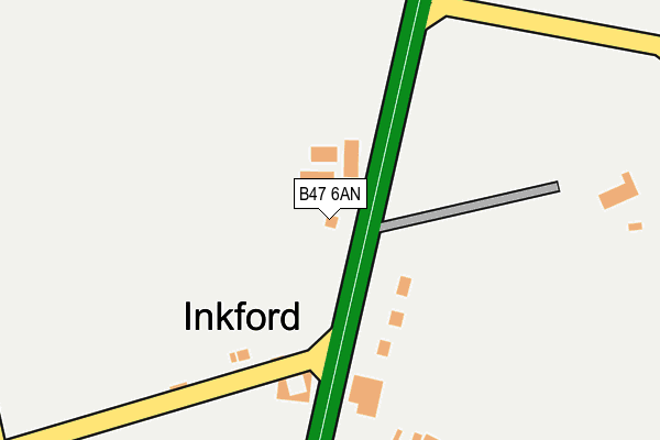
B47 6AN is located in the Wythall West electoral ward, within the local authority district of Bromsgrove and the English Parliamentary constituency of Bromsgrove. The Sub Integrated Care Board (ICB) Location is NHS Herefordshire and Worcestershire ICB - 18C and the police force is West Mercia. This postcode has been in use since January 1980.


GetTheData
Source: OS OpenMap – Local (Ordnance Survey)
Source: OS VectorMap District (Ordnance Survey)
Licence: Open Government Licence (requires attribution)
| Easting | 407737 |
| Northing | 274608 |
| Latitude | 52.369481 |
| Longitude | -1.887781 |
GetTheData
Source: Open Postcode Geo
Licence: Open Government Licence
| Country | England |
| Postcode District | B47 |
| ➜ B47 open data dashboard ➜ See where B47 is on a map ➜ Where is Inkford? | |
GetTheData
Source: Land Registry Price Paid Data
Licence: Open Government Licence
Elevation or altitude of B47 6AN as distance above sea level:
| Metres | Feet | |
|---|---|---|
| Elevation | 160m | 525ft |
Elevation is measured from the approximate centre of the postcode, to the nearest point on an OS contour line from OS Terrain 50, which has contour spacing of ten vertical metres.
➜ How high above sea level am I? Find the elevation of your current position using your device's GPS.
GetTheData
Source: Open Postcode Elevation
Licence: Open Government Licence
| Ward | Wythall West |
| Constituency | Bromsgrove |
GetTheData
Source: ONS Postcode Database
Licence: Open Government Licence
| June 2022 | Other theft | On or near Petrol Station | 171m |
| June 2022 | Public order | On or near Petrol Station | 171m |
| April 2022 | Other theft | On or near Petrol Station | 171m |
| ➜ Get more crime data in our Crime section | |||
GetTheData
Source: data.police.uk
Licence: Open Government Licence
| Hill Lane (Alcester Road) | Inkford | 67m |
| Becketts Farm Shop (Alcester Road) | Wythall | 362m |
| Church (Chapel Lane) | Wythall | 492m |
| Church (Chapel Lane) | Wythall | 509m |
| Wythall Island (Station Road) | Wythall | 551m |
| Earlswood (West Midlands) Station | 1.8km |
| Wythall Station | 1.9km |
| The Lakes Station | 3.2km |
GetTheData
Source: NaPTAN
Licence: Open Government Licence
| Percentage of properties with Next Generation Access | 100.0% |
| Percentage of properties with Superfast Broadband | 100.0% |
| Percentage of properties with Ultrafast Broadband | 0.0% |
| Percentage of properties with Full Fibre Broadband | 0.0% |
Superfast Broadband is between 30Mbps and 300Mbps
Ultrafast Broadband is > 300Mbps
| Percentage of properties unable to receive 2Mbps | 0.0% |
| Percentage of properties unable to receive 5Mbps | 0.0% |
| Percentage of properties unable to receive 10Mbps | 0.0% |
| Percentage of properties unable to receive 30Mbps | 0.0% |
GetTheData
Source: Ofcom
Licence: Ofcom Terms of Use (requires attribution)
GetTheData
Source: ONS Postcode Database
Licence: Open Government Licence


➜ Get more ratings from the Food Standards Agency
GetTheData
Source: Food Standards Agency
Licence: FSA terms & conditions
| Last Collection | |||
|---|---|---|---|
| Location | Mon-Fri | Sat | Distance |
| Inkford Brook | 17:00 | 11:30 | 588m |
| Gorsey Lane / Station Road Wytha | 17:15 | 11:30 | 1,117m |
| Houndsfield Lane / Alcester Road | 17:15 | 11:30 | 1,609m |
GetTheData
Source: Dracos
Licence: Creative Commons Attribution-ShareAlike
| Facility | Distance |
|---|---|
| The Wendy House Chapel Lane, Chapel Lane, Wythall, Birmingham Grass Pitches | 503m |
| Meadow Green Primary School Meadow Road, Wythall, Birmingham Grass Pitches | 732m |
| Fulford Heath Golf Club Tanners Green Lane, Wythall Golf | 914m |
GetTheData
Source: Active Places
Licence: Open Government Licence
| School | Phase of Education | Distance |
|---|---|---|
| Meadow Green Primary School Meadow Road, Wythall, Birmingham, B47 6EQ | Primary | 732m |
| Woodrush High School Shawhurst Lane, Wythall, B47 5JW | Secondary | 2.2km |
| Coppice Primary School Shawhurst Lane, Hollywood, Birmingham, B47 5JN | Primary | 2.3km |
GetTheData
Source: Edubase
Licence: Open Government Licence
The below table lists the International Territorial Level (ITL) codes (formerly Nomenclature of Territorial Units for Statistics (NUTS) codes) and Local Administrative Units (LAU) codes for B47 6AN:
| ITL 1 Code | Name |
|---|---|
| TLG | West Midlands (England) |
| ITL 2 Code | Name |
| TLG1 | Herefordshire, Worcestershire and Warwickshire |
| ITL 3 Code | Name |
| TLG12 | Worcestershire CC |
| LAU 1 Code | Name |
| E07000234 | Bromsgrove |
GetTheData
Source: ONS Postcode Directory
Licence: Open Government Licence
The below table lists the Census Output Area (OA), Lower Layer Super Output Area (LSOA), and Middle Layer Super Output Area (MSOA) for B47 6AN:
| Code | Name | |
|---|---|---|
| OA | E00164123 | |
| LSOA | E01032178 | Bromsgrove 005D |
| MSOA | E02006700 | Bromsgrove 005 |
GetTheData
Source: ONS Postcode Directory
Licence: Open Government Licence
| B47 6DJ | Alcester Road | 163m |
| B47 6AU | Hill Lane | 209m |
| B47 6AP | Alcester Road | 226m |
| B47 6AR | Orchard Villas | 460m |
| B47 6JX | Chapel Lane | 505m |
| B47 6BY | Barkers Lane | 535m |
| B47 6BU | Barkers Lane | 585m |
| B47 6AA | Station Road | 600m |
| B47 6BS | Barkers Lane | 662m |
| B47 6JP | Chapel Drive | 683m |
GetTheData
Source: Open Postcode Geo; Land Registry Price Paid Data
Licence: Open Government Licence