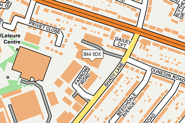
B44 9DX is located in the Oscott electoral ward, within the metropolitan district of Birmingham and the English Parliamentary constituency of Birmingham, Perry Barr. The Sub Integrated Care Board (ICB) Location is NHS Birmingham and Solihull ICB - 15E and the police force is West Midlands. This postcode has been in use since December 1981.


GetTheData
Source: OS OpenMap – Local (Ordnance Survey)
Source: OS VectorMap District (Ordnance Survey)
Licence: Open Government Licence (requires attribution)
| Easting | 407284 |
| Northing | 295094 |
| Latitude | 52.553641 |
| Longitude | -1.894002 |
GetTheData
Source: Open Postcode Geo
Licence: Open Government Licence
| Country | England |
| Postcode District | B44 |
| ➜ B44 open data dashboard ➜ See where B44 is on a map ➜ Where is Birmingham? | |
GetTheData
Source: Land Registry Price Paid Data
Licence: Open Government Licence
Elevation or altitude of B44 9DX as distance above sea level:
| Metres | Feet | |
|---|---|---|
| Elevation | 150m | 492ft |
Elevation is measured from the approximate centre of the postcode, to the nearest point on an OS contour line from OS Terrain 50, which has contour spacing of ten vertical metres.
➜ How high above sea level am I? Find the elevation of your current position using your device's GPS.
GetTheData
Source: Open Postcode Elevation
Licence: Open Government Licence
| Ward | Oscott |
| Constituency | Birmingham, Perry Barr |
GetTheData
Source: ONS Postcode Database
Licence: Open Government Licence
| January 2024 | Other theft | On or near Dormington Road | 341m |
| January 2024 | Anti-social behaviour | On or near Dormington Road | 341m |
| December 2023 | Burglary | On or near Dunedin Road | 386m |
| ➜ Get more crime data in our Crime section | |||
GetTheData
Source: data.police.uk
Licence: Open Government Licence
| Shady Lane (Kings Rd) | Kingstanding | 153m |
| Shady Lane (Kings Rd) | Kingstanding | 214m |
| Penge Grove (Kings Rd) | Kingstanding | 258m |
| Penge Grove (Kings Rd) | Kingstanding | 295m |
| Middle (Shady Lane) | Old Oscott | 309m |
| Hamstead (Birmingham) Station | 3.5km |
| Perry Barr Station | 4.2km |
| Wylde Green Station | 4.3km |
GetTheData
Source: NaPTAN
Licence: Open Government Licence
GetTheData
Source: ONS Postcode Database
Licence: Open Government Licence


➜ Get more ratings from the Food Standards Agency
GetTheData
Source: Food Standards Agency
Licence: FSA terms & conditions
| Last Collection | |||
|---|---|---|---|
| Location | Mon-Fri | Sat | Distance |
| Shady Lane / Gailey Croft | 17:45 | 12:30 | 118m |
| Oscott School Lane | 17:45 | 12:30 | 420m |
| Bandywood Road / Wandsworth Road | 17:15 | 12:30 | 468m |
GetTheData
Source: Dracos
Licence: Creative Commons Attribution-ShareAlike
| Facility | Distance |
|---|---|
| David Lloyd (Birmingham) Shady Lane, Birmingham Sports Hall, Swimming Pool, Health and Fitness Gym, Indoor Tennis Centre, Studio, Squash Courts, Outdoor Tennis Courts | 204m |
| Sundridge Primary School Sundridge Road, Birmingham Grass Pitches | 483m |
| Cardinal Wiseman Catholic Technology College Old Oscott Hill, Birmingham Swimming Pool, Sports Hall, Grass Pitches | 585m |
GetTheData
Source: Active Places
Licence: Open Government Licence
| School | Phase of Education | Distance |
|---|---|---|
| Sundridge Primary School Sundridge Road, Kingstanding, Birmingham, B44 9NY | Primary | 483m |
| Cardinal Wiseman Catholic School Old Oscott Hill, Kingstanding, Birmingham, B44 9SR | Secondary | 613m |
| Kingsland Primary School (NC) Bandywood Crescent, Birmingham, B44 9NA | Primary | 614m |
GetTheData
Source: Edubase
Licence: Open Government Licence
The below table lists the International Territorial Level (ITL) codes (formerly Nomenclature of Territorial Units for Statistics (NUTS) codes) and Local Administrative Units (LAU) codes for B44 9DX:
| ITL 1 Code | Name |
|---|---|
| TLG | West Midlands (England) |
| ITL 2 Code | Name |
| TLG3 | West Midlands |
| ITL 3 Code | Name |
| TLG31 | Birmingham |
| LAU 1 Code | Name |
| E08000025 | Birmingham |
GetTheData
Source: ONS Postcode Directory
Licence: Open Government Licence
The below table lists the Census Output Area (OA), Lower Layer Super Output Area (LSOA), and Middle Layer Super Output Area (MSOA) for B44 9DX:
| Code | Name | |
|---|---|---|
| OA | E00046803 | |
| LSOA | E01009222 | Birmingham 008B |
| MSOA | E02001834 | Birmingham 008 |
GetTheData
Source: ONS Postcode Directory
Licence: Open Government Licence
| B44 9HB | Gailey Croft | 84m |
| B44 9HE | Farrow Road | 100m |
| B44 9HW | Kings Road | 118m |
| B44 9HA | Shady Lane | 119m |
| B44 9HD | Shady Lane | 140m |
| B44 9DJ | Beechdale Avenue | 162m |
| B44 9JA | Kings Road | 172m |
| B44 9DH | Beechdale Avenue | 195m |
| B44 9DG | Dunedin Road | 202m |
| B44 9NX | Copthorne Road | 207m |
GetTheData
Source: Open Postcode Geo; Land Registry Price Paid Data
Licence: Open Government Licence