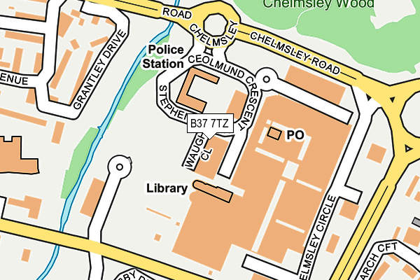
B37 7TZ is located in the Chelmsley Wood electoral ward, within the metropolitan district of Solihull and the English Parliamentary constituency of Meriden. The Sub Integrated Care Board (ICB) Location is NHS Birmingham and Solihull ICB - 15E and the police force is West Midlands. This postcode has been in use since January 1995.


GetTheData
Source: OS OpenMap – Local (Ordnance Survey)
Source: OS VectorMap District (Ordnance Survey)
Licence: Open Government Licence (requires attribution)
| Easting | 417704 |
| Northing | 286964 |
| Latitude | 52.480332 |
| Longitude | -1.740744 |
GetTheData
Source: Open Postcode Geo
Licence: Open Government Licence
| Country | England |
| Postcode District | B37 |
| ➜ B37 open data dashboard ➜ See where B37 is on a map ➜ Where is Birmingham? | |
GetTheData
Source: Land Registry Price Paid Data
Licence: Open Government Licence
Elevation or altitude of B37 7TZ as distance above sea level:
| Metres | Feet | |
|---|---|---|
| Elevation | 90m | 295ft |
Elevation is measured from the approximate centre of the postcode, to the nearest point on an OS contour line from OS Terrain 50, which has contour spacing of ten vertical metres.
➜ How high above sea level am I? Find the elevation of your current position using your device's GPS.
GetTheData
Source: Open Postcode Elevation
Licence: Open Government Licence
| Ward | Chelmsley Wood |
| Constituency | Meriden |
GetTheData
Source: ONS Postcode Database
Licence: Open Government Licence
| January 2024 | Criminal damage and arson | On or near Conway Road | 403m |
| January 2024 | Violence and sexual offences | On or near Conway Road | 403m |
| January 2024 | Violence and sexual offences | On or near Conway Road | 403m |
| ➜ Get more crime data in our Crime section | |||
GetTheData
Source: data.police.uk
Licence: Open Government Licence
| Chelmsley Interchange (Chelmsley Circle) | Chelmsley Wood | 175m |
| Chelmsley Interchange (Chelmsley Circle) | Chelmsley Wood | 177m |
| Chelmsley Interchange (Chelmsley Circle) | Chelmsley Wood | 179m |
| Chelmsley Interchange (Chelmsley Circle) | Chelmsley Wood | 186m |
| Chelmsley Interchange (Chelmsley Circle) | Chelmsley Wood | 189m |
| Marston Green Station | 1.8km |
| Lea Hall Station | 3.1km |
| Birmingham International Station | 3.4km |
GetTheData
Source: NaPTAN
Licence: Open Government Licence
GetTheData
Source: ONS Postcode Database
Licence: Open Government Licence


➜ Get more ratings from the Food Standards Agency
GetTheData
Source: Food Standards Agency
Licence: FSA terms & conditions
| Last Collection | |||
|---|---|---|---|
| Location | Mon-Fri | Sat | Distance |
| Winchester Drive Near Chinches | 17:15 | 12:30 | 566m |
| Bosworth Drive / Yorklea Croft | 17:00 | 12:30 | 791m |
| Chapelhouse Road | 16:45 | 12:15 | 867m |
GetTheData
Source: Dracos
Licence: Creative Commons Attribution-ShareAlike
| Facility | Distance |
|---|---|
| Energie Fitness (Chelmsley Wood) Chelmsley Wood Shopping Centre, Birmingham Health and Fitness Gym, Studio | 104m |
| Meriden Park Crossman Close, Birmingham Grass Pitches, Outdoor Tennis Courts | 316m |
| The Fordbridge Centre Nineacres Drive, Birmingham Sports Hall | 389m |
GetTheData
Source: Active Places
Licence: Open Government Licence
| School | Phase of Education | Distance |
|---|---|---|
| Lea Hall Academy Hallmoor Road, Birmingham, B33 9QY | Not applicable | 186m |
| WMG Academy for Young Engineers (Solihull) Chelmsley Road, Chelmsley Wood, Birmingham, B37 5FD | Secondary | 265m |
| St Anne's Catholic Primary School Bosworth Drive, Chelmsley Wood, Birmingham, B37 5DP | Primary | 416m |
GetTheData
Source: Edubase
Licence: Open Government Licence
The below table lists the International Territorial Level (ITL) codes (formerly Nomenclature of Territorial Units for Statistics (NUTS) codes) and Local Administrative Units (LAU) codes for B37 7TZ:
| ITL 1 Code | Name |
|---|---|
| TLG | West Midlands (England) |
| ITL 2 Code | Name |
| TLG3 | West Midlands |
| ITL 3 Code | Name |
| TLG32 | Solihull |
| LAU 1 Code | Name |
| E08000029 | Solihull |
GetTheData
Source: ONS Postcode Directory
Licence: Open Government Licence
The below table lists the Census Output Area (OA), Lower Layer Super Output Area (LSOA), and Middle Layer Super Output Area (MSOA) for B37 7TZ:
| Code | Name | |
|---|---|---|
| OA | E00051218 | |
| LSOA | E01010125 | Solihull 006A |
| MSOA | E02002086 | Solihull 006 |
GetTheData
Source: ONS Postcode Directory
Licence: Open Government Licence
| B37 5UH | Chelmsley Circle | 167m |
| B37 5TD | Moorend Avenue | 206m |
| B37 5LW | Grantley Drive | 216m |
| B37 5NF | Perch Avenue | 243m |
| B37 5QR | Derby Drive | 246m |
| B37 5RJ | Ipswich Walk | 289m |
| B37 5LS | Pendrell Close | 293m |
| B37 5SJ | Bosworth Drive | 302m |
| B37 7UR | Larch Croft | 303m |
| B37 5RH | Ipswich Walk | 305m |
GetTheData
Source: Open Postcode Geo; Land Registry Price Paid Data
Licence: Open Government Licence