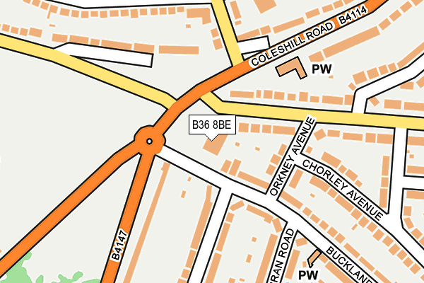
B36 8BE is located in the Bromford & Hodge Hill electoral ward, within the metropolitan district of Birmingham and the English Parliamentary constituency of Birmingham, Hodge Hill. The Sub Integrated Care Board (ICB) Location is NHS Birmingham and Solihull ICB - 15E and the police force is West Midlands. This postcode has been in use since January 1980.


GetTheData
Source: OS OpenMap – Local (Ordnance Survey)
Source: OS VectorMap District (Ordnance Survey)
Licence: Open Government Licence (requires attribution)
| Easting | 413495 |
| Northing | 289044 |
| Latitude | 52.499135 |
| Longitude | -1.802641 |
GetTheData
Source: Open Postcode Geo
Licence: Open Government Licence
| Country | England |
| Postcode District | B36 |
| ➜ B36 open data dashboard ➜ See where B36 is on a map ➜ Where is Birmingham? | |
GetTheData
Source: Land Registry Price Paid Data
Licence: Open Government Licence
Elevation or altitude of B36 8BE as distance above sea level:
| Metres | Feet | |
|---|---|---|
| Elevation | 100m | 328ft |
Elevation is measured from the approximate centre of the postcode, to the nearest point on an OS contour line from OS Terrain 50, which has contour spacing of ten vertical metres.
➜ How high above sea level am I? Find the elevation of your current position using your device's GPS.
GetTheData
Source: Open Postcode Elevation
Licence: Open Government Licence
| Ward | Bromford & Hodge Hill |
| Constituency | Birmingham, Hodge Hill |
GetTheData
Source: ONS Postcode Database
Licence: Open Government Licence
| January 2024 | Violence and sexual offences | On or near Parking Area | 331m |
| January 2024 | Drugs | On or near Vallian Croft | 406m |
| January 2024 | Drugs | On or near Vallian Croft | 406m |
| ➜ Get more crime data in our Crime section | |||
GetTheData
Source: data.police.uk
Licence: Open Government Licence
| Heathway (Coleshill Rd) | Hodgehill | 86m |
| Heathway (Coleshill Rd) | Hodgehill | 127m |
| Shawsdale Rd (Chipperfield Rd) | Hodgehill | 153m |
| Shawsdale Rd (Chipperfield Rd) | Hodgehill | 154m |
| Hodge Hill Common (Coleshill Rd) | Hodgehill | 341m |
| Stechford Station | 1.7km |
| Lea Hall Station | 2.3km |
| Gravelly Hill Station | 3.8km |
GetTheData
Source: NaPTAN
Licence: Open Government Licence
GetTheData
Source: ONS Postcode Database
Licence: Open Government Licence


➜ Get more ratings from the Food Standards Agency
GetTheData
Source: Food Standards Agency
Licence: FSA terms & conditions
| Last Collection | |||
|---|---|---|---|
| Location | Mon-Fri | Sat | Distance |
| Hodge Hill Road / Maryland Avenu | 17:30 | 11:30 | 424m |
| Ventnor Avenue / Coleshill Road | 17:30 | 12:30 | 467m |
| Bromford Road Collingbourne Road | 17:30 | 12:30 | 569m |
GetTheData
Source: Dracos
Licence: Creative Commons Attribution-ShareAlike
| Facility | Distance |
|---|---|
| Heathlands Primary Academy Heath Way, Birmingham Grass Pitches | 480m |
| Ward End Unity Cricket Club Stechford Road, Birmingham Grass Pitches | 824m |
| Stechford Road Playing Fields Stechford Road, Birmingham Grass Pitches | 848m |
GetTheData
Source: Active Places
Licence: Open Government Licence
| School | Phase of Education | Distance |
|---|---|---|
| Heathlands Primary Academy Heath Way, Castle Bromwich, Birmingham, B34 6NB | Primary | 480m |
| Firs Primary School Dreghorn Road, Castle Bromwich, Firs Primary School, Birmingham, B36 8LL | Primary | 534m |
| St Wilfrid's Catholic Junior and Infant School Shawsdale Road, Birmingham, B36 8LY | Primary | 665m |
GetTheData
Source: Edubase
Licence: Open Government Licence
The below table lists the International Territorial Level (ITL) codes (formerly Nomenclature of Territorial Units for Statistics (NUTS) codes) and Local Administrative Units (LAU) codes for B36 8BE:
| ITL 1 Code | Name |
|---|---|
| TLG | West Midlands (England) |
| ITL 2 Code | Name |
| TLG3 | West Midlands |
| ITL 3 Code | Name |
| TLG31 | Birmingham |
| LAU 1 Code | Name |
| E08000025 | Birmingham |
GetTheData
Source: ONS Postcode Directory
Licence: Open Government Licence
The below table lists the Census Output Area (OA), Lower Layer Super Output Area (LSOA), and Middle Layer Super Output Area (MSOA) for B36 8BE:
| Code | Name | |
|---|---|---|
| OA | E00046105 | |
| LSOA | E01009087 | Birmingham 042C |
| MSOA | E02001868 | Birmingham 042 |
GetTheData
Source: ONS Postcode Directory
Licence: Open Government Licence
| B34 6LJ | Heath Way | 75m |
| B34 6LL | Heath Way | 130m |
| B34 6BY | Orkney Avenue | 130m |
| B36 8AN | Bromford Road | 140m |
| B36 8BJ | Chipperfield Road | 149m |
| B34 6BN | Stechford Road | 174m |
| B36 8DN | Chipperfield Road | 185m |
| B34 6BS | Rymond Road | 188m |
| B34 6BX | Rymond Road | 202m |
| B34 6DA | Chorley Avenue | 203m |
GetTheData
Source: Open Postcode Geo; Land Registry Price Paid Data
Licence: Open Government Licence