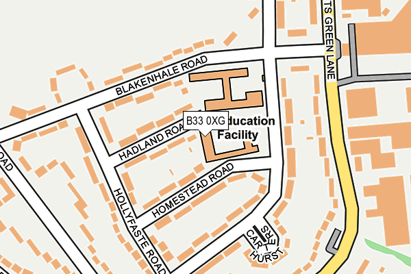
B33 0XG is located in the Garretts Green electoral ward, within the metropolitan district of Birmingham and the English Parliamentary constituency of Birmingham, Yardley. The Sub Integrated Care Board (ICB) Location is NHS Birmingham and Solihull ICB - 15E and the police force is West Midlands. This postcode has been in use since January 1980.


GetTheData
Source: OS OpenMap – Local (Ordnance Survey)
Source: OS VectorMap District (Ordnance Survey)
Licence: Open Government Licence (requires attribution)
| Easting | 414851 |
| Northing | 286183 |
| Latitude | 52.473380 |
| Longitude | -1.782793 |
GetTheData
Source: Open Postcode Geo
Licence: Open Government Licence
| Country | England |
| Postcode District | B33 |
| ➜ B33 open data dashboard ➜ See where B33 is on a map ➜ Where is Birmingham? | |
GetTheData
Source: Land Registry Price Paid Data
Licence: Open Government Licence
Elevation or altitude of B33 0XG as distance above sea level:
| Metres | Feet | |
|---|---|---|
| Elevation | 110m | 361ft |
Elevation is measured from the approximate centre of the postcode, to the nearest point on an OS contour line from OS Terrain 50, which has contour spacing of ten vertical metres.
➜ How high above sea level am I? Find the elevation of your current position using your device's GPS.
GetTheData
Source: Open Postcode Elevation
Licence: Open Government Licence
| Ward | Garretts Green |
| Constituency | Birmingham, Yardley |
GetTheData
Source: ONS Postcode Database
Licence: Open Government Licence
| January 2024 | Drugs | On or near Meon Grove | 420m |
| December 2023 | Violence and sexual offences | On or near Meon Grove | 420m |
| December 2023 | Violence and sexual offences | On or near Meon Grove | 420m |
| ➜ Get more crime data in our Crime section | |||
GetTheData
Source: data.police.uk
Licence: Open Government Licence
| Blakenhale Rd (Garretts Green Lane) | Garretts Green | 206m |
| Sheldon Walk (Garretts Green Lane) | Garretts Green | 215m |
| Blakenhale Rd (Garretts Green Lane) | Garretts Green | 238m |
| Sheldon Walk (Garretts Green Lane) | Garretts Green | 240m |
| Blakenhale Rd (Sheldon Heath Rd) | Garretts Green | 282m |
| Lea Hall Station | 0.8km |
| Marston Green Station | 2km |
| Stechford Station | 2.3km |
GetTheData
Source: NaPTAN
Licence: Open Government Licence
GetTheData
Source: ONS Postcode Database
Licence: Open Government Licence


➜ Get more ratings from the Food Standards Agency
GetTheData
Source: Food Standards Agency
Licence: FSA terms & conditions
| Last Collection | |||
|---|---|---|---|
| Location | Mon-Fri | Sat | Distance |
| Brinsley Road | 17:30 | 11:30 | 377m |
| Valpits Road / Granby Avenue | 17:30 | 11:30 | 426m |
| Meadway Post Office | 17:30 | 11:30 | 603m |
GetTheData
Source: Dracos
Licence: Creative Commons Attribution-ShareAlike
| Facility | Distance |
|---|---|
| City College East Birmingham Campus (Closed) Garretts Green Lane, Birmingham Health and Fitness Gym, Sports Hall | 262m |
| Kents Moat Recreation Ground Meadway, Birmingham Grass Pitches | 318m |
| King Edward Vi Sheldon Heath Academy Sheldon Heath Road, Birmingham Sports Hall, Artificial Grass Pitch, Grass Pitches, Studio, Health and Fitness Gym | 602m |
GetTheData
Source: Active Places
Licence: Open Government Licence
| School | Phase of Education | Distance |
|---|---|---|
| Oasis Academy Blakenhale Junior Homestead Road, Garretts Green, Birmingham, B33 0XG | Primary | 0m |
| Oasis Academy Blakenhale Infants Blakenhale Road, Garrett's Green, Birmingham, B33 0XD | Primary | 91m |
| Gossey Lane Academy Gossey Lane, Kitts Green, Birmingham, B33 0DS | Primary | 662m |
GetTheData
Source: Edubase
Licence: Open Government Licence
The below table lists the International Territorial Level (ITL) codes (formerly Nomenclature of Territorial Units for Statistics (NUTS) codes) and Local Administrative Units (LAU) codes for B33 0XG:
| ITL 1 Code | Name |
|---|---|
| TLG | West Midlands (England) |
| ITL 2 Code | Name |
| TLG3 | West Midlands |
| ITL 3 Code | Name |
| TLG31 | Birmingham |
| LAU 1 Code | Name |
| E08000025 | Birmingham |
GetTheData
Source: ONS Postcode Directory
Licence: Open Government Licence
The below table lists the Census Output Area (OA), Lower Layer Super Output Area (LSOA), and Middle Layer Super Output Area (MSOA) for B33 0XG:
| Code | Name | |
|---|---|---|
| OA | E00048163 | |
| LSOA | E01009512 | Birmingham 062A |
| MSOA | E02001888 | Birmingham 062 |
GetTheData
Source: ONS Postcode Directory
Licence: Open Government Licence
| B33 0UY | Hadland Road | 72m |
| B33 0US | Homestead Road | 93m |
| B33 0XD | Blakenhale Road | 101m |
| B33 0XE | Blakenhale Road | 129m |
| B33 0UP | Outmore Road | 129m |
| B33 0UX | Hollyfaste Road | 130m |
| B33 0UN | Outmore Road | 151m |
| B33 0UL | Blakenhale Road | 168m |
| B33 0UU | Hollyfaste Road | 175m |
| B33 0TR | Garretts Green Lane | 180m |
GetTheData
Source: Open Postcode Geo; Land Registry Price Paid Data
Licence: Open Government Licence