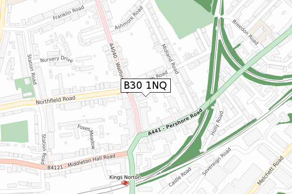
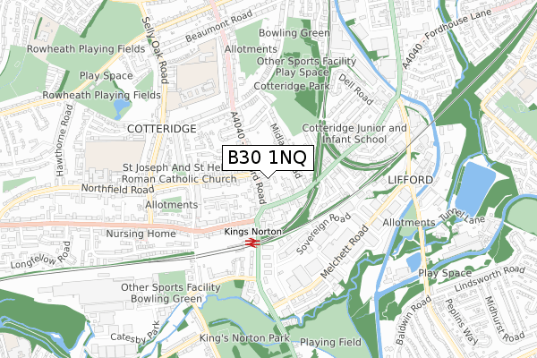
B30 1NQ is located in the Bournville & Cotteridge electoral ward, within the metropolitan district of Birmingham and the English Parliamentary constituency of Birmingham, Selly Oak. The Sub Integrated Care Board (ICB) Location is NHS Birmingham and Solihull ICB - 15E and the police force is West Midlands. This postcode has been in use since June 1999.


GetTheData
Source: OS Open Zoomstack (Ordnance Survey)
Licence: Open Government Licence (requires attribution)
Attribution: Contains OS data © Crown copyright and database right 2024
Source: Open Postcode Geo
Licence: Open Government Licence (requires attribution)
Attribution: Contains OS data © Crown copyright and database right 2024; Contains Royal Mail data © Royal Mail copyright and database right 2024; Source: Office for National Statistics licensed under the Open Government Licence v.3.0
| Easting | 404848 |
| Northing | 279910 |
| Latitude | 52.417165 |
| Longitude | -1.930145 |
GetTheData
Source: Open Postcode Geo
Licence: Open Government Licence
| Country | England |
| Postcode District | B30 |
| ➜ B30 open data dashboard ➜ See where B30 is on a map ➜ Where is Birmingham? | |
GetTheData
Source: Land Registry Price Paid Data
Licence: Open Government Licence
Elevation or altitude of B30 1NQ as distance above sea level:
| Metres | Feet | |
|---|---|---|
| Elevation | 150m | 492ft |
Elevation is measured from the approximate centre of the postcode, to the nearest point on an OS contour line from OS Terrain 50, which has contour spacing of ten vertical metres.
➜ How high above sea level am I? Find the elevation of your current position using your device's GPS.
GetTheData
Source: Open Postcode Elevation
Licence: Open Government Licence
| Ward | Bournville & Cotteridge |
| Constituency | Birmingham, Selly Oak |
GetTheData
Source: ONS Postcode Database
Licence: Open Government Licence
| January 2024 | Vehicle crime | On or near Foxes Meadow | 255m |
| December 2023 | Vehicle crime | On or near Parking Area | 444m |
| December 2023 | Violence and sexual offences | On or near Parking Area | 444m |
| ➜ Get more crime data in our Crime section | |||
GetTheData
Source: data.police.uk
Licence: Open Government Licence
| Pershore Rd (Watford Rd) | Cotteridge | 58m |
| Pershore Rd (Watford Rd) | Cotteridge | 68m |
| Pershore Rd (Watford Rd) | Cotteridge | 78m |
| Pershore Rd (Watford Rd) | Cotteridge | 85m |
| Watford Rd (Pershore Rd) | Cotteridge | 133m |
| Kings Norton Station | 0.4km |
| Bournville Station | 1.1km |
| Northfield Station | 2.6km |
GetTheData
Source: NaPTAN
Licence: Open Government Licence
GetTheData
Source: ONS Postcode Database
Licence: Open Government Licence


➜ Get more ratings from the Food Standards Agency
GetTheData
Source: Food Standards Agency
Licence: FSA terms & conditions
| Last Collection | |||
|---|---|---|---|
| Location | Mon-Fri | Sat | Distance |
| Cotteridge Post Office | 18:00 | 12:30 | 47m |
| St Agnes Church | 17:15 | 12:30 | 148m |
| Cotteridge | 17:15 | 12:30 | 330m |
GetTheData
Source: Dracos
Licence: Creative Commons Attribution-ShareAlike
| Facility | Distance |
|---|---|
| Bournville Squash Club (Closed) Bournville, Birmingham Squash Courts | 0m |
| Kings Norton Girls' School & Sixth Form Selly Oak Road, Birmingham Sports Hall, Grass Pitches | 531m |
| Iron Works Fitness Concepts Pershore Road South, Kings Norton, Birmingham Health and Fitness Gym, Studio | 542m |
GetTheData
Source: Active Places
Licence: Open Government Licence
| School | Phase of Education | Distance |
|---|---|---|
| Cotteridge Primary School Breedon Road, Cotteridge, Birmingham, B30 2HT | Primary | 460m |
| Kings Norton Girls' School Selly Oak Road, Kings Norton, Birmingham, B30 1HW | Secondary | 522m |
| Kings Norton Nursery School Westhill Road, Kings Norton, Birmingham, B38 8SY | Nursery | 641m |
GetTheData
Source: Edubase
Licence: Open Government Licence
The below table lists the International Territorial Level (ITL) codes (formerly Nomenclature of Territorial Units for Statistics (NUTS) codes) and Local Administrative Units (LAU) codes for B30 1NQ:
| ITL 1 Code | Name |
|---|---|
| TLG | West Midlands (England) |
| ITL 2 Code | Name |
| TLG3 | West Midlands |
| ITL 3 Code | Name |
| TLG31 | Birmingham |
| LAU 1 Code | Name |
| E08000025 | Birmingham |
GetTheData
Source: ONS Postcode Directory
Licence: Open Government Licence
The below table lists the Census Output Area (OA), Lower Layer Super Output Area (LSOA), and Middle Layer Super Output Area (MSOA) for B30 1NQ:
| Code | Name | |
|---|---|---|
| OA | E00045443 | |
| LSOA | E01008961 | Birmingham 116C |
| MSOA | E02001942 | Birmingham 116 |
GetTheData
Source: ONS Postcode Directory
Licence: Open Government Licence
| B30 1NW | Watford Road | 46m |
| B30 2EU | Rowheath Road | 48m |
| B30 1JA | Watford Road | 73m |
| B30 2EX | Rowheath Road | 74m |
| B30 1JB | Watford Road | 77m |
| B30 3DJ | Pershore Road | 112m |
| B30 2ES | Midland Road | 119m |
| B30 2ET | Midland Road | 153m |
| B30 1PD | Watford Road | 164m |
| B30 2EN | Midland Road | 188m |
GetTheData
Source: Open Postcode Geo; Land Registry Price Paid Data
Licence: Open Government Licence