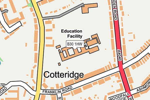
B30 1HW is located in the Bournville & Cotteridge electoral ward, within the metropolitan district of Birmingham and the English Parliamentary constituency of Birmingham, Selly Oak. The Sub Integrated Care Board (ICB) Location is NHS Birmingham and Solihull ICB - 15E and the police force is West Midlands. This postcode has been in use since January 1980.


GetTheData
Source: OS OpenMap – Local (Ordnance Survey)
Source: OS VectorMap District (Ordnance Survey)
Licence: Open Government Licence (requires attribution)
| Easting | 404500 |
| Northing | 280311 |
| Latitude | 52.420772 |
| Longitude | -1.935257 |
GetTheData
Source: Open Postcode Geo
Licence: Open Government Licence
| Country | England |
| Postcode District | B30 |
| ➜ B30 open data dashboard ➜ See where B30 is on a map ➜ Where is Birmingham? | |
GetTheData
Source: Land Registry Price Paid Data
Licence: Open Government Licence
Elevation or altitude of B30 1HW as distance above sea level:
| Metres | Feet | |
|---|---|---|
| Elevation | 150m | 492ft |
Elevation is measured from the approximate centre of the postcode, to the nearest point on an OS contour line from OS Terrain 50, which has contour spacing of ten vertical metres.
➜ How high above sea level am I? Find the elevation of your current position using your device's GPS.
GetTheData
Source: Open Postcode Elevation
Licence: Open Government Licence
| Ward | Bournville & Cotteridge |
| Constituency | Birmingham, Selly Oak |
GetTheData
Source: ONS Postcode Database
Licence: Open Government Licence
| December 2023 | Violence and sexual offences | On or near Parking Area | 448m |
| October 2023 | Violence and sexual offences | On or near Parking Area | 448m |
| October 2023 | Vehicle crime | On or near Parking Area | 448m |
| ➜ Get more crime data in our Crime section | |||
GetTheData
Source: data.police.uk
Licence: Open Government Licence
| Franklin Rd (Watford Rd) | Cotteridge | 168m |
| Franklin Rd (Linden Rd) | Cotteridge | 190m |
| Franklin Rd (Ashmore Rd) | Cotteridge | 284m |
| Franklin Rd (Ashmore Rd) | Cotteridge | 312m |
| Mary Vale Rd (Linden Rd) | Bournville | 373m |
| Kings Norton Station | 0.7km |
| Bournville Station | 0.9km |
| Selly Oak Station | 2.4km |
GetTheData
Source: NaPTAN
Licence: Open Government Licence
GetTheData
Source: ONS Postcode Database
Licence: Open Government Licence


➜ Get more ratings from the Food Standards Agency
GetTheData
Source: Food Standards Agency
Licence: FSA terms & conditions
| Last Collection | |||
|---|---|---|---|
| Location | Mon-Fri | Sat | Distance |
| Station Road / Franklin Road | 17:15 | 12:30 | 175m |
| Selly Oak Road Near Heath Road | 17:15 | 12:30 | 260m |
| Franklin Road / Midland Road | 17:45 | 12:30 | 292m |
GetTheData
Source: Dracos
Licence: Creative Commons Attribution-ShareAlike
| Facility | Distance |
|---|---|
| Kings Norton Girls' School & Sixth Form Selly Oak Road, Birmingham Sports Hall, Grass Pitches | 0m |
| Rowheath Pavilion Heath Road, Birmingham Sports Hall, Athletics, Grass Pitches | 439m |
| Bournville Squash Club (Closed) Bournville, Birmingham Squash Courts | 531m |
GetTheData
Source: Active Places
Licence: Open Government Licence
| School | Phase of Education | Distance |
|---|---|---|
| Kings Norton Girls' School Selly Oak Road, Kings Norton, Birmingham, B30 1HW | Secondary | 36m |
| St Joseph's Catholic Primary School Selly Oak Road, Kings Norton, Birmingham, B30 1HN | Primary | 180m |
| King Edward VI King's Norton School for Boys Northfield Road, King's Norton, Birmingham, B30 1DY | Secondary | 589m |
GetTheData
Source: Edubase
Licence: Open Government Licence
The below table lists the International Territorial Level (ITL) codes (formerly Nomenclature of Territorial Units for Statistics (NUTS) codes) and Local Administrative Units (LAU) codes for B30 1HW:
| ITL 1 Code | Name |
|---|---|
| TLG | West Midlands (England) |
| ITL 2 Code | Name |
| TLG3 | West Midlands |
| ITL 3 Code | Name |
| TLG31 | Birmingham |
| LAU 1 Code | Name |
| E08000025 | Birmingham |
GetTheData
Source: ONS Postcode Directory
Licence: Open Government Licence
The below table lists the Census Output Area (OA), Lower Layer Super Output Area (LSOA), and Middle Layer Super Output Area (MSOA) for B30 1HW:
| Code | Name | |
|---|---|---|
| OA | E00045497 | |
| LSOA | E01008956 | Birmingham 112D |
| MSOA | E02001938 | Birmingham 112 |
GetTheData
Source: ONS Postcode Directory
Licence: Open Government Licence
| B30 1HN | Selly Oak Road | 98m |
| B30 1NE | Franklin Road | 118m |
| B30 1NH | Franklin Road | 151m |
| B30 1HL | Selly Oak Road | 158m |
| B30 1NG | Franklin Road | 178m |
| B30 1NS | Linden Road | 184m |
| B30 1PA | Linden Road | 213m |
| B30 1DS | Nursery Close | 217m |
| B30 1NR | Woodfall Avenue | 227m |
| B30 1NU | Beaumont Road | 230m |
GetTheData
Source: Open Postcode Geo; Land Registry Price Paid Data
Licence: Open Government Licence