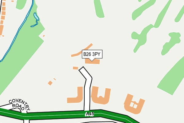
B26 3PY is located in the Sheldon electoral ward, within the metropolitan district of Birmingham and the English Parliamentary constituency of Birmingham, Yardley. The Sub Integrated Care Board (ICB) Location is NHS Birmingham and Solihull ICB - 15E and the police force is West Midlands. This postcode has been in use since January 1980.


GetTheData
Source: OS OpenMap – Local (Ordnance Survey)
Source: OS VectorMap District (Ordnance Survey)
Licence: Open Government Licence (requires attribution)
| Easting | 416171 |
| Northing | 283929 |
| Latitude | 52.453095 |
| Longitude | -1.763463 |
GetTheData
Source: Open Postcode Geo
Licence: Open Government Licence
| Country | England |
| Postcode District | B26 |
| ➜ B26 open data dashboard ➜ See where B26 is on a map ➜ Where is Birmingham? | |
GetTheData
Source: Land Registry Price Paid Data
Licence: Open Government Licence
Elevation or altitude of B26 3PY as distance above sea level:
| Metres | Feet | |
|---|---|---|
| Elevation | 100m | 328ft |
Elevation is measured from the approximate centre of the postcode, to the nearest point on an OS contour line from OS Terrain 50, which has contour spacing of ten vertical metres.
➜ How high above sea level am I? Find the elevation of your current position using your device's GPS.
GetTheData
Source: Open Postcode Elevation
Licence: Open Government Licence
| Ward | Sheldon |
| Constituency | Birmingham, Yardley |
GetTheData
Source: ONS Postcode Database
Licence: Open Government Licence
| January 2024 | Vehicle crime | On or near Olorenshaw Road | 465m |
| January 2024 | Other theft | On or near Olorenshaw Road | 465m |
| January 2024 | Burglary | On or near Olorenshaw Road | 465m |
| ➜ Get more crime data in our Crime section | |||
GetTheData
Source: data.police.uk
Licence: Open Government Licence
| Goodway Rd (Coventry Rd) | Elmdon | 169m |
| Glencroft Rd (Coventry Rd) | Cranes Park | 290m |
| Goodway Rd (Rangoon Rd) | Elmdon | 317m |
| Glencroft Rd (Rangoon Rd) | Elmdon | 322m |
| Goodway Rd (Rangoon Rd) | Elmdon | 330m |
| Marston Green Station | 1.7km |
| Birmingham International Station | 2.6km |
| Olton Station | 3.2km |
GetTheData
Source: NaPTAN
Licence: Open Government Licence
GetTheData
Source: ONS Postcode Database
Licence: Open Government Licence


➜ Get more ratings from the Food Standards Agency
GetTheData
Source: Food Standards Agency
Licence: FSA terms & conditions
| Last Collection | |||
|---|---|---|---|
| Location | Mon-Fri | Sat | Distance |
| Hatchford Brook | 17:30 | 11:30 | 473m |
| Walford Drive / Victor Road | 17:30 | 12:00 | 537m |
| Valley Road / Old Lodge Lane | 17:30 | 12:00 | 1,117m |
GetTheData
Source: Dracos
Licence: Creative Commons Attribution-ShareAlike
| Facility | Distance |
|---|---|
| Hatchford Brook Golf Course Coventry Road, Sheldon, Birmingham Golf, Health and Fitness Gym | 0m |
| Mapledene Primary School Mapledene Road, Birmingham Grass Pitches | 726m |
| Ivy Leaf Social Club Coventry Road, Sheldon, Birmingham Sports Hall | 915m |
GetTheData
Source: Active Places
Licence: Open Government Licence
| School | Phase of Education | Distance |
|---|---|---|
| Mapledene Primary School Mapledene Road, Mapledene Road, Birmingham, Uk, Birmingham, B26 3XE | Primary | 729m |
| Valley Primary Old Lode Lane, Solihull, B92 8LW | Primary | 1.1km |
| Elms Farm Community Primary School Dorncliffe Avenue, Sheldon, Birmingham, B33 0PJ | Primary | 1.4km |
GetTheData
Source: Edubase
Licence: Open Government Licence
The below table lists the International Territorial Level (ITL) codes (formerly Nomenclature of Territorial Units for Statistics (NUTS) codes) and Local Administrative Units (LAU) codes for B26 3PY:
| ITL 1 Code | Name |
|---|---|
| TLG | West Midlands (England) |
| ITL 2 Code | Name |
| TLG3 | West Midlands |
| ITL 3 Code | Name |
| TLG31 | Birmingham |
| LAU 1 Code | Name |
| E08000025 | Birmingham |
GetTheData
Source: ONS Postcode Directory
Licence: Open Government Licence
The below table lists the Census Output Area (OA), Lower Layer Super Output Area (LSOA), and Middle Layer Super Output Area (MSOA) for B26 3PY:
| Code | Name | |
|---|---|---|
| OA | E00047243 | |
| LSOA | E01009320 | Birmingham 081F |
| MSOA | E02001907 | Birmingham 081 |
GetTheData
Source: ONS Postcode Directory
Licence: Open Government Licence
| B26 3PX | Coventry Road | 233m |
| B92 9DD | Rangoon Road | 286m |
| B92 9DB | Rangoon Road | 290m |
| B26 3RR | Sheldonfield Road | 307m |
| B92 9DE | Goodway Road | 328m |
| B92 9BA | Glencroft Road | 340m |
| B26 3RS | Sheldonfield Road | 348m |
| B92 9DQ | Irving Road | 380m |
| B92 9AZ | Valley Road | 382m |
| B92 9DF | Rangoon Road | 398m |
GetTheData
Source: Open Postcode Geo; Land Registry Price Paid Data
Licence: Open Government Licence