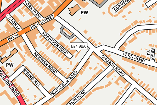
B24 9BA is located in the Erdington electoral ward, within the metropolitan district of Birmingham and the English Parliamentary constituency of Birmingham, Erdington. The Sub Integrated Care Board (ICB) Location is NHS Birmingham and Solihull ICB - 15E and the police force is West Midlands. This postcode has been in use since January 1992.


GetTheData
Source: OS OpenMap – Local (Ordnance Survey)
Source: OS VectorMap District (Ordnance Survey)
Licence: Open Government Licence (requires attribution)
| Easting | 411020 |
| Northing | 291546 |
| Latitude | 52.521698 |
| Longitude | -1.839010 |
GetTheData
Source: Open Postcode Geo
Licence: Open Government Licence
| Country | England |
| Postcode District | B24 |
| ➜ B24 open data dashboard ➜ See where B24 is on a map ➜ Where is Birmingham? | |
GetTheData
Source: Land Registry Price Paid Data
Licence: Open Government Licence
Elevation or altitude of B24 9BA as distance above sea level:
| Metres | Feet | |
|---|---|---|
| Elevation | 120m | 394ft |
Elevation is measured from the approximate centre of the postcode, to the nearest point on an OS contour line from OS Terrain 50, which has contour spacing of ten vertical metres.
➜ How high above sea level am I? Find the elevation of your current position using your device's GPS.
GetTheData
Source: Open Postcode Elevation
Licence: Open Government Licence
| Ward | Erdington |
| Constituency | Birmingham, Erdington |
GetTheData
Source: ONS Postcode Database
Licence: Open Government Licence
| January 2024 | Anti-social behaviour | On or near Parking Area | 33m |
| January 2024 | Public order | On or near Parking Area | 33m |
| January 2024 | Drugs | On or near York Road | 289m |
| ➜ Get more crime data in our Crime section | |||
GetTheData
Source: data.police.uk
Licence: Open Government Licence
| High Street (Barnabas Rd) | Erdington | 245m |
| Six Ways Island (Sutton New Rd) | Erdington | 287m |
| Six Ways Island (Sutton New Rd) | Erdington | 300m |
| Machin Rd (Sutton New Rd) | Erdington | 307m |
| Six Ways Island (Sutton New Rd) | Erdington | 309m |
| Erdington Station | 0.7km |
| Gravelly Hill Station | 1.2km |
| Chester Road Station | 1.6km |
GetTheData
Source: NaPTAN
Licence: Open Government Licence
| Percentage of properties with Next Generation Access | 100.0% |
| Percentage of properties with Superfast Broadband | 100.0% |
| Percentage of properties with Ultrafast Broadband | 0.0% |
| Percentage of properties with Full Fibre Broadband | 0.0% |
Superfast Broadband is between 30Mbps and 300Mbps
Ultrafast Broadband is > 300Mbps
| Percentage of properties unable to receive 2Mbps | 0.0% |
| Percentage of properties unable to receive 5Mbps | 0.0% |
| Percentage of properties unable to receive 10Mbps | 0.0% |
| Percentage of properties unable to receive 30Mbps | 0.0% |
GetTheData
Source: Ofcom
Licence: Ofcom Terms of Use (requires attribution)
GetTheData
Source: ONS Postcode Database
Licence: Open Government Licence


➜ Get more ratings from the Food Standards Agency
GetTheData
Source: Food Standards Agency
Licence: FSA terms & conditions
| Last Collection | |||
|---|---|---|---|
| Location | Mon-Fri | Sat | Distance |
| High St / Barnabas Road | 17:45 | 12:15 | 225m |
| Erdington Del Office | 358m | ||
| Erdington Delivery Office | 19:00 | 12:30 | 359m |
GetTheData
Source: Dracos
Licence: Creative Commons Attribution-ShareAlike
| Facility | Distance |
|---|---|
| Jetts Erdington Gravelly Hill North, Erdington, Birmingham Health and Fitness Gym | 409m |
| Rookery Park Rollason Road, Birmingham Grass Pitches, Outdoor Tennis Courts | 418m |
| Saint Barnabas Ce Primary School Spring Lane, Birmingham Grass Pitches | 461m |
GetTheData
Source: Active Places
Licence: Open Government Licence
| School | Phase of Education | Distance |
|---|---|---|
| Saint Barnabas Church of England Primary School Spring Lane, Erdington, Birmingham, B24 9BY | Primary | 461m |
| Imedia School 85 Summer Road, Erdington, Birmingham, B23 6UT | Not applicable | 467m |
| Queensbury School Wood End Road, Birmingham, B24 8BL | Not applicable | 546m |
GetTheData
Source: Edubase
Licence: Open Government Licence
The below table lists the International Territorial Level (ITL) codes (formerly Nomenclature of Territorial Units for Statistics (NUTS) codes) and Local Administrative Units (LAU) codes for B24 9BA:
| ITL 1 Code | Name |
|---|---|
| TLG | West Midlands (England) |
| ITL 2 Code | Name |
| TLG3 | West Midlands |
| ITL 3 Code | Name |
| TLG31 | Birmingham |
| LAU 1 Code | Name |
| E08000025 | Birmingham |
GetTheData
Source: ONS Postcode Directory
Licence: Open Government Licence
The below table lists the Census Output Area (OA), Lower Layer Super Output Area (LSOA), and Middle Layer Super Output Area (MSOA) for B24 9BA:
| Code | Name | |
|---|---|---|
| OA | E00045696 | |
| LSOA | E01009013 | Birmingham 031D |
| MSOA | E02001857 | Birmingham 031 |
GetTheData
Source: ONS Postcode Directory
Licence: Open Government Licence
| B24 9AX | Church Road | 66m |
| B24 9DE | Fern Road | 72m |
| B24 9AR | Trafalgar Road | 74m |
| B24 9AY | Church Road | 78m |
| B24 9BB | Church Road | 79m |
| B24 9AB | Harrison Road | 99m |
| B24 9AA | Harrison Road | 105m |
| B24 9AQ | Newman Road | 107m |
| B24 9AH | Deakin Road | 114m |
| B24 9AL | Deakin Road | 152m |
GetTheData
Source: Open Postcode Geo; Land Registry Price Paid Data
Licence: Open Government Licence