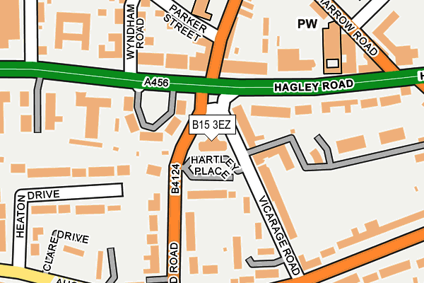
B15 3EZ is located in the Edgbaston electoral ward, within the metropolitan district of Birmingham and the English Parliamentary constituency of Birmingham, Edgbaston. The Sub Integrated Care Board (ICB) Location is NHS Birmingham and Solihull ICB - 15E and the police force is West Midlands. This postcode has been in use since August 1992.


GetTheData
Source: OS OpenMap – Local (Ordnance Survey)
Source: OS VectorMap District (Ordnance Survey)
Licence: Open Government Licence (requires attribution)
| Easting | 404751 |
| Northing | 285910 |
| Latitude | 52.471120 |
| Longitude | -1.931483 |
GetTheData
Source: Open Postcode Geo
Licence: Open Government Licence
| Country | England |
| Postcode District | B15 |
| ➜ B15 open data dashboard ➜ See where B15 is on a map ➜ Where is Birmingham? | |
GetTheData
Source: Land Registry Price Paid Data
Licence: Open Government Licence
Elevation or altitude of B15 3EZ as distance above sea level:
| Metres | Feet | |
|---|---|---|
| Elevation | 160m | 525ft |
Elevation is measured from the approximate centre of the postcode, to the nearest point on an OS contour line from OS Terrain 50, which has contour spacing of ten vertical metres.
➜ How high above sea level am I? Find the elevation of your current position using your device's GPS.
GetTheData
Source: Open Postcode Elevation
Licence: Open Government Licence
| Ward | Edgbaston |
| Constituency | Birmingham, Edgbaston |
GetTheData
Source: ONS Postcode Database
Licence: Open Government Licence
| January 2024 | Public order | On or near Parking Area | 231m |
| January 2024 | Public order | On or near Parking Area | 231m |
| January 2024 | Robbery | On or near Parker Street | 254m |
| ➜ Get more crime data in our Crime section | |||
GetTheData
Source: data.police.uk
Licence: Open Government Licence
| The Ivy Bush (Hagley Rd) | Botanical Gardens | 99m |
| The Ivy Bush (Hagley Rd) | Botanical Gardens | 108m |
| The Ivy Bush (Hagley Rd) | Botanical Gardens | 122m |
| Parker St (Monument Rd) | Botanical Gardens | 175m |
| Chad Rd (Harborne Rd) | Botanical Gardens | 220m |
| Five Ways Station | 1.3km |
| University Station | 2.2km |
| Birmingham New Street Station | 2.3km |
GetTheData
Source: NaPTAN
Licence: Open Government Licence
GetTheData
Source: ONS Postcode Database
Licence: Open Government Licence


➜ Get more ratings from the Food Standards Agency
GetTheData
Source: Food Standards Agency
Licence: FSA terms & conditions
| Last Collection | |||
|---|---|---|---|
| Location | Mon-Fri | Sat | Distance |
| Ivy Bush Post Office | 18:30 | 12:30 | 221m |
| Chad Road / Augustus Road | 18:00 | 12:30 | 240m |
| Harborne Road | 18:00 | 12:30 | 324m |
GetTheData
Source: Dracos
Licence: Creative Commons Attribution-ShareAlike
| Facility | Distance |
|---|---|
| St Georges C Of E Primary School (Edgbaston) Beaufort Road, Edgbaston, Birmingham Sports Hall, Artificial Grass Pitch | 306m |
| Quality Living Health Club (Birmingham) (Closed) Hagley Road, Birmingham Health and Fitness Gym, Swimming Pool | 521m |
| Edgbaston High School For Girls Westbourne Road, Edgbaston, Birmingham Swimming Pool, Sports Hall, Artificial Grass Pitch, Grass Pitches | 529m |
GetTheData
Source: Active Places
Licence: Open Government Licence
| School | Phase of Education | Distance |
|---|---|---|
| St George's Church of England Primary School Beaufort Road, Edgbaston, Birmingham, B16 8HY | Primary | 306m |
| Edgbaston High School for Girls Westbourne Road, Edgbaston, Birmingham, B15 3TS | Not applicable | 543m |
| Hopwood Hall School 15 Highfield Road, Edgbaston, Birmingham, B15 3DU | Not applicable | 558m |
GetTheData
Source: Edubase
Licence: Open Government Licence
The below table lists the International Territorial Level (ITL) codes (formerly Nomenclature of Territorial Units for Statistics (NUTS) codes) and Local Administrative Units (LAU) codes for B15 3EZ:
| ITL 1 Code | Name |
|---|---|
| TLG | West Midlands (England) |
| ITL 2 Code | Name |
| TLG3 | West Midlands |
| ITL 3 Code | Name |
| TLG31 | Birmingham |
| LAU 1 Code | Name |
| E08000025 | Birmingham |
GetTheData
Source: ONS Postcode Directory
Licence: Open Government Licence
The below table lists the Census Output Area (OA), Lower Layer Super Output Area (LSOA), and Middle Layer Super Output Area (MSOA) for B15 3EZ:
| Code | Name | |
|---|---|---|
| OA | E00045610 | |
| LSOA | E01008988 | Birmingham 064C |
| MSOA | E02001890 | Birmingham 064 |
GetTheData
Source: ONS Postcode Directory
Licence: Open Government Licence
| B15 3HS | Hartley Place | 74m |
| B16 9NS | Kenilworth Court | 93m |
| B16 9NT | Kenilworth Court | 93m |
| B16 9NU | Kenilworth Court | 93m |
| B15 3ES | Vicarage Road | 111m |
| B16 9RD | Hagley Road | 113m |
| B15 3EN | Chad Road | 119m |
| B16 8UQ | Hagley Road | 125m |
| B15 3ER | Chad Road | 144m |
| B16 9RE | Hagley Road | 146m |
GetTheData
Source: Open Postcode Geo; Land Registry Price Paid Data
Licence: Open Government Licence