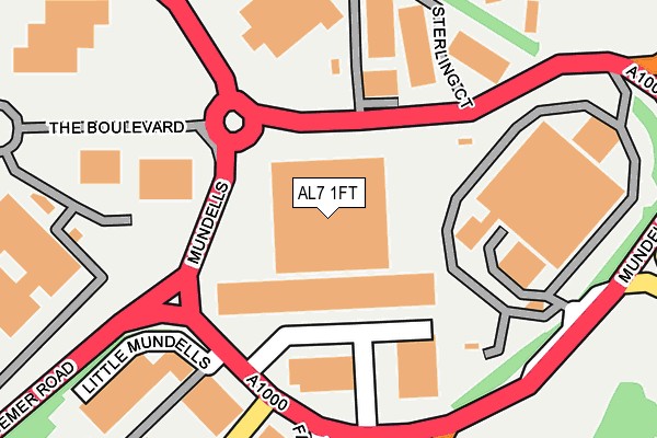
AL7 1FT is located in the Haldens electoral ward, within the local authority district of Welwyn Hatfield and the English Parliamentary constituency of Welwyn Hatfield. The Sub Integrated Care Board (ICB) Location is NHS Hertfordshire and West Essex ICB - 06K and the police force is Hertfordshire. This postcode has been in use since March 2006.


GetTheData
Source: OS OpenMap – Local (Ordnance Survey)
Source: OS VectorMap District (Ordnance Survey)
Licence: Open Government Licence (requires attribution)
| Easting | 524937 |
| Northing | 213668 |
| Latitude | 51.807698 |
| Longitude | -0.189242 |
GetTheData
Source: Open Postcode Geo
Licence: Open Government Licence
| Country | England |
| Postcode District | AL7 |
| ➜ AL7 open data dashboard ➜ See where AL7 is on a map ➜ Where is Welwyn Garden City? | |
GetTheData
Source: Land Registry Price Paid Data
Licence: Open Government Licence
Elevation or altitude of AL7 1FT as distance above sea level:
| Metres | Feet | |
|---|---|---|
| Elevation | 80m | 262ft |
Elevation is measured from the approximate centre of the postcode, to the nearest point on an OS contour line from OS Terrain 50, which has contour spacing of ten vertical metres.
➜ How high above sea level am I? Find the elevation of your current position using your device's GPS.
GetTheData
Source: Open Postcode Elevation
Licence: Open Government Licence
| Ward | Haldens |
| Constituency | Welwyn Hatfield |
GetTheData
Source: ONS Postcode Database
Licence: Open Government Licence
| January 2024 | Anti-social behaviour | On or near Parking Area | 451m |
| January 2024 | Anti-social behaviour | On or near Parking Area | 451m |
| January 2024 | Burglary | On or near Parking Area | 451m |
| ➜ Get more crime data in our Crime section | |||
GetTheData
Source: data.police.uk
Licence: Open Government Licence
| Mundells | Panshanger | 192m |
| Waterside (Mundells) | Welwyn Garden City | 231m |
| Business Parks North (Bessemer Road) | Welwyn Garden City | 248m |
| Business Parks South (Bessemer Road) | Welwyn Garden City | 287m |
| Shire Park (Falcon Way) | Welwyn Garden City | 387m |
| Welwyn Garden City Station | 1.3km |
| Welwyn North Station | 1.8km |
| Hatfield (Herts) Station | 5.2km |
GetTheData
Source: NaPTAN
Licence: Open Government Licence
Estimated total energy consumption in AL7 1FT by fuel type, 2015.
| Consumption (kWh) | 61,360 |
|---|---|
| Meter count | 6 |
| Mean (kWh/meter) | 10,227 |
| Median (kWh/meter) | 9,931 |
GetTheData
Source: Postcode level gas estimates: 2015 (experimental)
Source: Postcode level electricity estimates: 2015 (experimental)
Licence: Open Government Licence
GetTheData
Source: ONS Postcode Database
Licence: Open Government Licence


➜ Get more ratings from the Food Standards Agency
GetTheData
Source: Food Standards Agency
Licence: FSA terms & conditions
| Last Collection | |||
|---|---|---|---|
| Location | Mon-Fri | Sat | Distance |
| Brownfields | 18:25 | 11:45 | 310m |
| Westfield | 17:30 | 11:45 | 430m |
| Rowans | 17:30 | 11:30 | 512m |
GetTheData
Source: Dracos
Licence: Creative Commons Attribution-ShareAlike
| Facility | Distance |
|---|---|
| The Holy Family Catholic Primary School Crookhams, Welwyn Garden City Grass Pitches | 696m |
| Waterside Academy Rowans, Welwyn Garden City Grass Pitches | 707m |
| Welwyn Garden City Football Club Herns Way, Welwyn Garden City Grass Pitches, Artificial Grass Pitch | 822m |
GetTheData
Source: Active Places
Licence: Open Government Licence
| School | Phase of Education | Distance |
|---|---|---|
| The Holy Family Catholic Primary School Crookhams, Welwyn Garden City, AL7 1PG | Primary | 696m |
| Waterside Academy Rowans, Welwyn Garden City, AL7 1NZ | Primary | 704m |
| Panshanger Primary School Daniells, Welwyn Garden City, AL7 1QY | Primary | 778m |
GetTheData
Source: Edubase
Licence: Open Government Licence
The below table lists the International Territorial Level (ITL) codes (formerly Nomenclature of Territorial Units for Statistics (NUTS) codes) and Local Administrative Units (LAU) codes for AL7 1FT:
| ITL 1 Code | Name |
|---|---|
| TLH | East |
| ITL 2 Code | Name |
| TLH2 | Bedfordshire and Hertfordshire |
| ITL 3 Code | Name |
| TLH23 | Hertfordshire CC |
| LAU 1 Code | Name |
| E07000241 | Welwyn Hatfield |
GetTheData
Source: ONS Postcode Directory
Licence: Open Government Licence
The below table lists the Census Output Area (OA), Lower Layer Super Output Area (LSOA), and Middle Layer Super Output Area (MSOA) for AL7 1FT:
| Code | Name | |
|---|---|---|
| OA | E00121421 | |
| LSOA | E01023912 | Welwyn Hatfield 004A |
| MSOA | E02004983 | Welwyn Hatfield 004 |
GetTheData
Source: ONS Postcode Directory
Licence: Open Government Licence
| AL7 1FS | Mundells | 68m |
| AL7 1FX | Mundells | 187m |
| AL7 1NQ | Maple Grove | 266m |
| AL7 1NG | Sloansway | 283m |
| AL7 1NL | Maple Grove | 325m |
| AL7 1NN | Maple Grove | 352m |
| AL7 1NH | Maple Grove | 365m |
| AL7 1BJ | Sutherland Court | 366m |
| AL7 1NF | Sloansway | 374m |
| AL7 1AJ | Brownfields Court | 378m |
GetTheData
Source: Open Postcode Geo; Land Registry Price Paid Data
Licence: Open Government Licence