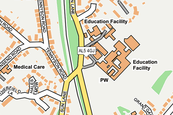
AL5 4GJ is located in the Harpenden East electoral ward, within the local authority district of St Albans and the English Parliamentary constituency of Hitchin and Harpenden. The Sub Integrated Care Board (ICB) Location is NHS Hertfordshire and West Essex ICB - 06N and the police force is Hertfordshire. This postcode has been in use since June 2001.


GetTheData
Source: OS OpenMap – Local (Ordnance Survey)
Source: OS VectorMap District (Ordnance Survey)
Licence: Open Government Licence (requires attribution)
| Easting | 513503 |
| Northing | 214923 |
| Latitude | 51.821413 |
| Longitude | -0.354600 |
GetTheData
Source: Open Postcode Geo
Licence: Open Government Licence
| Country | England |
| Postcode District | AL5 |
| ➜ AL5 open data dashboard ➜ See where AL5 is on a map ➜ Where is Harpenden? | |
GetTheData
Source: Land Registry Price Paid Data
Licence: Open Government Licence
Elevation or altitude of AL5 4GJ as distance above sea level:
| Metres | Feet | |
|---|---|---|
| Elevation | 120m | 394ft |
Elevation is measured from the approximate centre of the postcode, to the nearest point on an OS contour line from OS Terrain 50, which has contour spacing of ten vertical metres.
➜ How high above sea level am I? Find the elevation of your current position using your device's GPS.
GetTheData
Source: Open Postcode Elevation
Licence: Open Government Licence
| Ward | Harpenden East |
| Constituency | Hitchin And Harpenden |
GetTheData
Source: ONS Postcode Database
Licence: Open Government Licence
| January 2024 | Other crime | On or near Sun Lane | 94m |
| November 2023 | Anti-social behaviour | On or near Sun Lane | 94m |
| September 2023 | Anti-social behaviour | On or near Parking Area | 291m |
| ➜ Get more crime data in our Crime section | |||
GetTheData
Source: data.police.uk
Licence: Open Government Licence
| St Georges School (Sun Lane) | Harpenden | 37m |
| St Georges School (Sun Lane) | Harpenden | 72m |
| Ox Lane (Sun Lane) | Harpenden | 197m |
| Ox Lane (Sun Lane) | Harpenden | 199m |
| Ox Lane West (Ox Lane) | Harpenden | 288m |
| Harpenden Station | 0.8km |
GetTheData
Source: NaPTAN
Licence: Open Government Licence
GetTheData
Source: ONS Postcode Database
Licence: Open Government Licence


➜ Get more ratings from the Food Standards Agency
GetTheData
Source: Food Standards Agency
Licence: FSA terms & conditions
| Last Collection | |||
|---|---|---|---|
| Location | Mon-Fri | Sat | Distance |
| Wordsworth Road | 18:30 | 11:45 | 251m |
| Sun Lane | 18:30 | 11:45 | 366m |
| Ox Lane | 18:30 | 11:45 | 438m |
GetTheData
Source: Dracos
Licence: Creative Commons Attribution-ShareAlike
| Facility | Distance |
|---|---|
| St Georges School Sun Lane, Harpenden Sports Hall, Health and Fitness Gym, Grass Pitches, Outdoor Tennis Courts | 174m |
| Elliswick Lawn Tennis Club Elliswick Road, Harpenden Outdoor Tennis Courts | 447m |
| Sir John Lawes School Manland Way, Harpenden Grass Pitches, Sports Hall | 611m |
GetTheData
Source: Active Places
Licence: Open Government Licence
| School | Phase of Education | Distance |
|---|---|---|
| St George's School Sun Lane, Harpenden, AL5 4TD | Secondary | 123m |
| Manland Primary School Sauncey Avenue, Harpenden, AL5 4QW | Primary | 521m |
| St Nicholas CofE VA Primary School Church Green, Harpenden, AL5 2TP | Primary | 553m |
GetTheData
Source: Edubase
Licence: Open Government Licence
The below table lists the International Territorial Level (ITL) codes (formerly Nomenclature of Territorial Units for Statistics (NUTS) codes) and Local Administrative Units (LAU) codes for AL5 4GJ:
| ITL 1 Code | Name |
|---|---|
| TLH | East |
| ITL 2 Code | Name |
| TLH2 | Bedfordshire and Hertfordshire |
| ITL 3 Code | Name |
| TLH23 | Hertfordshire CC |
| LAU 1 Code | Name |
| E07000240 | St Albans |
GetTheData
Source: ONS Postcode Directory
Licence: Open Government Licence
The below table lists the Census Output Area (OA), Lower Layer Super Output Area (LSOA), and Middle Layer Super Output Area (MSOA) for AL5 4GJ:
| Code | Name | |
|---|---|---|
| OA | E00120282 | |
| LSOA | E01023689 | St Albans 002E |
| MSOA | E02004925 | St Albans 002 |
GetTheData
Source: ONS Postcode Directory
Licence: Open Government Licence
| AL5 4EY | Sun Lane | 109m |
| AL5 4EX | Sun Lane | 122m |
| AL5 4BE | Tennyson Road | 135m |
| AL5 4BB | Tennyson Road | 156m |
| AL5 4EZ | Pigeonwick | 181m |
| AL5 4BG | Townsend Road | 191m |
| AL5 4JB | Hales Meadow | 191m |
| AL5 4JD | Hitherfield Lane | 197m |
| AL5 4BD | Tennyson Road | 211m |
| AL5 4EU | Sun Lane | 211m |
GetTheData
Source: Open Postcode Geo; Land Registry Price Paid Data
Licence: Open Government Licence