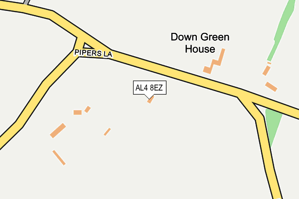
AL4 8EZ is located in the Sandridge & Wheathampstead electoral ward, within the local authority district of St Albans and the English Parliamentary constituency of Hitchin and Harpenden. The Sub Integrated Care Board (ICB) Location is NHS Hertfordshire and West Essex ICB - 06N and the police force is Hertfordshire. This postcode has been in use since June 2000.


GetTheData
Source: OS OpenMap – Local (Ordnance Survey)
Source: OS VectorMap District (Ordnance Survey)
Licence: Open Government Licence (requires attribution)
| Easting | 516440 |
| Northing | 213701 |
| Latitude | 51.809827 |
| Longitude | -0.312417 |
GetTheData
Source: Open Postcode Geo
Licence: Open Government Licence
| Country | England |
| Postcode District | AL4 |
| ➜ AL4 open data dashboard ➜ See where AL4 is on a map | |
GetTheData
Source: Land Registry Price Paid Data
Licence: Open Government Licence
Elevation or altitude of AL4 8EZ as distance above sea level:
| Metres | Feet | |
|---|---|---|
| Elevation | 120m | 394ft |
Elevation is measured from the approximate centre of the postcode, to the nearest point on an OS contour line from OS Terrain 50, which has contour spacing of ten vertical metres.
➜ How high above sea level am I? Find the elevation of your current position using your device's GPS.
GetTheData
Source: Open Postcode Elevation
Licence: Open Government Licence
| Ward | Sandridge & Wheathampstead |
| Constituency | Hitchin And Harpenden |
GetTheData
Source: ONS Postcode Database
Licence: Open Government Licence
| Long Buftlers | Harpenden | 768m |
| Cottages (Lower Luton Road) | The Folly | 898m |
| Folly Fields (Lower Luton Road) | The Folly | 900m |
| Folly Fields (Lower Luton Road) | The Folly | 904m |
| Wheathampsted Road (Meadway) | Harpenden | 918m |
| Harpenden Station | 2.7km |
GetTheData
Source: NaPTAN
Licence: Open Government Licence
GetTheData
Source: ONS Postcode Database
Licence: Open Government Licence


➜ Get more ratings from the Food Standards Agency
GetTheData
Source: Food Standards Agency
Licence: FSA terms & conditions
| Last Collection | |||
|---|---|---|---|
| Location | Mon-Fri | Sat | Distance |
| Amwell | 16:15 | 10:15 | 629m |
| The Folly Wheathampstead | 17:00 | 10:15 | 905m |
| Meadway | 17:45 | 12:15 | 921m |
GetTheData
Source: Dracos
Licence: Creative Commons Attribution-ShareAlike
| Facility | Distance |
|---|---|
| Wheathampstead Golf Course Ltd Harpenden Road, Wheathampstead, St. Albans Golf | 0m |
| Folly Fields Recreation Ground Folly Fields, Wheathampstead Grass Pitches | 1.1km |
| Aldwickbury Park Golf Club Piggottshill Lane, Harpenden Golf | 1.1km |
GetTheData
Source: Active Places
Licence: Open Government Licence
| School | Phase of Education | Distance |
|---|---|---|
| St Helen's Church of England Primary School Brewhouse Hill, Wheathampstead, St Albans, AL4 8AN | Primary | 1.2km |
| Aldwickbury School Aldwickbury School, Wheathampstead Road, Harpenden, AL5 1AD | Not applicable | 1.3km |
| Beech Hyde Primary School and Nursery Nurseries Road, Wheathampstead, St. Albans, AL4 8TP | Primary | 1.6km |
GetTheData
Source: Edubase
Licence: Open Government Licence
The below table lists the International Territorial Level (ITL) codes (formerly Nomenclature of Territorial Units for Statistics (NUTS) codes) and Local Administrative Units (LAU) codes for AL4 8EZ:
| ITL 1 Code | Name |
|---|---|
| TLH | East |
| ITL 2 Code | Name |
| TLH2 | Bedfordshire and Hertfordshire |
| ITL 3 Code | Name |
| TLH23 | Hertfordshire CC |
| LAU 1 Code | Name |
| E07000240 | St Albans |
GetTheData
Source: ONS Postcode Directory
Licence: Open Government Licence
The below table lists the Census Output Area (OA), Lower Layer Super Output Area (LSOA), and Middle Layer Super Output Area (MSOA) for AL4 8EZ:
| Code | Name | |
|---|---|---|
| OA | E00120585 | |
| LSOA | E01023749 | St Albans 004D |
| MSOA | E02004927 | St Albans 004 |
GetTheData
Source: ONS Postcode Directory
Licence: Open Government Licence
| AL5 1AF | Pipers Lane | 399m |
| AL4 8EE | Leasey Bridge Lane | 491m |
| AL4 8EB | Down Green Lane | 553m |
| AL4 8EA | Amwell Lane | 614m |
| AL5 1JD | Poynings Close | 626m |
| AL5 1JF | Long Buftlers | 690m |
| AL4 8EF | Leasey Bridge Lane | 717m |
| AL5 1JE | Long Buftlers | 769m |
| AL4 8DZ | Amwell Lane | 793m |
| AL5 1JB | Wheathampstead Road | 809m |
GetTheData
Source: Open Postcode Geo; Land Registry Price Paid Data
Licence: Open Government Licence