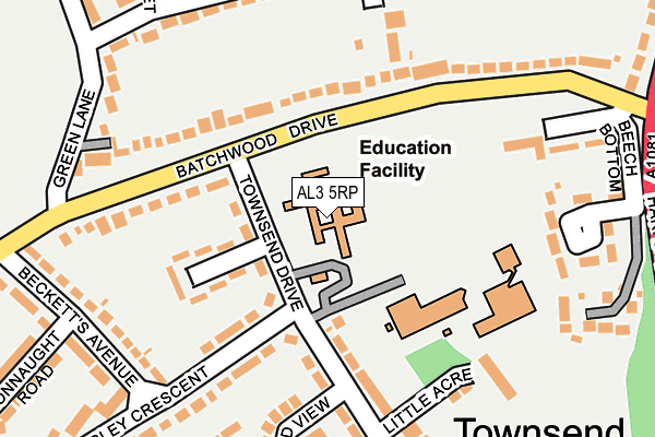
AL3 5RP is located in the Batchwood electoral ward, within the local authority district of St Albans and the English Parliamentary constituency of St Albans. The Sub Integrated Care Board (ICB) Location is NHS Hertfordshire and West Essex ICB - 06N and the police force is Hertfordshire. This postcode has been in use since January 1980.


GetTheData
Source: OS OpenMap – Local (Ordnance Survey)
Source: OS VectorMap District (Ordnance Survey)
Licence: Open Government Licence (requires attribution)
| Easting | 514638 |
| Northing | 208717 |
| Latitude | 51.765413 |
| Longitude | -0.340165 |
GetTheData
Source: Open Postcode Geo
Licence: Open Government Licence
| Country | England |
| Postcode District | AL3 |
| ➜ AL3 open data dashboard ➜ See where AL3 is on a map ➜ Where is St Albans? | |
GetTheData
Source: Land Registry Price Paid Data
Licence: Open Government Licence
Elevation or altitude of AL3 5RP as distance above sea level:
| Metres | Feet | |
|---|---|---|
| Elevation | 100m | 328ft |
Elevation is measured from the approximate centre of the postcode, to the nearest point on an OS contour line from OS Terrain 50, which has contour spacing of ten vertical metres.
➜ How high above sea level am I? Find the elevation of your current position using your device's GPS.
GetTheData
Source: Open Postcode Elevation
Licence: Open Government Licence
| Ward | Batchwood |
| Constituency | St Albans |
GetTheData
Source: ONS Postcode Database
Licence: Open Government Licence
| August 2023 | Vehicle crime | On or near Batchwood View | 324m |
| January 2023 | Vehicle crime | On or near High Grove | 278m |
| June 2022 | Violence and sexual offences | On or near Grimthorpe Close | 104m |
| ➜ Get more crime data in our Crime section | |||
GetTheData
Source: data.police.uk
Licence: Open Government Licence
| Alverton (Green Lane) | New Greens | 211m |
| Batchwood Hall (Batchwood Drive) | St Albans | 311m |
| Batchwood Hall (Batchwood Drive) | St Albans | 320m |
| Green Lane (Toulmin Drive) | New Greens | 341m |
| The Ancient Briton (Harpenden Road) | New Greens | 345m |
| St Albans City Station | 1.9km |
| St Albans Abbey Station | 2.3km |
| Park Street Station | 4.4km |
GetTheData
Source: NaPTAN
Licence: Open Government Licence
GetTheData
Source: ONS Postcode Database
Licence: Open Government Licence


➜ Get more ratings from the Food Standards Agency
GetTheData
Source: Food Standards Agency
Licence: FSA terms & conditions
| Last Collection | |||
|---|---|---|---|
| Location | Mon-Fri | Sat | Distance |
| Becketts Avenue | 18:30 | 12:30 | 237m |
| Beech Bottom | 16:00 | 12:00 | 414m |
| High Oaks P.o | 16:00 | 12:15 | 538m |
GetTheData
Source: Dracos
Licence: Creative Commons Attribution-ShareAlike
| Facility | Distance |
|---|---|
| Garden Fields Jmi School Townsend Drive, St. Albans Grass Pitches | 222m |
| St Albans High School For Girls Grass Pitches Townsend Drive, St. Albans Grass Pitches, Outdoor Tennis Courts | 446m |
| Townsend Sports And Bowls Club Waverley Road, St. Albans Sports Hall, Outdoor Tennis Courts | 570m |
GetTheData
Source: Active Places
Licence: Open Government Licence
| School | Phase of Education | Distance |
|---|---|---|
| Batchwood School Townsend Drive, St Albans, AL3 5RP | Not applicable | 0m |
| Garden Fields Junior Mixed and Infant School Townsend Drive, St Albans, AL3 5RL | Primary | 221m |
| Heathlands School Heathlands Drive, St Albans, AL3 5AY | Not applicable | 596m |
GetTheData
Source: Edubase
Licence: Open Government Licence
The below table lists the International Territorial Level (ITL) codes (formerly Nomenclature of Territorial Units for Statistics (NUTS) codes) and Local Administrative Units (LAU) codes for AL3 5RP:
| ITL 1 Code | Name |
|---|---|
| TLH | East |
| ITL 2 Code | Name |
| TLH2 | Bedfordshire and Hertfordshire |
| ITL 3 Code | Name |
| TLH23 | Hertfordshire CC |
| LAU 1 Code | Name |
| E07000240 | St Albans |
GetTheData
Source: ONS Postcode Directory
Licence: Open Government Licence
The below table lists the Census Output Area (OA), Lower Layer Super Output Area (LSOA), and Middle Layer Super Output Area (MSOA) for AL3 5RP:
| Code | Name | |
|---|---|---|
| OA | E00120220 | |
| LSOA | E01023672 | St Albans 009D |
| MSOA | E02004932 | St Albans 009 |
GetTheData
Source: ONS Postcode Directory
Licence: Open Government Licence
| AL3 5RN | Townsend Drive | 78m |
| AL3 5SA | Batchwood Drive | 79m |
| AL3 5RW | Grimthorpe Close | 132m |
| AL3 5RJ | Townsend Drive | 160m |
| AL3 5RZ | Batchwood Drive | 161m |
| AL3 6BN | Therfield Road | 166m |
| AL3 5RH | Townsend Drive | 174m |
| AL3 5RR | Langley Crescent | 187m |
| AL3 5SD | Batchwood Drive | 190m |
| AL3 6HA | Green Lane | 192m |
GetTheData
Source: Open Postcode Geo; Land Registry Price Paid Data
Licence: Open Government Licence