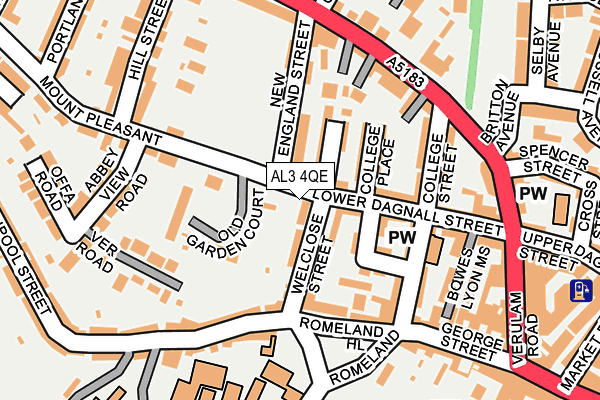
AL3 4QE is located in the Verulam electoral ward, within the local authority district of St Albans and the English Parliamentary constituency of St Albans. The Sub Integrated Care Board (ICB) Location is NHS Hertfordshire and West Essex ICB - 06N and the police force is Hertfordshire. This postcode has been in use since January 1980.


GetTheData
Source: OS OpenMap – Local (Ordnance Survey)
Source: OS VectorMap District (Ordnance Survey)
Licence: Open Government Licence (requires attribution)
| Easting | 514386 |
| Northing | 207312 |
| Latitude | 51.752831 |
| Longitude | -0.344300 |
GetTheData
Source: Open Postcode Geo
Licence: Open Government Licence
| Country | England |
| Postcode District | AL3 |
| ➜ AL3 open data dashboard ➜ See where AL3 is on a map ➜ Where is St Albans? | |
GetTheData
Source: Land Registry Price Paid Data
Licence: Open Government Licence
Elevation or altitude of AL3 4QE as distance above sea level:
| Metres | Feet | |
|---|---|---|
| Elevation | 90m | 295ft |
Elevation is measured from the approximate centre of the postcode, to the nearest point on an OS contour line from OS Terrain 50, which has contour spacing of ten vertical metres.
➜ How high above sea level am I? Find the elevation of your current position using your device's GPS.
GetTheData
Source: Open Postcode Elevation
Licence: Open Government Licence
| Ward | Verulam |
| Constituency | St Albans |
GetTheData
Source: ONS Postcode Database
Licence: Open Government Licence
| December 2023 | Other theft | On or near Bowes Lyon Mews | 175m |
| November 2023 | Anti-social behaviour | On or near Bowes Lyon Mews | 175m |
| November 2023 | Vehicle crime | On or near Bowes Lyon Mews | 175m |
| ➜ Get more crime data in our Crime section | |||
GetTheData
Source: data.police.uk
Licence: Open Government Licence
| Cannon Street (Folly Lane) | St Albans | 366m |
| Town Hall (Chequer Street) | St Albans | 373m |
| Town Hall (Chequer Street) | St Albans | 375m |
| Cannon Street (Folly Lane) | St Albans | 377m |
| Abbey (Holywell Hill) | St Albans | 431m |
| St Albans Abbey Station | 0.9km |
| St Albans City Station | 1.2km |
| Park Street Station | 3.1km |
GetTheData
Source: NaPTAN
Licence: Open Government Licence
GetTheData
Source: ONS Postcode Database
Licence: Open Government Licence


➜ Get more ratings from the Food Standards Agency
GetTheData
Source: Food Standards Agency
Licence: FSA terms & conditions
| Last Collection | |||
|---|---|---|---|
| Location | Mon-Fri | Sat | Distance |
| Romeland Hill | 18:30 | 12:00 | 158m |
| Spencer Street | 18:30 | 12:00 | 209m |
| Fishpool Street | 17:30 | 12:00 | 266m |
GetTheData
Source: Dracos
Licence: Creative Commons Attribution-ShareAlike
| Facility | Distance |
|---|---|
| King Harry Playing Fields (Closed) Abbey Gateway, St. Albans Grass Pitches | 218m |
| Fitness First (St Albans) Christopher Place, St. Albans Health and Fitness Gym, Studio | 260m |
| St Albans School Abbey Gateway, St. Albans Sports Hall, Swimming Pool, Health and Fitness Gym, Studio | 271m |
GetTheData
Source: Active Places
Licence: Open Government Licence
| School | Phase of Education | Distance |
|---|---|---|
| St Albans School Abbey Gateway, St Albans, AL3 4HB | Not applicable | 218m |
| Muriel Green Nursery School Church Crescent, St Albans, AL3 5JB | Nursery | 256m |
| Aboyne Lodge Junior Mixed and Infant School Etna Road, St Albans, AL3 5NL | Primary | 459m |
GetTheData
Source: Edubase
Licence: Open Government Licence
The below table lists the International Territorial Level (ITL) codes (formerly Nomenclature of Territorial Units for Statistics (NUTS) codes) and Local Administrative Units (LAU) codes for AL3 4QE:
| ITL 1 Code | Name |
|---|---|
| TLH | East |
| ITL 2 Code | Name |
| TLH2 | Bedfordshire and Hertfordshire |
| ITL 3 Code | Name |
| TLH23 | Hertfordshire CC |
| LAU 1 Code | Name |
| E07000240 | St Albans |
GetTheData
Source: ONS Postcode Directory
Licence: Open Government Licence
The below table lists the Census Output Area (OA), Lower Layer Super Output Area (LSOA), and Middle Layer Super Output Area (MSOA) for AL3 4QE:
| Code | Name | |
|---|---|---|
| OA | E00120566 | |
| LSOA | E01023743 | St Albans 014B |
| MSOA | E02004937 | St Albans 014 |
GetTheData
Source: ONS Postcode Directory
Licence: Open Government Licence
| AL3 4QF | Lower Dagnall Street | 29m |
| AL3 4PX | Lower Dagnall Street | 46m |
| AL3 4PY | Lower Dagnall Street | 48m |
| AL3 4QB | Welclose Street | 49m |
| AL3 4QD | Welclose Street | 57m |
| AL3 4PZ | Temperance Street | 59m |
| AL3 4QA | Temperance Street | 70m |
| AL3 4PU | College Place | 80m |
| AL3 4PJ | Queen Street | 87m |
| AL3 4QG | New England Street | 93m |
GetTheData
Source: Open Postcode Geo; Land Registry Price Paid Data
Licence: Open Government Licence