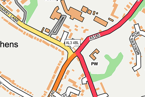
AL3 4BL is located in the Verulam electoral ward, within the local authority district of St Albans and the English Parliamentary constituency of St Albans. The Sub Integrated Care Board (ICB) Location is NHS Hertfordshire and West Essex ICB - 06N and the police force is Hertfordshire. This postcode has been in use since January 1980.


GetTheData
Source: OS OpenMap – Local (Ordnance Survey)
Source: OS VectorMap District (Ordnance Survey)
Licence: Open Government Licence (requires attribution)
| Easting | 514056 |
| Northing | 206104 |
| Latitude | 51.742041 |
| Longitude | -0.349475 |
GetTheData
Source: Open Postcode Geo
Licence: Open Government Licence
| Country | England |
| Postcode District | AL3 |
| ➜ AL3 open data dashboard ➜ See where AL3 is on a map ➜ Where is St Albans? | |
GetTheData
Source: Land Registry Price Paid Data
Licence: Open Government Licence
Elevation or altitude of AL3 4BL as distance above sea level:
| Metres | Feet | |
|---|---|---|
| Elevation | 100m | 328ft |
Elevation is measured from the approximate centre of the postcode, to the nearest point on an OS contour line from OS Terrain 50, which has contour spacing of ten vertical metres.
➜ How high above sea level am I? Find the elevation of your current position using your device's GPS.
GetTheData
Source: Open Postcode Elevation
Licence: Open Government Licence
| Ward | Verulam |
| Constituency | St Albans |
GetTheData
Source: ONS Postcode Database
Licence: Open Government Licence
| June 2022 | Violence and sexual offences | On or near Falstaff Gardens | 196m |
| June 2022 | Violence and sexual offences | On or near Falstaff Gardens | 196m |
| June 2022 | Violence and sexual offences | On or near Falstaff Gardens | 196m |
| ➜ Get more crime data in our Crime section | |||
GetTheData
Source: data.police.uk
Licence: Open Government Licence
| King Harry Ph (Watford Road) | St Stephens | 107m |
| King Harry Ph (Watford Road) | St Stephens | 141m |
| St Columba's College (King Harry Lane) | St Stephens | 169m |
| St Columba's College (King Harry Lane) | St Stephens | 170m |
| Cardinal Grove (Abbey Avenue) | St Stephens | 399m |
| St Albans Abbey Station | 0.6km |
| St Albans City Station | 1.8km |
| Park Street Station | 2km |
GetTheData
Source: NaPTAN
Licence: Open Government Licence
GetTheData
Source: ONS Postcode Database
Licence: Open Government Licence


➜ Get more ratings from the Food Standards Agency
GetTheData
Source: Food Standards Agency
Licence: FSA terms & conditions
| Last Collection | |||
|---|---|---|---|
| Location | Mon-Fri | Sat | Distance |
| St Stephens P.o | 17:30 | 12:00 | 535m |
| Dellfield | 17:30 | 12:00 | 727m |
| The Brambles | 17:30 | 12:00 | 775m |
GetTheData
Source: Dracos
Licence: Creative Commons Attribution-ShareAlike
| Facility | Distance |
|---|---|
| St Columba's College King Harry Lane, St. Albans Health and Fitness Gym, Grass Pitches, Sports Hall, Outdoor Tennis Courts | 208m |
| The Marlborough Science Academy Watling Street, St. Albans Swimming Pool, Sports Hall, Grass Pitches, Outdoor Tennis Courts | 372m |
| Abbey View Sports Complex Holywell Hill, St. Albans Golf, Athletics, Grass Pitches, Outdoor Tennis Courts | 453m |
GetTheData
Source: Active Places
Licence: Open Government Licence
| School | Phase of Education | Distance |
|---|---|---|
| St Columba's College King Harry Lane, St Albans, AL3 4AW | Not applicable | 167m |
| The Marlborough Science Academy Watling Street, St Albans, AL1 2QA | Secondary | 393m |
| St Adrian Roman Catholic Primary School Watling View, St Albans, AL1 2PB | Primary | 609m |
GetTheData
Source: Edubase
Licence: Open Government Licence
The below table lists the International Territorial Level (ITL) codes (formerly Nomenclature of Territorial Units for Statistics (NUTS) codes) and Local Administrative Units (LAU) codes for AL3 4BL:
| ITL 1 Code | Name |
|---|---|
| TLH | East |
| ITL 2 Code | Name |
| TLH2 | Bedfordshire and Hertfordshire |
| ITL 3 Code | Name |
| TLH23 | Hertfordshire CC |
| LAU 1 Code | Name |
| E07000240 | St Albans |
GetTheData
Source: ONS Postcode Directory
Licence: Open Government Licence
The below table lists the Census Output Area (OA), Lower Layer Super Output Area (LSOA), and Middle Layer Super Output Area (MSOA) for AL3 4BL:
| Code | Name | |
|---|---|---|
| OA | E00120563 | |
| LSOA | E01023743 | St Albans 014B |
| MSOA | E02004937 | St Albans 014 |
GetTheData
Source: ONS Postcode Directory
Licence: Open Government Licence
| AL1 2PT | Watling Street | 66m |
| AL3 4BN | Romans End | 82m |
| AL3 4LD | Havercroft Close | 87m |
| AL1 2AJ | Watford Road | 146m |
| AL1 2AA | Watford Road | 146m |
| AL1 2AL | Falstaff Gardens | 206m |
| AL1 2PU | Vicarage Close | 206m |
| AL1 2PX | Watling Street | 235m |
| AL1 2DT | Trevelyan Place | 246m |
| AL1 2QS | Mercers Row | 255m |
GetTheData
Source: Open Postcode Geo; Land Registry Price Paid Data
Licence: Open Government Licence