Yeovil Alpine Village (Closed)
Yeovil Alpine Village (Closed) is located in Yeovil (BA20).
| Address | Addlewell Lane, Yeovil, BA20 1QW |
| Car Park | Yes |
| Car Park Capacity | 70 |
| Management Type | Not Known |
| Management Group | Not Known |
| Owner Type | Commercial |
| Owner Group | Commercial |
| Education Phase | Not Known |
| Closure Date | 1st Sep 2007 |
| Closure Reason | Unclassified |
Facilities
| Closure Date | 1st Sep 2007 |
| Closure Reason | Unclassified |
| Accessibility | Pay and Play |
| Management Type | Not Known |
| Year Built | 1998 |
| Changing Rooms | Yes |
| Year Changing Rooms Refurbished | 2006 |
| Date Record Checked | 23rd Nov 2007 |
| Opening Times | Detailed Timings |
Facility specifics
| Floodlit | Yes |
| Length | 40m |
| Slope Type | Nursery |
| Width | 30m |
| Closure Date | 1st Sep 2007 |
| Closure Reason | Unclassified |
| Accessibility | Pay and Play |
| Management Type | Not Known |
| Year Built | 1998 |
| Changing Rooms | Yes |
| Year Changing Rooms Refurbished | 2006 |
| Date Record Checked | 23rd Nov 2007 |
| Opening Times | Detailed Timings |
Facility specifics
| Floodlit | Yes |
| Length | 130m |
| Slope Type | Intermediate |
| Width | 12m |
| Closure Date | 1st Sep 2007 |
| Closure Reason | Unclassified |
| Accessibility | Pay and Play |
| Management Type | Not Known |
| Year Built | 1998 |
| Changing Rooms | Yes |
| Year Changing Rooms Refurbished | 2006 |
| Date Record Checked | 23rd Nov 2007 |
| Opening Times | Detailed Timings |
Facility specifics
| Floodlit | Yes |
| Length | 110m |
| Slope Type | Intermediate |
| Width | 15m |
| Closure Date | 1st Sep 2007 |
| Closure Reason | Unclassified |
| Accessibility | Pay and Play |
| Management Type | Not Known |
| Year Built | 1998 |
| Changing Rooms | Yes |
| Year Changing Rooms Refurbished | 2006 |
| Date Record Checked | 23rd Nov 2007 |
| Opening Times | Detailed Timings |
Facility specifics
| Floodlit | Yes |
| Length | 130m |
| Slope Type | Advanced |
| Width | 20m |
| Closure Date | 1st Sep 2007 |
| Closure Reason | Unclassified |
| Accessibility | Pay and Play |
| Management Type | Not Known |
| Year Built | 1998 |
| Changing Rooms | Yes |
| Year Changing Rooms Refurbished | 2006 |
| Date Record Checked | 23rd Nov 2007 |
| Opening Times | Detailed Timings |
Facility specifics
| Floodlit | Yes |
| Length | 110m |
| Slope Type | Other |
| Width | 15m |
Where is Yeovil Alpine Village (Closed)?
| Sub Building Name | |
| Building Name | |
| Building Number | 0 |
| Dependent Thoroughfare | |
| Thoroughfare Name | Addlewell Lane |
| Double Dependent Locality | |
| Dependent Locality | |
| PostTown | Yeovil |
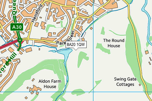
| Postcode | BA20 1QW |
Yeovil Alpine Village (Closed) on a map

Yeovil Alpine Village (Closed) geodata
| Easting | 355979.9 |
| Northing | 115637.7 |
| Latitude | 50.938492 |
| Longitude | -2.627867 |
| Local Authority Name | South Somerset |
| Local Authority Code | E07000189 |
| Parliamentary Constituency Name | Yeovil |
| Parliamentary Constituency Code | E14001060 |
| Region Name | South West |
| Region Code | E15000009 |
| Ward Name | Yeovil Westland |
| Ward Code | E05012546 |
| Output Area Code | E00166018 |
About this data
This data is open data sourced from Active Places Power and licenced under the Active Places Open Data Licence.
| Created On | 14th Dec 2014 |
| Audited On | 26th Jan 2015 |
| Checked On | 23rd Nov 2007 |
