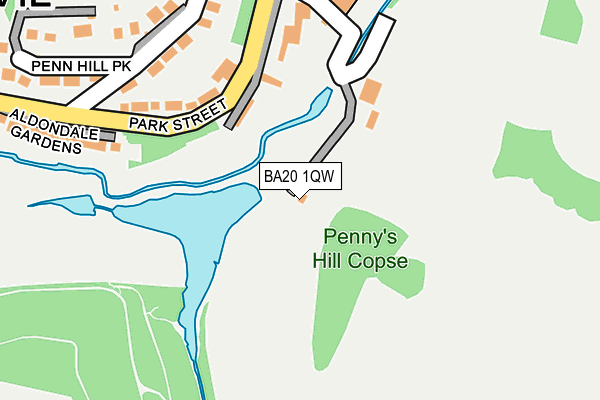
BA20 1QW is located in the Yeovil South electoral ward, within the unitary authority of Somerset and the English Parliamentary constituency of Yeovil. The Sub Integrated Care Board (ICB) Location is NHS Somerset ICB - 11X and the police force is Avon and Somerset. This postcode has been in use since January 1980.


GetTheData
Source: OS OpenMap – Local (Ordnance Survey)
Source: OS VectorMap District (Ordnance Survey)
Licence: Open Government Licence (requires attribution)
| Easting | 355902 |
| Northing | 115489 |
| Latitude | 50.937142 |
| Longitude | -2.628958 |
GetTheData
Source: Open Postcode Geo
Licence: Open Government Licence
| Country | England |
| Postcode District | BA20 |
➜ See where BA20 is on a map | |
GetTheData
Source: Land Registry Price Paid Data
Licence: Open Government Licence
Elevation or altitude of BA20 1QW as distance above sea level:
| Metres | Feet | |
|---|---|---|
| Elevation | 40m | 131ft |
Elevation is measured from the approximate centre of the postcode, to the nearest point on an OS contour line from OS Terrain 50, which has contour spacing of ten vertical metres.
➜ How high above sea level am I? Find the elevation of your current position using your device's GPS.
GetTheData
Source: Open Postcode Elevation
Licence: Open Government Licence
| Ward | Yeovil South |
| Constituency | Yeovil |
GetTheData
Source: ONS Postcode Database
Licence: Open Government Licence
| St Nicholas Close | Yeovil | 318m |
| Bingo Hall (Stars Lane) | Yeovil | 410m |
| Wilkinsons Car Park | Yeovil | 444m |
| South Street | Yeovil | 470m |
| Cineworld | Yeovil | 475m |
| Yeovil Pen Mill Station | 1.4km |
| Yeovil Junction Station | 1.8km |
| Thornford Station | 4.6km |
GetTheData
Source: NaPTAN
Licence: Open Government Licence
| Percentage of properties with Next Generation Access | 50.0% |
| Percentage of properties with Superfast Broadband | 50.0% |
| Percentage of properties with Ultrafast Broadband | 0.0% |
| Percentage of properties with Full Fibre Broadband | 0.0% |
Superfast Broadband is between 30Mbps and 300Mbps
Ultrafast Broadband is > 300Mbps
| Percentage of properties unable to receive 2Mbps | 0.0% |
| Percentage of properties unable to receive 5Mbps | 0.0% |
| Percentage of properties unable to receive 10Mbps | 0.0% |
| Percentage of properties unable to receive 30Mbps | 0.0% |
GetTheData
Source: Ofcom
Licence: Ofcom Terms of Use (requires attribution)
GetTheData
Source: ONS Postcode Database
Licence: Open Government Licence


➜ Get more ratings from the Food Standards Agency
GetTheData
Source: Food Standards Agency
Licence: FSA terms & conditions
| Last Collection | |||
|---|---|---|---|
| Location | Mon-Fri | Sat | Distance |
| Bond Street | 17:30 | 12:00 | 401m |
| Sherborne Road | 16:30 | 12:00 | 486m |
| Manor Road | 17:30 | 12:00 | 551m |
GetTheData
Source: Dracos
Licence: Creative Commons Attribution-ShareAlike
The below table lists the International Territorial Level (ITL) codes (formerly Nomenclature of Territorial Units for Statistics (NUTS) codes) and Local Administrative Units (LAU) codes for BA20 1QW:
| ITL 1 Code | Name |
|---|---|
| TLK | South West (England) |
| ITL 2 Code | Name |
| TLK2 | Dorset and Somerset |
| ITL 3 Code | Name |
| TLK23 | Somerset CC |
| LAU 1 Code | Name |
| E07000189 | South Somerset |
GetTheData
Source: ONS Postcode Directory
Licence: Open Government Licence
The below table lists the Census Output Area (OA), Lower Layer Super Output Area (LSOA), and Middle Layer Super Output Area (MSOA) for BA20 1QW:
| Code | Name | |
|---|---|---|
| OA | E00166018 | |
| LSOA | E01029243 | South Somerset 018C |
| MSOA | E02006092 | South Somerset 018 |
GetTheData
Source: ONS Postcode Directory
Licence: Open Government Licence
| BA20 1QN | Addlewell Lane | 110m |
| BA20 1QT | Park Street | 202m |
| BA20 1NU | Central Acre | 227m |
| BA20 1NY | Woodland Terrace | 279m |
| BA20 1NZ | Woodland Grove | 295m |
| BA20 1EH | Tanyard Way | 312m |
| BA20 1SE | Penn Hill Park | 316m |
| BA20 1NL | Summer House Terrace | 324m |
| BA20 1QU | Aldondale Gardens | 326m |
| BA20 1SX | St Nicholas Park | 340m |
GetTheData
Source: Open Postcode Geo; Land Registry Price Paid Data
Licence: Open Government Licence