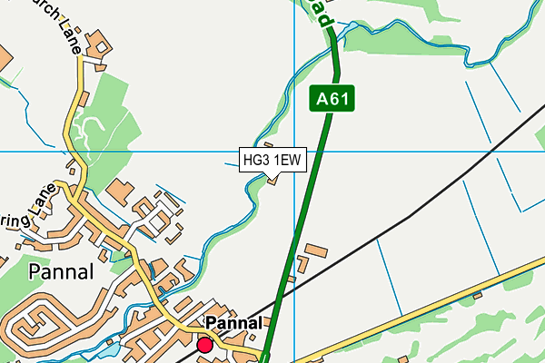
Pannal Community Park - Leeds Road
Pannal Community Park is located in Leeds Road, Pannal (HG3), and offers Grass Pitches.
| Address | SPORTS FIELD, Leeds Road, Leeds Road, Pannal, HG3 1EW |
| Car Park | Yes |
| Car Park Capacity | 40 |
| Management Type | Sport Club |
| Management Group | Others |
| Owner Type | Sports Club |
| Owner Group | Sports Club |
| Education Phase | Not applicable |
Facilities
| Accessibility | Sports Club / Community Association |
| Management Type | Sport Club |
| Year Built | 2019 |
| Changing Rooms | No |
| Date Record Created | 22nd Oct 2019 |
| Date Record Checked | 9th Dec 2022 |
| Opening Times | Dawn To Dusk |
Facility specifics
| Accessibility | Sports Club / Community Association |
| Management Type | Sport Club |
| Year Built | 2019 |
| Changing Rooms | No |
| Date Record Created | 22nd Oct 2019 |
| Date Record Checked | 9th Dec 2022 |
| Opening Times | Dawn To Dusk |
Facility specifics
| Accessibility | Sports Club / Community Association |
| Management Type | Sport Club |
| Changing Rooms | No |
| Date Record Created | 22nd Oct 2019 |
| Date Record Checked | 9th Dec 2022 |
| Opening Times | Dawn To Dusk |
Facility specifics
| Accessibility | Sports Club / Community Association |
| Management Type | Sport Club |
| Year Built | 2019 |
| Changing Rooms | No |
| Date Record Created | 22nd Oct 2019 |
| Date Record Checked | 9th Dec 2022 |
| Opening Times | Dawn To Dusk |
Facility specifics
| Accessibility | Sports Club / Community Association |
| Management Type | Sport Club |
| Year Built | 2019 |
| Changing Rooms | No |
| Date Record Created | 22nd Oct 2019 |
| Date Record Checked | 9th Dec 2022 |
| Opening Times | Dawn To Dusk |
Facility specifics
Contact
Where is Pannal Community Park?
| Sub Building Name | |
| Building Name | SPORTS FIELD |
| Building Number | 0 |
| Dependent Thoroughfare | |
| Thoroughfare Name | LEEDS ROAD |
| Double Dependent Locality | LEEDS ROAD |
| Dependent Locality | |
| PostTown | PANNAL |
| Postcode | HG3 1EW |
Pannal Community Park on a map

Pannal Community Park geodata
| Easting | 430972 |
| Northing | 451823 |
| Latitude | 53.961569 |
| Longitude | -1.529438 |
| Local Authority Name | Harrogate |
| Local Authority Code | E07000165 |
| Parliamentary Constituency Name | Harrogate and Knaresborough |
| Parliamentary Constituency Code | E14000730 |
| Region Name | Yorkshire and the Humber |
| Region Code | E15000003 |
| Ward Name | Harrogate Pannal |
| Ward Code | E05011325 |
| Output Area Code | E00141063 |
About this data
This data is open data sourced from Active Places Power and licenced under the Active Places Open Data Licence.
| toid | osgb1000000079067729 |
| Created On | 22nd Oct 2019 |
| Audited On | 9th Dec 2022 |
| Checked On | 9th Dec 2022 |
