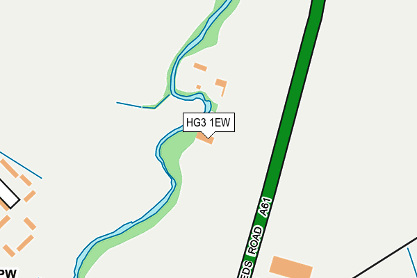
HG3 1EW is located in the Oatlands & Pannal electoral ward, within the unitary authority of North Yorkshire and the English Parliamentary constituency of Harrogate and Knaresborough. The Sub Integrated Care Board (ICB) Location is NHS Humber and North Yorkshire ICB - 42D and the police force is North Yorkshire. This postcode has been in use since January 1980.


GetTheData
Source: OS OpenMap – Local (Ordnance Survey)
Source: OS VectorMap District (Ordnance Survey)
Licence: Open Government Licence (requires attribution)
| Easting | 430963 |
| Northing | 451941 |
| Latitude | 53.962646 |
| Longitude | -1.529568 |
GetTheData
Source: Open Postcode Geo
Licence: Open Government Licence
| Country | England |
| Postcode District | HG3 |
➜ See where HG3 is on a map ➜ Where is Pannal? | |
GetTheData
Source: Land Registry Price Paid Data
Licence: Open Government Licence
Elevation or altitude of HG3 1EW as distance above sea level:
| Metres | Feet | |
|---|---|---|
| Elevation | 80m | 262ft |
Elevation is measured from the approximate centre of the postcode, to the nearest point on an OS contour line from OS Terrain 50, which has contour spacing of ten vertical metres.
➜ How high above sea level am I? Find the elevation of your current position using your device's GPS.
GetTheData
Source: Open Postcode Elevation
Licence: Open Government Licence
| Ward | Oatlands & Pannal |
| Constituency | Harrogate And Knaresborough |
GetTheData
Source: ONS Postcode Database
Licence: Open Government Licence
| Crimple Valley (Leeds Road) | Spacey Houses | 129m |
| Cragside Garage (Leeds Road) | Spacey Houses | 168m |
| Rosedale Corner (Rosedale) | Pannal | 562m |
| Rosedale Corner (Rosedale) | Pannal | 564m |
| Sandy Bank (Church Lane) | Pannal | 592m |
| Pannal Station | 0.5km |
| Hornbeam Park Station | 1.9km |
| Harrogate Station | 3.4km |
GetTheData
Source: NaPTAN
Licence: Open Government Licence
GetTheData
Source: ONS Postcode Database
Licence: Open Government Licence


➜ Get more ratings from the Food Standards Agency
GetTheData
Source: Food Standards Agency
Licence: FSA terms & conditions
| Last Collection | |||
|---|---|---|---|
| Location | Mon-Fri | Sat | Distance |
| Almsford Park | 17:45 | 11:30 | 881m |
| Firs View/Firs Crescent | 18:00 | 11:45 | 1,048m |
| Firs Ave/Leeds Road | 18:00 | 11:30 | 1,276m |
GetTheData
Source: Dracos
Licence: Creative Commons Attribution-ShareAlike
The below table lists the International Territorial Level (ITL) codes (formerly Nomenclature of Territorial Units for Statistics (NUTS) codes) and Local Administrative Units (LAU) codes for HG3 1EW:
| ITL 1 Code | Name |
|---|---|
| TLE | Yorkshire and The Humber |
| ITL 2 Code | Name |
| TLE2 | North Yorkshire |
| ITL 3 Code | Name |
| TLE22 | North Yorkshire CC |
| LAU 1 Code | Name |
| E07000165 | Harrogate |
GetTheData
Source: ONS Postcode Directory
Licence: Open Government Licence
The below table lists the Census Output Area (OA), Lower Layer Super Output Area (LSOA), and Middle Layer Super Output Area (MSOA) for HG3 1EW:
| Code | Name | |
|---|---|---|
| OA | E00141063 | |
| LSOA | E01027700 | Harrogate 021B |
| MSOA | E02005781 | Harrogate 021 |
GetTheData
Source: ONS Postcode Directory
Licence: Open Government Licence
| HG3 1EP | Leeds Road | 271m |
| HG3 1LH | Pannal Green | 340m |
| HG3 1RS | Clark Beck Close | 392m |
| HG3 1JP | Hillside Road | 440m |
| HG3 1JW | Milton Road | 442m |
| HG3 1JG | Pannal Bank | 480m |
| HG3 1JN | Station Road | 482m |
| HG3 1JZ | Main Street | 489m |
| HG3 1JJ | Station Road | 542m |
| HG3 1JX | Mill Lane | 560m |
GetTheData
Source: Open Postcode Geo; Land Registry Price Paid Data
Licence: Open Government Licence