Nottingham Forest Fc (The City Ground) - West Bridgford
Nottingham Forest Fc (The City Ground) is located in West Bridgford, Nottingham (NG2), and offers Grass Pitches.
| Address | Pavilion Road, West Bridgford, Nottingham, NG2 5FJ |
| Car Park | Yes |
| Car Park Capacity | 500 |
| Management Type | Sport Club |
| Management Group | Others |
| Owner Type | Sports Club |
| Owner Group | Sports Club |
| Education Phase | Not applicable |
Aliases
Nottingham Forest Fc (The City Ground) is also known as:
Facilities
| Accessibility | Private Use |
| Management Type | Sport Club |
| Year Built | 1898 |
| Year Refurbished | 2018 |
| Changing Rooms | Yes |
| Year Changing Rooms Refurbished | 2017 |
| Date Record Created | 3rd Jun 2016 |
| Date Record Checked | 10th Oct 2023 |
Opening times
| Access description | Private Use |
|---|
| Opening time | 08:00 |
| Closing time | 22:00 |
| Period open for | Every day |
Facility specifics
Disabled access
| Disabled Access | Yes |
| Disabled Parking | Yes |
| Finding/Reaching Entrance | Yes |
| Reception Area | Yes |
| Doorways | Yes |
| Disabled Changing Facilities | Yes |
| Activity Areas | Yes |
| Disabled Toilets | Yes |
| Social Areas | Yes |
| Spectator Areas | Yes |
| Emergency Exits | Yes |
Contact
Disabled access
Disabled access for Nottingham Forest Fc (The City Ground)
| Disabled Access | Yes |
| Disabled Parking | Yes |
| Finding/Reaching Entrance | Yes |
| Reception Area | Yes |
| Doorways | Yes |
| Disabled Changing Facilities | Yes |
| Activity Areas | Yes |
| Disabled Toilets | Yes |
| Social Areas | Yes |
| Spectator Areas | Yes |
| Emergency Exits | Yes |
Where is Nottingham Forest Fc (The City Ground)?
| Sub Building Name | |
| Building Name | |
| Building Number | 0 |
| Dependent Thoroughfare | |
| Thoroughfare Name | PAVILION ROAD |
| Double Dependent Locality | |
| Dependent Locality | WEST BRIDGFORD |
| PostTown | NOTTINGHAM |
| Postcode | NG2 5FJ |
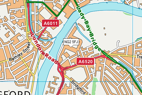
Nottingham Forest Fc (The City Ground) on a map

Nottingham Forest Fc (The City Ground) geodata
| Easting | 458351 |
| Northing | 338357 |
| Latitude | 52.939444 |
| Longitude | -1.133199 |
| Local Authority Name | Rushcliffe |
| Local Authority Code | E07000176 |
| Parliamentary Constituency Name | Rushcliffe |
| Parliamentary Constituency Code | E14000908 |
| Region Name | East Midlands |
| Region Code | E15000004 |
| Ward Name | Trent Bridge |
| Ward Code | E05009732 |
| Output Area Code | E00144807 |
About this data
This data is open data sourced from Active Places Power and licenced under the Active Places Open Data Licence.
| toid | osgb1000023130885 |
| Created On | 3rd Jun 2016 |
| Audited On | 10th Oct 2023 |
| Checked On | 10th Oct 2023 |
