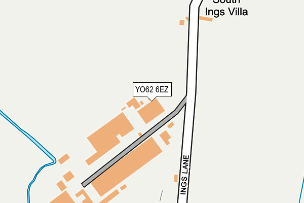
YO62 6EZ is located in the Kirkbymoorside & Dales electoral ward, within the unitary authority of North Yorkshire and the English Parliamentary constituency of Thirsk and Malton. The Sub Integrated Care Board (ICB) Location is NHS Humber and North Yorkshire ICB - 03Q and the police force is North Yorkshire. This postcode has been in use since June 1998.


GetTheData
Source: OS OpenMap – Local (Ordnance Survey)
Source: OS VectorMap District (Ordnance Survey)
Licence: Open Government Licence (requires attribution)
| Easting | 469473 |
| Northing | 484752 |
| Latitude | 54.253754 |
| Longitude | -0.935174 |
GetTheData
Source: Open Postcode Geo
Licence: Open Government Licence
| Country | England |
| Postcode District | YO62 |
➜ See where YO62 is on a map | |
GetTheData
Source: Land Registry Price Paid Data
Licence: Open Government Licence
Elevation or altitude of YO62 6EZ as distance above sea level:
| Metres | Feet | |
|---|---|---|
| Elevation | 40m | 131ft |
Elevation is measured from the approximate centre of the postcode, to the nearest point on an OS contour line from OS Terrain 50, which has contour spacing of ten vertical metres.
➜ How high above sea level am I? Find the elevation of your current position using your device's GPS.
GetTheData
Source: Open Postcode Elevation
Licence: Open Government Licence
| Ward | Kirkbymoorside & Dales |
| Constituency | Thirsk And Malton |
GetTheData
Source: ONS Postcode Database
Licence: Open Government Licence
| Great Edstone Village (Main Street) | Great Edstone | 1,370m |
| Welburn Special School (Back Lane) | Wombleton | 1,436m |
| Cooks Motors (New Road) | Kirkbymoorside | 1,451m |
| Welburn Special School (Back Lane) | Wombleton | 1,454m |
| Vivers Place (New Road) | Kirkbymoorside | 1,476m |
GetTheData
Source: NaPTAN
Licence: Open Government Licence
GetTheData
Source: ONS Postcode Database
Licence: Open Government Licence


➜ Get more ratings from the Food Standards Agency
GetTheData
Source: Food Standards Agency
Licence: FSA terms & conditions
| Last Collection | |||
|---|---|---|---|
| Location | Mon-Fri | Sat | Distance |
| 38 Queensway Kirkbymoorside | 17:30 | 09:30 | 1,468m |
| West End Kirkbymoorside | 17:15 | 11:30 | 1,649m |
| Kirkbymoorside Post Office | 17:30 | 11:30 | 1,823m |
GetTheData
Source: Dracos
Licence: Creative Commons Attribution-ShareAlike
The below table lists the International Territorial Level (ITL) codes (formerly Nomenclature of Territorial Units for Statistics (NUTS) codes) and Local Administrative Units (LAU) codes for YO62 6EZ:
| ITL 1 Code | Name |
|---|---|
| TLE | Yorkshire and The Humber |
| ITL 2 Code | Name |
| TLE2 | North Yorkshire |
| ITL 3 Code | Name |
| TLE22 | North Yorkshire CC |
| LAU 1 Code | Name |
| E07000167 | Ryedale |
GetTheData
Source: ONS Postcode Directory
Licence: Open Government Licence
The below table lists the Census Output Area (OA), Lower Layer Super Output Area (LSOA), and Middle Layer Super Output Area (MSOA) for YO62 6EZ:
| Code | Name | |
|---|---|---|
| OA | E00141501 | |
| LSOA | E01027783 | Ryedale 001C |
| MSOA | E02005788 | Ryedale 001 |
GetTheData
Source: ONS Postcode Directory
Licence: Open Government Licence
| YO62 6EY | Ings Lane | 59m |
| YO62 7HE | 1038m | |
| YO62 6DR | Gawtersyke Lane | 1110m |
| YO62 6QR | Dove Way | 1181m |
| YO62 6HJ | Back Lane | 1225m |
| YO62 6DP | Ings Lane | 1227m |
| YO62 6DN | Ings Lane | 1242m |
| YO62 6NZ | 1305m | |
| YO62 6PA | Pond Cottages | 1320m |
| YO62 6AH | West Lund Lane | 1344m |
GetTheData
Source: Open Postcode Geo; Land Registry Price Paid Data
Licence: Open Government Licence