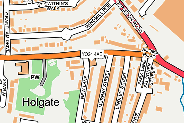
YO24 4AE is located in the Holgate electoral ward, within the unitary authority of York and the English Parliamentary constituency of York Central. The Sub Integrated Care Board (ICB) Location is NHS Humber and North Yorkshire ICB - 03Q and the police force is North Yorkshire. This postcode has been in use since June 1998.


GetTheData
Source: OS OpenMap – Local (Ordnance Survey)
Source: OS VectorMap District (Ordnance Survey)
Licence: Open Government Licence (requires attribution)
| Easting | 458504 |
| Northing | 451387 |
| Latitude | 53.955276 |
| Longitude | -1.109943 |
GetTheData
Source: Open Postcode Geo
Licence: Open Government Licence
| Country | England |
| Postcode District | YO24 |
➜ See where YO24 is on a map ➜ Where is York? | |
GetTheData
Source: Land Registry Price Paid Data
Licence: Open Government Licence
Elevation or altitude of YO24 4AE as distance above sea level:
| Metres | Feet | |
|---|---|---|
| Elevation | 20m | 66ft |
Elevation is measured from the approximate centre of the postcode, to the nearest point on an OS contour line from OS Terrain 50, which has contour spacing of ten vertical metres.
➜ How high above sea level am I? Find the elevation of your current position using your device's GPS.
GetTheData
Source: Open Postcode Elevation
Licence: Open Government Licence
| Ward | Holgate |
| Constituency | York Central |
GetTheData
Source: ONS Postcode Database
Licence: Open Government Licence
| Holgate Methodist Church (Acomb Road) | Holgate | 41m |
| Holgate Methodist Church (Acomb Road) | Holgate | 54m |
| Holgate Park (Poppleton Road) | Holgate | 226m |
| Holgate Park (Poppleton Road) | Holgate | 262m |
| Fox Inn (Holgate Road) | Holgate | 263m |
| York Station | 1.1km |
| Poppleton Station | 3.4km |
GetTheData
Source: NaPTAN
Licence: Open Government Licence
GetTheData
Source: ONS Postcode Database
Licence: Open Government Licence


➜ Get more ratings from the Food Standards Agency
GetTheData
Source: Food Standards Agency
Licence: FSA terms & conditions
| Last Collection | |||
|---|---|---|---|
| Location | Mon-Fri | Sat | Distance |
| West Bank Acomb | 17:45 | 12:15 | 332m |
| Hamilton Drive | 18:15 | 12:45 | 378m |
| 4 Hollybank Road York | 18:15 | 12:45 | 537m |
GetTheData
Source: Dracos
Licence: Creative Commons Attribution-ShareAlike
The below table lists the International Territorial Level (ITL) codes (formerly Nomenclature of Territorial Units for Statistics (NUTS) codes) and Local Administrative Units (LAU) codes for YO24 4AE:
| ITL 1 Code | Name |
|---|---|
| TLE | Yorkshire and The Humber |
| ITL 2 Code | Name |
| TLE2 | North Yorkshire |
| ITL 3 Code | Name |
| TLE21 | York |
| LAU 1 Code | Name |
| E06000014 | York |
GetTheData
Source: ONS Postcode Directory
Licence: Open Government Licence
The below table lists the Census Output Area (OA), Lower Layer Super Output Area (LSOA), and Middle Layer Super Output Area (MSOA) for YO24 4AE:
| Code | Name | |
|---|---|---|
| OA | E00067623 | |
| LSOA | E01013395 | York 016C |
| MSOA | E02002787 | York 016 |
GetTheData
Source: ONS Postcode Directory
Licence: Open Government Licence
| YO24 4EP | Acomb Road | 60m |
| YO24 4NT | New Lane | 92m |
| YO26 4TU | Windmill Rise | 92m |
| YO24 4JA | Murray Street | 105m |
| YO24 4JE | Murray Street | 106m |
| YO24 4EW | Acomb Road | 114m |
| YO24 4JF | Lindley Street | 132m |
| YO26 4TX | Windmill Rise | 145m |
| YO24 4JQ | Park Lane | 157m |
| YO24 4JG | Lindley Street | 158m |
GetTheData
Source: Open Postcode Geo; Land Registry Price Paid Data
Licence: Open Government Licence