YO23 1LU maps, stats, and open data
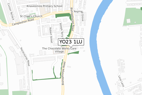
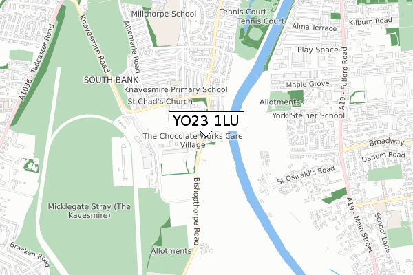
YO23 1LU lies on Bishopthorpe Road in York. YO23 1LU is located in the Micklegate electoral ward, within the unitary authority of York and the English Parliamentary constituency of York Central. The Sub Integrated Care Board (ICB) Location is NHS Humber and North Yorkshire ICB - 03Q and the police force is North Yorkshire. This postcode has been in use since May 2003.
YO23 1LU maps


Licence: Open Government Licence (requires attribution)
Attribution: Contains OS data © Crown copyright and database right 2025
Source: Open Postcode Geo
Licence: Open Government Licence (requires attribution)
Attribution: Contains OS data © Crown copyright and database right 2025; Contains Royal Mail data © Royal Mail copyright and database right 2025; Source: Office for National Statistics licensed under the Open Government Licence v.3.0
YO23 1LU geodata
| Easting | 460053 |
| Northing | 449866 |
| Latitude | 53.941449 |
| Longitude | -1.086647 |
Where is YO23 1LU?
| Street | Bishopthorpe Road |
| Town/City | York |
| Country | England |
| Postcode District | YO23 |
YO23 1LU Elevation
Elevation or altitude of YO23 1LU as distance above sea level:
| Metres | Feet | |
|---|---|---|
| Elevation | 10m | 33ft |
Elevation is measured from the approximate centre of the postcode, to the nearest point on an OS contour line from OS Terrain 50, which has contour spacing of ten vertical metres.
➜ How high above sea level am I? Find the elevation of your current position using your device's GPS.
Politics
| Ward | Micklegate |
|---|---|
| Constituency | York Central |
Transport
Nearest bus stops to YO23 1LU
| Terry's (Bishopthorpe Road) | Nunthorpe | 34m |
| Terry's (Bishopthorpe Road) | Nunthorpe | 95m |
| Reginald Grove (Bishopthorpe Road) | South Bank | 229m |
| Knavesmire Primary School (Campleshon Road) | South Bank | 281m |
| Knavesmire Primary School (Campleshon Road) | South Bank | 296m |
Nearest railway stations to YO23 1LU
| York Station | 1.9km |
| Poppleton Station | 5.6km |
Broadband
Broadband access in YO23 1LU (2020 data)
| Percentage of properties with Next Generation Access | 100.0% |
| Percentage of properties with Superfast Broadband | 100.0% |
| Percentage of properties with Ultrafast Broadband | 0.0% |
| Percentage of properties with Full Fibre Broadband | 0.0% |
Superfast Broadband is between 30Mbps and 300Mbps
Ultrafast Broadband is > 300Mbps
Broadband speed in YO23 1LU (2019 data)
Download
| Median download speed | 44.6Mbps |
| Average download speed | 40.9Mbps |
| Maximum download speed | 78.11Mbps |
Upload
| Median upload speed | 10.0Mbps |
| Average upload speed | 10.2Mbps |
| Maximum upload speed | 20.00Mbps |
Broadband limitations in YO23 1LU (2020 data)
| Percentage of properties unable to receive 2Mbps | 0.0% |
| Percentage of properties unable to receive 5Mbps | 0.0% |
| Percentage of properties unable to receive 10Mbps | 0.0% |
| Percentage of properties unable to receive 30Mbps | 0.0% |
YO23 1LU gas and electricity consumption
Estimated total energy consumption in YO23 1LU by fuel type, 2015.
Gas
| Consumption (kWh) | 171,996 |
|---|---|
| Meter count | 18 |
| Mean (kWh/meter) | 9,555 |
| Median (kWh/meter) | 8,047 |
Electricity
| Consumption (kWh) | 54,112 |
|---|---|
| Meter count | 19 |
| Mean (kWh/meter) | 2,848 |
| Median (kWh/meter) | 2,244 |
- Consumption: The estimated total energy consumption, in kWh, across all meters in YO23 1LU, for 2015.
- Meter count: The total number of meters in YO23 1LU.
- Mean: The mean average consumption per meter, in kWh.
- Median: The median average consumption per meter, in kWh.
Source: Postcode level electricity estimates: 2015 (experimental)
Licence: Open Government Licence
Deprivation
9.6% of English postcodes are less deprived than YO23 1LU:Food Standards Agency
Three nearest food hygiene ratings to YO23 1LU (metres)


➜ Get more ratings from the Food Standards Agency
Nearest post box to YO23 1LU
| Last Collection | |||
|---|---|---|---|
| Location | Mon-Fri | Sat | Distance |
| Balmoral Terrace | 18:20 | 12:30 | 421m |
| 110 Albermarle Road York | 18:15 | 12:30 | 598m |
| 2 Danesmead Close Fulford York | 17:45 | 12:00 | 624m |
YO23 1LU ITL and YO23 1LU LAU
The below table lists the International Territorial Level (ITL) codes (formerly Nomenclature of Territorial Units for Statistics (NUTS) codes) and Local Administrative Units (LAU) codes for YO23 1LU:
| ITL 1 Code | Name |
|---|---|
| TLE | Yorkshire and The Humber |
| ITL 2 Code | Name |
| TLE2 | North Yorkshire |
| ITL 3 Code | Name |
| TLE21 | York |
| LAU 1 Code | Name |
| E06000014 | York |
YO23 1LU census areas
The below table lists the Census Output Area (OA), Lower Layer Super Output Area (LSOA), and Middle Layer Super Output Area (MSOA) for YO23 1LU:
| Code | Name | |
|---|---|---|
| OA | E00067714 | |
| LSOA | E01013414 | York 021D |
| MSOA | E02002792 | York 021 |
Nearest postcodes to YO23 1LU
| YO23 1LH | Bishopthorpe Road | 44m |
| YO23 1PG | Bishopthorpe Road | 67m |
| YO23 1LX | St Chads Wharf | 127m |
| YO23 1LJ | Bishopthorpe Road | 132m |
| YO23 1LN | Reginald Grove | 209m |
| YO23 1PZ | Joseph Terry Grove | 230m |
| YO23 1LG | Bishopthorpe Road | 235m |
| YO23 1LL | Reginald Grove | 241m |
| YO23 1PY | Joseph Terry Grove | 248m |
| YO23 1PX | Joseph Terry Grove | 274m |