YO18 8JJ maps, stats, and open data
YO18 8JJ lies on Yatts Road in Newbridge, Pickering. YO18 8JJ is located in the Pickering electoral ward, within the unitary authority of North Yorkshire and the English Parliamentary constituency of Thirsk and Malton. The Sub Integrated Care Board (ICB) Location is NHS Humber and North Yorkshire ICB - 03Q and the police force is North Yorkshire. This postcode has been in use since January 1980.
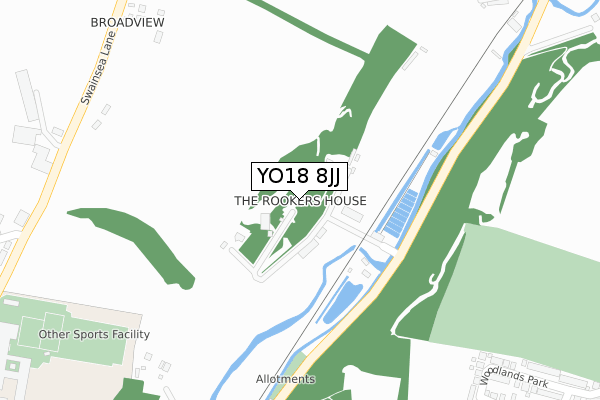
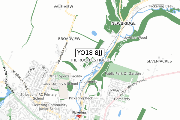
YO18 8JJ maps


Licence: Open Government Licence (requires attribution)
Attribution: Contains OS data © Crown copyright and database right 2025
Source: Open Postcode Geo
Licence: Open Government Licence (requires attribution)
Attribution: Contains OS data © Crown copyright and database right 2025; Contains Royal Mail data © Royal Mail copyright and database right 2025; Source: Office for National Statistics licensed under the Open Government Licence v.3.0
YO18 8JJ geodata
| Easting | 479835 |
| Northing | 484941 |
| Latitude | 54.253928 |
| Longitude | -0.776104 |
Where is YO18 8JJ?
| Street | Yatts Road |
| Locality | Newbridge |
| Town/City | Pickering |
| Country | England |
| Postcode District | YO18 |
YO18 8JJ Elevation
Elevation or altitude of YO18 8JJ as distance above sea level:
| Metres | Feet | |
|---|---|---|
| Elevation | 40m | 131ft |
Elevation is measured from the approximate centre of the postcode, to the nearest point on an OS contour line from OS Terrain 50, which has contour spacing of ten vertical metres.
➜ How high above sea level am I? Find the elevation of your current position using your device's GPS.
Politics
| Ward | Pickering |
|---|---|
| Constituency | Thirsk And Malton |
Transport
Nearest bus stops to YO18 8JJ
| Westlands Mayfield (Westlands) | Pickering | 542m |
| Westlands (Whitby Road) | Pickering | 624m |
| Lady Lumley's School (Swainsea Lane) | Pickering | 636m |
| Littledale | Middleton | 670m |
| Junior School (Middleton Road) | Pickering | 879m |
Nearest underground/metro/tram to YO18 8JJ
| Pickering (North Yorkshire Moors Railway) | Pickering | 778m |
Broadband
Broadband access in YO18 8JJ (2020 data)
| Percentage of properties with Next Generation Access | 100.0% |
| Percentage of properties with Superfast Broadband | 100.0% |
| Percentage of properties with Ultrafast Broadband | 0.0% |
| Percentage of properties with Full Fibre Broadband | 0.0% |
Superfast Broadband is between 30Mbps and 300Mbps
Ultrafast Broadband is > 300Mbps
Broadband limitations in YO18 8JJ (2020 data)
| Percentage of properties unable to receive 2Mbps | 0.0% |
| Percentage of properties unable to receive 5Mbps | 0.0% |
| Percentage of properties unable to receive 10Mbps | 0.0% |
| Percentage of properties unable to receive 30Mbps | 0.0% |
Deprivation
12.6% of English postcodes are less deprived than YO18 8JJ:Food Standards Agency
Three nearest food hygiene ratings to YO18 8JJ (metres)


➜ Get more ratings from the Food Standards Agency
Nearest post box to YO18 8JJ
| Last Collection | |||
|---|---|---|---|
| Location | Mon-Fri | Sat | Distance |
| Park Street | 16:00 | 11:45 | 771m |
| Picking Post Office | 17:30 | 12:30 | 888m |
| Market Place (Right Box) | 17:30 | 12:45 | 908m |
YO18 8JJ ITL and YO18 8JJ LAU
The below table lists the International Territorial Level (ITL) codes (formerly Nomenclature of Territorial Units for Statistics (NUTS) codes) and Local Administrative Units (LAU) codes for YO18 8JJ:
| ITL 1 Code | Name |
|---|---|
| TLE | Yorkshire and The Humber |
| ITL 2 Code | Name |
| TLE2 | North Yorkshire |
| ITL 3 Code | Name |
| TLE22 | North Yorkshire CC |
| LAU 1 Code | Name |
| E07000167 | Ryedale |
YO18 8JJ census areas
The below table lists the Census Output Area (OA), Lower Layer Super Output Area (LSOA), and Middle Layer Super Output Area (MSOA) for YO18 8JJ:
| Code | Name | |
|---|---|---|
| OA | E00141571 | |
| LSOA | E01027794 | Ryedale 002C |
| MSOA | E02005789 | Ryedale 002 |
Nearest postcodes to YO18 8JJ
| YO18 7HB | Herisson Close | 490m |
| YO18 7AH | Woodlands Park | 504m |
| YO18 8JL | Church Row | 507m |
| YO18 8ND | College View | 509m |
| YO18 8BF | Bursary Court | 540m |
| YO18 7BB | Undercliffe | 541m |
| YO18 7HJ | Westlands | 556m |
| YO18 7BA | Castle Road | 559m |
| YO18 7HF | Rosamund Avenue | 603m |
| YO18 8NE | Swainsea Lane | 604m |