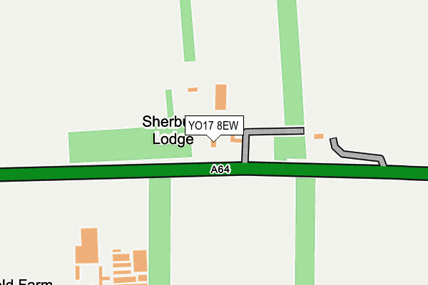
YO17 8EW is located in the Hunmanby & Sherburn electoral ward, within the unitary authority of North Yorkshire and the English Parliamentary constituency of Thirsk and Malton. The Sub Integrated Care Board (ICB) Location is NHS Humber and North Yorkshire ICB - 42D and the police force is North Yorkshire. This postcode has been in use since January 1980.


GetTheData
Source: OS OpenMap – Local (Ordnance Survey)
Source: OS VectorMap District (Ordnance Survey)
Licence: Open Government Licence (requires attribution)
| Easting | 494732 |
| Northing | 476785 |
| Latitude | 54.178113 |
| Longitude | -0.550092 |
GetTheData
Source: Open Postcode Geo
Licence: Open Government Licence
| Country | England |
| Postcode District | YO17 |
➜ See where YO17 is on a map | |
GetTheData
Source: Land Registry Price Paid Data
Licence: Open Government Licence
Elevation or altitude of YO17 8EW as distance above sea level:
| Metres | Feet | |
|---|---|---|
| Elevation | 40m | 131ft |
Elevation is measured from the approximate centre of the postcode, to the nearest point on an OS contour line from OS Terrain 50, which has contour spacing of ten vertical metres.
➜ How high above sea level am I? Find the elevation of your current position using your device's GPS.
GetTheData
Source: Open Postcode Elevation
Licence: Open Government Licence
| Ward | Hunmanby & Sherburn |
| Constituency | Thirsk And Malton |
GetTheData
Source: ONS Postcode Database
Licence: Open Government Licence
| Springfield Terrace (A64) | Sherburn | 745m |
| Millfield (A64) | Sherburn | 857m |
| Blue Chip Computers (High Street) | Sherburn | 1,029m |
| Blue Chip Computers (High Street) | Sherburn | 1,067m |
| Low Mill Farm (High Street) | Sherburn | 1,422m |
GetTheData
Source: NaPTAN
Licence: Open Government Licence
| Percentage of properties with Next Generation Access | 100.0% |
| Percentage of properties with Superfast Broadband | 66.7% |
| Percentage of properties with Ultrafast Broadband | 0.0% |
| Percentage of properties with Full Fibre Broadband | 0.0% |
Superfast Broadband is between 30Mbps and 300Mbps
Ultrafast Broadband is > 300Mbps
| Percentage of properties unable to receive 2Mbps | 0.0% |
| Percentage of properties unable to receive 5Mbps | 0.0% |
| Percentage of properties unable to receive 10Mbps | 0.0% |
| Percentage of properties unable to receive 30Mbps | 33.3% |
GetTheData
Source: Ofcom
Licence: Ofcom Terms of Use (requires attribution)
GetTheData
Source: ONS Postcode Database
Licence: Open Government Licence


➜ Get more ratings from the Food Standards Agency
GetTheData
Source: Food Standards Agency
Licence: FSA terms & conditions
| Last Collection | |||
|---|---|---|---|
| Location | Mon-Fri | Sat | Distance |
| Sherburn Post Office | 17:00 | 11:00 | 1,104m |
| 73 St Hilda's Street Sherburn | 16:45 | 11:00 | 1,307m |
| West Heslerton Post Office | 17:15 | 10:45 | 3,725m |
GetTheData
Source: Dracos
Licence: Creative Commons Attribution-ShareAlike
The below table lists the International Territorial Level (ITL) codes (formerly Nomenclature of Territorial Units for Statistics (NUTS) codes) and Local Administrative Units (LAU) codes for YO17 8EW:
| ITL 1 Code | Name |
|---|---|
| TLE | Yorkshire and The Humber |
| ITL 2 Code | Name |
| TLE2 | North Yorkshire |
| ITL 3 Code | Name |
| TLE22 | North Yorkshire CC |
| LAU 1 Code | Name |
| E07000167 | Ryedale |
GetTheData
Source: ONS Postcode Directory
Licence: Open Government Licence
The below table lists the Census Output Area (OA), Lower Layer Super Output Area (LSOA), and Middle Layer Super Output Area (MSOA) for YO17 8EW:
| Code | Name | |
|---|---|---|
| OA | E00141595 | |
| LSOA | E01027798 | Ryedale 004C |
| MSOA | E02005791 | Ryedale 004 |
GetTheData
Source: ONS Postcode Directory
Licence: Open Government Licence
| YO17 8QG | Springfield Terrace | 776m |
| YO17 8QF | Millfield | 877m |
| YO17 8PT | The Pastures | 1052m |
| YO17 8QD | Old Pigeon Pie Court | 1084m |
| YO17 8QB | High Street | 1089m |
| YO17 8PN | West Garth | 1132m |
| YO17 8PG | St Hildas Street | 1138m |
| YO17 8PA | Vicarage Farm Close | 1215m |
| YO17 8QQ | 1219m | |
| YO17 8PX | Sycamore Grove | 1230m |
GetTheData
Source: Open Postcode Geo; Land Registry Price Paid Data
Licence: Open Government Licence