YO13 0EX maps, stats, and open data
YO13 0EX is in Staintondale, Scarborough. YO13 0EX is located in the Esk Valley & Coast electoral ward, within the unitary authority of North Yorkshire and the English Parliamentary constituency of Scarborough and Whitby. The Sub Integrated Care Board (ICB) Location is NHS Humber and North Yorkshire ICB - 42D and the police force is North Yorkshire. This postcode has been in use since January 1980.
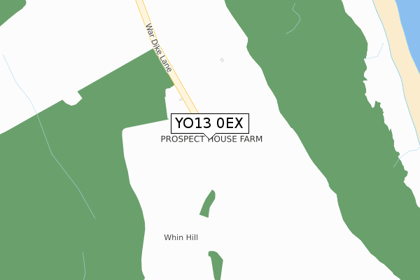
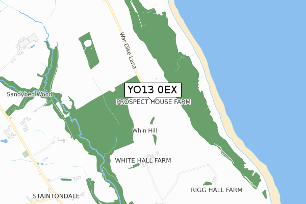
YO13 0EX maps


Licence: Open Government Licence (requires attribution)
Attribution: Contains OS data © Crown copyright and database right 2025
Source: Open Postcode Geo
Licence: Open Government Licence (requires attribution)
Attribution: Contains OS data © Crown copyright and database right 2025; Contains Royal Mail data © Royal Mail copyright and database right 2025; Source: Office for National Statistics licensed under the Open Government Licence v.3.0
YO13 0EX geodata
| Easting | 499882 |
| Northing | 499187 |
| Latitude | 54.378398 |
| Longitude | -0.463749 |
Where is YO13 0EX?
| Locality | Staintondale |
| Town/City | Scarborough |
| Country | England |
| Postcode District | YO13 |
YO13 0EX Elevation
Elevation or altitude of YO13 0EX as distance above sea level:
| Metres | Feet | |
|---|---|---|
| Elevation | 150m | 492ft |
Elevation is measured from the approximate centre of the postcode, to the nearest point on an OS contour line from OS Terrain 50, which has contour spacing of ten vertical metres.
➜ How high above sea level am I? Find the elevation of your current position using your device's GPS.
Politics
| Ward | Esk Valley & Coast |
|---|---|
| Constituency | Scarborough And Whitby |
Transport
Nearest bus stops to YO13 0EX
| Trekking Centre (Prior Wath Road) | Staintondale | 1,170m |
| Trekking Centre (Prior Wath Road) | Staintondale | 1,191m |
| Downdale Road (Hodgson Hill) | Staintondale | 1,455m |
| Downdale Road (Hodgson Hill) | Staintondale | 1,476m |
Deprivation
53.4% of English postcodes are less deprived than YO13 0EX:YO13 0EX ITL and YO13 0EX LAU
The below table lists the International Territorial Level (ITL) codes (formerly Nomenclature of Territorial Units for Statistics (NUTS) codes) and Local Administrative Units (LAU) codes for YO13 0EX:
| ITL 1 Code | Name |
|---|---|
| TLE | Yorkshire and The Humber |
| ITL 2 Code | Name |
| TLE2 | North Yorkshire |
| ITL 3 Code | Name |
| TLE22 | North Yorkshire CC |
| LAU 1 Code | Name |
| E07000168 | Scarborough |
YO13 0EX census areas
The below table lists the Census Output Area (OA), Lower Layer Super Output Area (LSOA), and Middle Layer Super Output Area (MSOA) for YO13 0EX:
| Code | Name | |
|---|---|---|
| OA | E00141924 | |
| LSOA | E01027857 | Scarborough 004F |
| MSOA | E02005798 | Scarborough 004 |
Nearest postcodes to YO13 0EX
| YO13 0EY | 856m | |
| YO13 0EL | 1007m | |
| YO13 0AZ | Prior Wath Road | 1199m |
| YO13 0AY | 1502m | |
| YO13 0EW | 1900m | |
| YO13 0AX | Staintondale Road | 1930m |
| YO13 0ER | Staintondale Road | 2254m |
| YO13 0LY | Loring Road | 2416m |
| YO13 0AU | Hayburn Wyke | 2449m |
| YO13 0LU | Station Square | 2553m |