YO13 0DD maps, stats, and open data
YO13 0DD is located in the Scalby & the Coast electoral ward, within the unitary authority of North Yorkshire and the English Parliamentary constituency of Scarborough and Whitby. The Sub Integrated Care Board (ICB) Location is NHS Humber and North Yorkshire ICB - 42D and the police force is North Yorkshire. This postcode has been in use since January 1983.
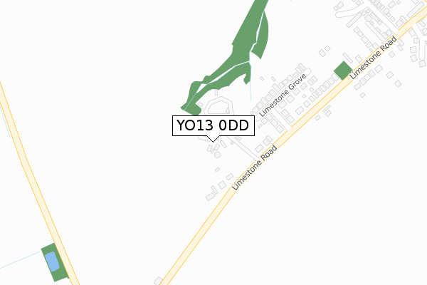
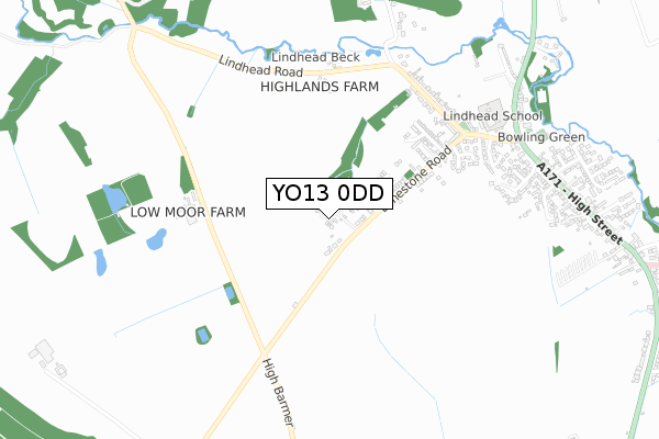
YO13 0DD maps


Licence: Open Government Licence (requires attribution)
Attribution: Contains OS data © Crown copyright and database right 2025
Source: Open Postcode Geo
Licence: Open Government Licence (requires attribution)
Attribution: Contains OS data © Crown copyright and database right 2025; Contains Royal Mail data © Royal Mail copyright and database right 2025; Source: Office for National Statistics licensed under the Open Government Licence v.3.0
YO13 0DD geodata
| Easting | 500129 |
| Northing | 493046 |
| Latitude | 54.323180 |
| Longitude | -0.462010 |
Where is YO13 0DD?
| Country | England |
| Postcode District | YO13 |
YO13 0DD Elevation
Elevation or altitude of YO13 0DD as distance above sea level:
| Metres | Feet | |
|---|---|---|
| Elevation | 80m | 262ft |
Elevation is measured from the approximate centre of the postcode, to the nearest point on an OS contour line from OS Terrain 50, which has contour spacing of ten vertical metres.
➜ How high above sea level am I? Find the elevation of your current position using your device's GPS.
Politics
| Ward | Scalby & The Coast |
|---|---|
| Constituency | Scarborough And Whitby |
Transport
Nearest bus stops to YO13 0DD
| Tidds Corner (Mill Lane) | Burniston | 783m |
| Tidds Corner (Mill Lane) | Burniston | 795m |
| Methodist Chapel (A171) | Burniston | 961m |
| War Memorial (A171) | Burniston | 973m |
| Three Jolly Sailors Ph (High Street) | Burniston | 1,129m |
Nearest railway stations to YO13 0DD
| Scarborough Station | 6.1km |
Deprivation
20.6% of English postcodes are less deprived than YO13 0DD:Food Standards Agency
Three nearest food hygiene ratings to YO13 0DD (metres)


➜ Get more ratings from the Food Standards Agency
Nearest post box to YO13 0DD
| Last Collection | |||
|---|---|---|---|
| Location | Mon-Fri | Sat | Distance |
| 1 Jubilee Terrace Scalby | 17:10 | 12:45 | 1,550m |
| Scalby Post Office | 17:00 | 12:25 | 3,015m |
| 9 Broadway Scarborough | 17:40 | 12:40 | 4,879m |
YO13 0DD ITL and YO13 0DD LAU
The below table lists the International Territorial Level (ITL) codes (formerly Nomenclature of Territorial Units for Statistics (NUTS) codes) and Local Administrative Units (LAU) codes for YO13 0DD:
| ITL 1 Code | Name |
|---|---|
| TLE | Yorkshire and The Humber |
| ITL 2 Code | Name |
| TLE2 | North Yorkshire |
| ITL 3 Code | Name |
| TLE22 | North Yorkshire CC |
| LAU 1 Code | Name |
| E07000168 | Scarborough |
YO13 0DD census areas
The below table lists the Census Output Area (OA), Lower Layer Super Output Area (LSOA), and Middle Layer Super Output Area (MSOA) for YO13 0DD:
| Code | Name | |
|---|---|---|
| OA | E00141809 | |
| LSOA | E01027836 | Scarborough 004E |
| MSOA | E02005798 | Scarborough 004 |
Nearest postcodes to YO13 0DD
| YO13 0DQ | Limestone Way | 150m |
| YO13 0DH | Limestone Grove | 201m |
| YO13 0DG | Limestone Road | 423m |
| YO13 0EF | Ashdown Rise | 443m |
| YO13 0EE | The Limes | 502m |
| YO13 0EG | Dale Rise | 530m |
| YO13 0EQ | Dale Avenue | 580m |
| YO13 0DF | Stone Quarry Road | 614m |
| YO13 0HF | The Green | 644m |
| YO13 0ED | Dale Close | 668m |