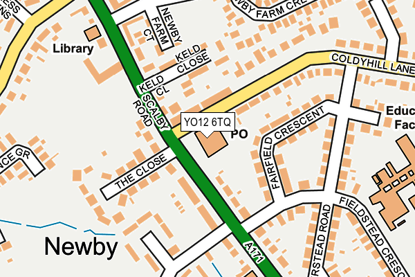
YO12 6TQ is located in the Newby electoral ward, within the unitary authority of North Yorkshire and the English Parliamentary constituency of Scarborough and Whitby. The Sub Integrated Care Board (ICB) Location is NHS Humber and North Yorkshire ICB - 42D and the police force is North Yorkshire. This postcode has been in use since January 1995.


GetTheData
Source: OS OpenMap – Local (Ordnance Survey)
Source: OS VectorMap District (Ordnance Survey)
Licence: Open Government Licence (requires attribution)
| Easting | 501676 |
| Northing | 489908 |
| Latitude | 54.294700 |
| Longitude | -0.439318 |
GetTheData
Source: Open Postcode Geo
Licence: Open Government Licence
| Country | England |
| Postcode District | YO12 |
➜ See where YO12 is on a map ➜ Where is Scarborough? | |
GetTheData
Source: Land Registry Price Paid Data
Licence: Open Government Licence
Elevation or altitude of YO12 6TQ as distance above sea level:
| Metres | Feet | |
|---|---|---|
| Elevation | 50m | 164ft |
Elevation is measured from the approximate centre of the postcode, to the nearest point on an OS contour line from OS Terrain 50, which has contour spacing of ten vertical metres.
➜ How high above sea level am I? Find the elevation of your current position using your device's GPS.
GetTheData
Source: Open Postcode Elevation
Licence: Open Government Licence
| Ward | Newby |
| Constituency | Scarborough And Whitby |
GetTheData
Source: ONS Postcode Database
Licence: Open Government Licence
| Coldyhill Lane | Newby | 25m |
| Coldyhill Lane | Newby | 38m |
| Proudfoot Foodstore (Scalby Road) | Newby | 48m |
| Green Lane (Scalby Road) | Newby | 50m |
| Keld Close (Scalby Road) | Newby | 125m |
| Scarborough Station | 2.7km |
GetTheData
Source: NaPTAN
Licence: Open Government Licence
GetTheData
Source: ONS Postcode Database
Licence: Open Government Licence


➜ Get more ratings from the Food Standards Agency
GetTheData
Source: Food Standards Agency
Licence: FSA terms & conditions
| Last Collection | |||
|---|---|---|---|
| Location | Mon-Fri | Sat | Distance |
| Scalby Post Office | 17:00 | 12:25 | 498m |
| 9 Broadway Scarborough | 17:40 | 12:40 | 1,566m |
| 2 Woodlands Ravine Scar/Ogh | 18:00 | 12:20 | 1,753m |
GetTheData
Source: Dracos
Licence: Creative Commons Attribution-ShareAlike
The below table lists the International Territorial Level (ITL) codes (formerly Nomenclature of Territorial Units for Statistics (NUTS) codes) and Local Administrative Units (LAU) codes for YO12 6TQ:
| ITL 1 Code | Name |
|---|---|
| TLE | Yorkshire and The Humber |
| ITL 2 Code | Name |
| TLE2 | North Yorkshire |
| ITL 3 Code | Name |
| TLE22 | North Yorkshire CC |
| LAU 1 Code | Name |
| E07000168 | Scarborough |
GetTheData
Source: ONS Postcode Directory
Licence: Open Government Licence
The below table lists the Census Output Area (OA), Lower Layer Super Output Area (LSOA), and Middle Layer Super Output Area (MSOA) for YO12 6TQ:
| Code | Name | |
|---|---|---|
| OA | E00141854 | |
| LSOA | E01027843 | Scarborough 005B |
| MSOA | E02005799 | Scarborough 005 |
GetTheData
Source: ONS Postcode Directory
Licence: Open Government Licence
| YO12 6SF | Coldyhill Lane | 100m |
| YO12 6TL | Fairfield Crescent | 103m |
| YO12 6UF | Keld Close | 127m |
| YO12 6EG | The Close | 154m |
| YO12 6UL | Newby Farm Court | 163m |
| YO12 6TW | Hirstead Road | 204m |
| YO12 6EE | Scalby Road | 227m |
| YO12 6TN | Hirstead Gardens | 230m |
| YO12 6UA | Scalby Road | 232m |
| YO12 6UW | Newby Farm Crescent | 232m |
GetTheData
Source: Open Postcode Geo; Land Registry Price Paid Data
Licence: Open Government Licence