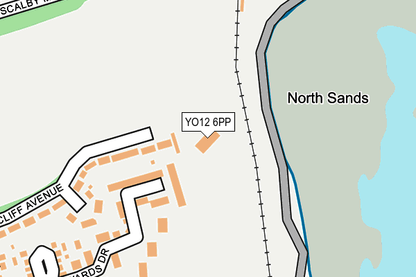
YO12 6PP is located in the Northstead electoral ward, within the unitary authority of North Yorkshire and the English Parliamentary constituency of Scarborough and Whitby. The Sub Integrated Care Board (ICB) Location is NHS Humber and North Yorkshire ICB - 42D and the police force is North Yorkshire. This postcode has been in use since January 1995.


GetTheData
Source: OS OpenMap – Local (Ordnance Survey)
Source: OS VectorMap District (Ordnance Survey)
Licence: Open Government Licence (requires attribution)
| Easting | 503461 |
| Northing | 490440 |
| Latitude | 54.299104 |
| Longitude | -0.411703 |
GetTheData
Source: Open Postcode Geo
Licence: Open Government Licence
| Country | England |
| Postcode District | YO12 |
➜ See where YO12 is on a map ➜ Where is Scarborough? | |
GetTheData
Source: Land Registry Price Paid Data
Licence: Open Government Licence
Elevation or altitude of YO12 6PP as distance above sea level:
| Metres | Feet | |
|---|---|---|
| Elevation | 20m | 66ft |
Elevation is measured from the approximate centre of the postcode, to the nearest point on an OS contour line from OS Terrain 50, which has contour spacing of ten vertical metres.
➜ How high above sea level am I? Find the elevation of your current position using your device's GPS.
GetTheData
Source: Open Postcode Elevation
Licence: Open Government Licence
| Ward | Northstead |
| Constituency | Scarborough And Whitby |
GetTheData
Source: ONS Postcode Database
Licence: Open Government Licence
| Scholes Park Avenue (Scalby Mills Road) | Peasholm Park | 297m |
| Scholes Park Junction (Scholes Park Road) | Peasholm Park | 383m |
| Old Scalby Mills (Scalby Mills Road) | Peasholm Park | 388m |
| Cross Lane (Burniston Road) | Peasholm Park | 436m |
| Scholes Park Cliff (Scholes Park Road) | Peasholm Park | 462m |
| Scarborough Station | 2.2km |
GetTheData
Source: NaPTAN
Licence: Open Government Licence
GetTheData
Source: ONS Postcode Database
Licence: Open Government Licence


➜ Get more ratings from the Food Standards Agency
GetTheData
Source: Food Standards Agency
Licence: FSA terms & conditions
| Last Collection | |||
|---|---|---|---|
| Location | Mon-Fri | Sat | Distance |
| 9 Broadway Scarborough | 17:40 | 12:40 | 1,384m |
| Oakville Avenue | 17:45 | 13:00 | 1,390m |
| Dean Road Post Office | 17:45 | 12:00 | 1,506m |
GetTheData
Source: Dracos
Licence: Creative Commons Attribution-ShareAlike
The below table lists the International Territorial Level (ITL) codes (formerly Nomenclature of Territorial Units for Statistics (NUTS) codes) and Local Administrative Units (LAU) codes for YO12 6PP:
| ITL 1 Code | Name |
|---|---|
| TLE | Yorkshire and The Humber |
| ITL 2 Code | Name |
| TLE2 | North Yorkshire |
| ITL 3 Code | Name |
| TLE22 | North Yorkshire CC |
| LAU 1 Code | Name |
| E07000168 | Scarborough |
GetTheData
Source: ONS Postcode Directory
Licence: Open Government Licence
The below table lists the Census Output Area (OA), Lower Layer Super Output Area (LSOA), and Middle Layer Super Output Area (MSOA) for YO12 6PP:
| Code | Name | |
|---|---|---|
| OA | E00141869 | |
| LSOA | E01027848 | Scarborough 006E |
| MSOA | E02005800 | Scarborough 006 |
GetTheData
Source: ONS Postcode Directory
Licence: Open Government Licence
| YO12 6QB | North Cliff Avenue | 65m |
| YO12 6QA | North Cliff Avenue | 88m |
| YO12 6PZ | North Cliff Avenue | 114m |
| YO12 6PE | Green Howards Drive | 174m |
| YO12 6PR | North Cliff Gardens | 208m |
| YO12 6PD | Green Howards Drive | 209m |
| YO12 6QS | Grenadier Court | 226m |
| YO12 6QF | Hussars Court | 245m |
| YO12 6PW | North Cliff Avenue | 265m |
| YO12 6QR | Guards Court | 288m |
GetTheData
Source: Open Postcode Geo; Land Registry Price Paid Data
Licence: Open Government Licence