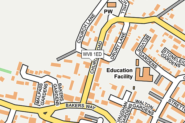
WV8 1ED lies on Church Road in Codsall, Wolverhampton. WV8 1ED is located in the Codsall electoral ward, within the local authority district of South Staffordshire and the English Parliamentary constituency of South Staffordshire. The Sub Integrated Care Board (ICB) Location is NHS Staffordshire and Stoke-on-Trent ICB - 05Q and the police force is Staffordshire. This postcode has been in use since January 1980.


GetTheData
Source: OS OpenMap – Local (Ordnance Survey)
Source: OS VectorMap District (Ordnance Survey)
Licence: Open Government Licence (requires attribution)
| Easting | 386559 |
| Northing | 303865 |
| Latitude | 52.632384 |
| Longitude | -2.200023 |
GetTheData
Source: Open Postcode Geo
Licence: Open Government Licence
| Street | Church Road |
| Locality | Codsall |
| Town/City | Wolverhampton |
| Country | England |
| Postcode District | WV8 |
➜ See where WV8 is on a map ➜ Where is Codsall? | |
GetTheData
Source: Land Registry Price Paid Data
Licence: Open Government Licence
Elevation or altitude of WV8 1ED as distance above sea level:
| Metres | Feet | |
|---|---|---|
| Elevation | 130m | 427ft |
Elevation is measured from the approximate centre of the postcode, to the nearest point on an OS contour line from OS Terrain 50, which has contour spacing of ten vertical metres.
➜ How high above sea level am I? Find the elevation of your current position using your device's GPS.
GetTheData
Source: Open Postcode Elevation
Licence: Open Government Licence
| Ward | Codsall |
| Constituency | South Staffordshire |
GetTheData
Source: ONS Postcode Database
Licence: Open Government Licence
| Church Road (Bakers Way) | Codsall Town Centre | 153m |
| Church Road (Bakers Way) | Codsall Town Centre | 164m |
| The Bull Ph (The Square) | Codsall Town Centre | 203m |
| The Bull Ph (The Square) | Codsall Town Centre | 221m |
| Wheel Avenue (Wolverhampton Road) | Codsall Town Centre | 389m |
| Codsall Station | 0.6km |
| Bilbrook Station | 1.3km |
| Albrighton Station | 4.7km |
GetTheData
Source: NaPTAN
Licence: Open Government Licence
| Percentage of properties with Next Generation Access | 100.0% |
| Percentage of properties with Superfast Broadband | 100.0% |
| Percentage of properties with Ultrafast Broadband | 0.0% |
| Percentage of properties with Full Fibre Broadband | 0.0% |
Superfast Broadband is between 30Mbps and 300Mbps
Ultrafast Broadband is > 300Mbps
| Percentage of properties unable to receive 2Mbps | 0.0% |
| Percentage of properties unable to receive 5Mbps | 0.0% |
| Percentage of properties unable to receive 10Mbps | 0.0% |
| Percentage of properties unable to receive 30Mbps | 0.0% |
GetTheData
Source: Ofcom
Licence: Ofcom Terms of Use (requires attribution)
GetTheData
Source: ONS Postcode Database
Licence: Open Government Licence


➜ Get more ratings from the Food Standards Agency
GetTheData
Source: Food Standards Agency
Licence: FSA terms & conditions
| Last Collection | |||
|---|---|---|---|
| Location | Mon-Fri | Sat | Distance |
| Elliots Lane | 16:45 | 12:30 | 811m |
| Gunstone | 16:30 | 11:30 | 993m |
| Oaken | 16:00 | 11:30 | 1,337m |
GetTheData
Source: Dracos
Licence: Creative Commons Attribution-ShareAlike
The below table lists the International Territorial Level (ITL) codes (formerly Nomenclature of Territorial Units for Statistics (NUTS) codes) and Local Administrative Units (LAU) codes for WV8 1ED:
| ITL 1 Code | Name |
|---|---|
| TLG | West Midlands (England) |
| ITL 2 Code | Name |
| TLG2 | Shropshire and Staffordshire |
| ITL 3 Code | Name |
| TLG24 | Staffordshire CC |
| LAU 1 Code | Name |
| E07000196 | South Staffordshire |
GetTheData
Source: ONS Postcode Directory
Licence: Open Government Licence
The below table lists the Census Output Area (OA), Lower Layer Super Output Area (LSOA), and Middle Layer Super Output Area (MSOA) for WV8 1ED:
| Code | Name | |
|---|---|---|
| OA | E00150961 | |
| LSOA | E01029626 | South Staffordshire 009A |
| MSOA | E02006182 | South Staffordshire 009 |
GetTheData
Source: ONS Postcode Directory
Licence: Open Government Licence
| WV8 1EB | Wheeler Close | 58m |
| WV8 1EA | Church Road | 85m |
| WV8 1EF | Church Lane | 92m |
| WV8 1EH | Church Road | 92m |
| WV8 1EE | Drury Lane | 98m |
| WV8 1HB | Bakers Way | 131m |
| WV8 1AH | Walton Gardens | 141m |
| WV8 1HA | Bakers Gardens | 161m |
| WV8 1AN | Belvide Gardens | 191m |
| WV8 1EQ | Church Hill | 204m |
GetTheData
Source: Open Postcode Geo; Land Registry Price Paid Data
Licence: Open Government Licence