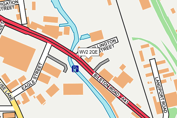
WV2 2QE is located in the East Park electoral ward, within the metropolitan district of Wolverhampton and the English Parliamentary constituency of Wolverhampton South East. The Sub Integrated Care Board (ICB) Location is NHS Black Country ICB - D2P2L and the police force is West Midlands. This postcode has been in use since January 1980.


GetTheData
Source: OS OpenMap – Local (Ordnance Survey)
Source: OS VectorMap District (Ordnance Survey)
Licence: Open Government Licence (requires attribution)
| Easting | 392533 |
| Northing | 297969 |
| Latitude | 52.579012 |
| Longitude | -2.110733 |
GetTheData
Source: Open Postcode Geo
Licence: Open Government Licence
| Country | England |
| Postcode District | WV2 |
➜ See where WV2 is on a map ➜ Where is Wolverhampton? | |
GetTheData
Source: Land Registry Price Paid Data
Licence: Open Government Licence
Elevation or altitude of WV2 2QE as distance above sea level:
| Metres | Feet | |
|---|---|---|
| Elevation | 150m | 492ft |
Elevation is measured from the approximate centre of the postcode, to the nearest point on an OS contour line from OS Terrain 50, which has contour spacing of ten vertical metres.
➜ How high above sea level am I? Find the elevation of your current position using your device's GPS.
GetTheData
Source: Open Postcode Elevation
Licence: Open Government Licence
| Ward | East Park |
| Constituency | Wolverhampton South East |
GetTheData
Source: ONS Postcode Database
Licence: Open Government Licence
| Eagle St (Bilston Rd) | Monmore Green | 112m |
| Eagle St (Bilston Rd) | Monmore Green | 187m |
| All Saints Church (Steelhouse Lane) | Monmore Green | 290m |
| All Saints Church (Steelhouse Lane) | Monmore Green | 308m |
| Sutherland Place (Steelhouse Lane) | Wolverhampton | 413m |
| The Royal (Midland Metro Stop) (Bilston St) | Wolverhampton | 459m |
| Wolverhampton St George's (Midland Metro Stop) (Bilston St) | Wolverhampton | 996m |
| Priestfield (Midland Metro Stop) (Junction Rd) | Priestfield | 1,289m |
| Wolverhampton Station | 1.1km |
| Coseley Station | 4.2km |
GetTheData
Source: NaPTAN
Licence: Open Government Licence
GetTheData
Source: ONS Postcode Database
Licence: Open Government Licence


➜ Get more ratings from the Food Standards Agency
GetTheData
Source: Food Standards Agency
Licence: FSA terms & conditions
| Last Collection | |||
|---|---|---|---|
| Location | Mon-Fri | Sat | Distance |
| Deans Road | 17:30 | 12:00 | 563m |
| Vicarage Road | 17:30 | 12:00 | 667m |
| Dixon Street | 17:00 | 12:30 | 906m |
GetTheData
Source: Dracos
Licence: Creative Commons Attribution-ShareAlike
The below table lists the International Territorial Level (ITL) codes (formerly Nomenclature of Territorial Units for Statistics (NUTS) codes) and Local Administrative Units (LAU) codes for WV2 2QE:
| ITL 1 Code | Name |
|---|---|
| TLG | West Midlands (England) |
| ITL 2 Code | Name |
| TLG3 | West Midlands |
| ITL 3 Code | Name |
| TLG39 | Wolverhampton |
| LAU 1 Code | Name |
| E08000031 | Wolverhampton |
GetTheData
Source: ONS Postcode Directory
Licence: Open Government Licence
The below table lists the Census Output Area (OA), Lower Layer Super Output Area (LSOA), and Middle Layer Super Output Area (MSOA) for WV2 2QE:
| Code | Name | |
|---|---|---|
| OA | E00052758 | |
| LSOA | E01010442 | Wolverhampton 018A |
| MSOA | E02002166 | Wolverhampton 018 |
GetTheData
Source: ONS Postcode Directory
Licence: Open Government Licence
| WV2 2AQ | Eagle Street | 165m |
| WV2 2AS | Parkyn Street | 362m |
| WV1 3RP | Sharrocks Street | 395m |
| WV2 2AU | Steelhouse Lane | 419m |
| WV1 3RN | York Street | 428m |
| WV1 3RQ | Commercial Road | 429m |
| WV2 1DW | Gower Street | 442m |
| WV2 2RJ | Central Industrial Estate | 445m |
| WV2 1DX | Adelaide Walk | 465m |
| WV2 2RL | Central Industrial Estate | 476m |
GetTheData
Source: Open Postcode Geo; Land Registry Price Paid Data
Licence: Open Government Licence